Nico Ditch
Commemorated on 1 plaque
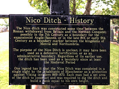
Nico Ditch - History The Nico ditch was constructed some time between the Roman withdrawl from Britain and the Norman Conquest; possibly in the 7th Century as a boundary for the expansionist Anglo-Saxons, or in the late 8th Century or early 9th century as boundary marker between the kingdoms of Mercia and Northumbria. The purpose of the Nico Ditch is unclear; it may have been used as a defensive fortification or as an administrative boundary. Regardless of its earlier use, the ditch has been used as a boundary since at least the Medieval Period One legend has it that the Nico Ditch was completed in a single night by the inhabitants of Manchester as a protection against Viking invaders 869-870. Each man had a set area of the ditch to construct and was required to dig the ditch and build a bank equal to his own height
Gorton Cemetery, Manchester, United Kingdom where it was


