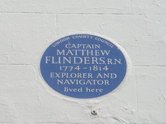
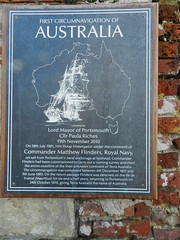
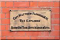
JarrahTree on Wikimedia Commons On 6 December 1801 Captain Matthew Flinders RN sighted Cape Leeuwin and commenced the mapping of the Australian coast. Leeuwin Road, Point Matthew, Cape Leeuwin, WA by Royal Western Australian Historical Society Colour: bronze Wikimedia: Flickr: [geolocate this address] See also... Gwynhafyr on Flickr Graham Tiller on Flickr Richard Croft on Geograph

