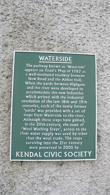
WATERSIDE. The pathway known as 'Waterside' appears on Todd's Map of 1787 as a well-instituted roadway between New Road and the Abbot Hall. When the yards between Highgate and the river were developed to accommodate the new industries which arrived with the industrial revolution of the late 18th and 19th centuries, each of the newly formed 'yards' was provided with a set of steps from Waterside to the river. Although these steps have gained, in the 20th century, the name of 'Wool Washing Steps', access to the river water supply was used by other than the wool trade. The steps surviving into the 21st century were preserved in 2005.

Waterside, Kendal
Google Streetview
OpenStreetMap
Subjects
None identified yet. Subjects are curated by hand so please bear with us.