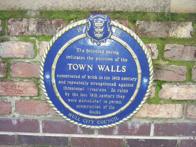
The brindled paving indicates the position of the Town Walls constructed of brick in the 14th century and repeatedly strengthened against threatened invasions. In ruins by the late 18th century, they were demolished to permit construction of the docks
Wall running between Humber Dock Street and the Marina, close to the junction with Castle Street, Hull