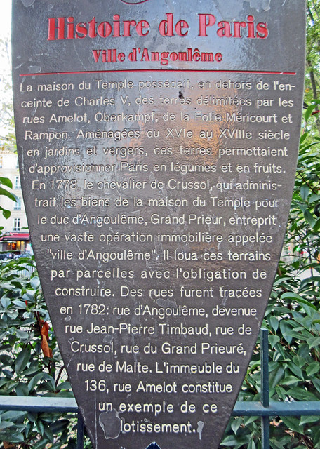
Ville d'Angoulême. La maison du Temple possédait, en dehors de l'enceinte de Charles V, des terres délimitées par les rues Amelot, Oberkampf, de la Folie Méricourt et Rampon. Aménagées du XVIe au XVIIIe siècle en jardins et vergers, ces terres permettaient d'approvisionner Paris en légumes et en fruits. En 1778, le chevalier de Crussol, qui administrait les biens de la maison du Temple pour le duc d'Angoulême, Grand Prieur, entreprit une vaste opération immobilière appelée "ville d'Angoulême". Il loua ces terrains par parcelles avec l'obligation de construire. Des rues furent tracées en 1782: rue d'Angoulême, devenue rue Jean-Pierre Timbaud, rue de Crussol, rue du Grand Prieuré, rue de Malte. L'immeuble du 136, rue Amelot constitue un exemple de ce lotissement.

Place Pasdeloup, Paris
Google Streetview
OpenStreetMap
Subjects
None identified yet. Subjects are curated by hand so please bear with us.