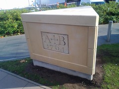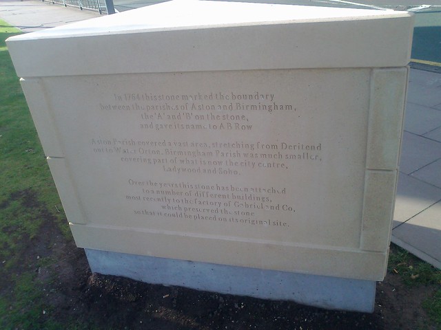
In 1764 this stone marked the boundary between the parishes of Aston and Birmingham, the 'A' and 'B' on the stone, and gave it's name to A B Row. Aston Parish covered a vast area, stretching from Deritend out to Water Orton. Birmingham Parish was much smaller, covering part of what is now the city centre, Ladywood and Soho. Over the years this stone has been attached to a number of different buildings, most recently to the factory of Gabriel and Co, which preserved this stone so that it could be placed on it's original site.
Colour: stone
Wikimedia:
Flickr: