
Nevada Historical Marker #171
Chief Tecopa Peacemaker Of The Paiutes. Chief Tecopa was a young man when the first European Americans came to Southern Nevada. As a leader among the Southern Paiutes, he fought with vigor to save their land and maintain a traditional way of life. He soon realized if his people were to survive and prosper, he would have to establish peace and live in harmony with the foreigners.During his life, which spanned almost the entire nineteenth century, his time and energy were devoted to the betterment of his people until his death here in Pahrump Valley.Chief Tecopa is honored for the peaceful relations he maintained between the Southern Paiutes and the settlers who came to live among them.
Chief Tecopa Cemetery, Pahrump, NV, United States

Nevada Historical Marker #172
Tybo (Silver — Lead — Zinc Camp). Eight miles northwest of this point lies what was formerly one of the leading lead-producing districts in the nation. Producing erratically from ore discovery in 1866 to the present (the last mill closed in 1937), Tybo managed to achieve an overall creditable record.Tybo, in its infancy, was known as a peaceful camp, but later strife between the Irish, Cornish, and central Europeans changed its reputation. Later, these groups banded together to drive away a company of Chinese woodcutters. The town was not unique in having three residential sections each with its ethnic group. However, all children went to the same brick school.
US-6, Tonopah, NV, United States

Nevada Historical Marker #173
Beatty. Beatty was the center of three short-lived, so-called “gold” railroads that were spawned by early 1900s strikes in Tonopah, Goldfield and Rhyolite. The town was referred to as the “Chicago of the West”.Between 1906 and 1907, railroad companies constructed the Las Vegas and Tonopah from Las Vegas through Beatty and Rhyolite to Goldfield, the Bullfrog Goldfield Railroad from Goldfield to Beatty and Rhyolite, and the Tonopah and Tidewater from Ludlow, California to Tonopah. The last of these used the Bullfrog Goldfield tracks to Beatty and Rhyolite until 1914. The rails were torn up at Beatty beginning on July18, 1942.
South Second St, Beatty, NV, United States
Nevada Historical Marker #174
Blair. The Pittsburgh-Silver Peak Gold Mining Company bought the major mines in the area in 1906. Land speculators at nearby Silver Peak bought up the land. As a result, the mining company surveyed a new townsite north of Silver Peak and named it Blair. The company built a 100-stamp mill in 1907. The company also constructed the 17 ½ mile Silver Peak railroad from Blair Junction to the Tonopah & Goldfield main line.By 1920, Blair was all but deserted. The remnants of stone buildings and mill foundations are the only survivors of the once thriving, but short-lived, mining town.
, Silver Peak, NV, United States

Nevada Historical Marker #175
Stewart Nye Residence. This house was built about 1860 of local sandstone for William Morris Stewart who lived here until 1862. He sold it to the territorial governor of Nevada, James W. Nye. The two men were elected as Nevada’s first United States senators after the territory achieved statehood in 1864. Stewart served from 1864 to1875 and again from 1887 to 1905. Nye served from 1864 to 1873. Both men were originally from New York.The house later became the home of Nevada Supreme Court Chief Justice George F. Talbot. In 1917 he sold the house and block to the Catholic diocese and it served as the rectory for the Catholic Church. It was subsequently sold for commercial use.
West King St, Carson City, NV, United States

Nevada Historical Marker #176
The Surveyors. The federal government historically has supported numerous surveys for the purpose of measuring the domain which extended, after 1848, to the Pacific. These surveys sought railway routes, military relationships, water transport and wagon roads. The survey activity was extended to all territories, but not to states. Nevada, in part, was the site of two notable surveys. Honey Lake to Fort Kearny Wagon Road, completed in 1860 by Captain Lander, and the route surveyed by Lieutenant Simpson, Camp Floyd to Genoa, in 1859. Military engineers engaged in this activity included Stansbury, Marcy, Whipple, Beale, Simpson and Lander. The name of Captain F. W. Lander stands out as a contributor to Nevada’s history. He has been memorialized in the name of a prominent Nevada county. Nearby Simpson Park Mountains are named for Lieutenant Simpson.
, Austin, NV, United States
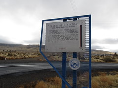
Nevada Historical Marker #177
Desert Well Station (Overland Mail And Stage Station). Located approximately one mile south are the remains of a typical stage station of the period 1843 to 1869, an era of transition between the arrival of the first emigrant wagon trains and the completion of the transcontinental railroad.Desert Well Station, which was later known as Nelsons, achieved a measure of fame when Mark Twain wrote of his experience there in Roughing It. The original site featured two wells, an inn, and corrals. One of the wells was used exclusively by camels brought to the Nevada desert to haul salt to the mines on the Comstock.
Cheyenne Drive, Stagecoach, NV, United States

Nevada Historical Marker #178
Hazen. Hazen was named for William Babcock Hazen, who served under General Sherman in his “march to the sea.” The town, established in 1903 to house laborers working on the Newlands irrigation project south of here, included hotels, saloons, brothels, churches, and schools.In 1905, the first train came through on the new route to Tonopah. The following year, the Southern Pacific Railroad built a large roundhouse here as well as a fine depot. In 1908, Hazen was nearly destroyed by fire.As a tough town, it had no peer in the state. A lynching occurred in Hazen when “Red” Wood was taken from the wooden jail and hanged on February 28, 1905.
, Hazen, NV, United States
Nevada Historical Marker #179
First Air Flight Over Nevada Nevada June 23, 1910. The first air flight in Nevada took place on the old Raycraft Ranch immediately to the west. The flight was of national interest, not only because an air journey had never before been made at such an altitude (4,675 feet), but also because Ivy Baldwin, a nationally-known parachutist and balloonist, would make the flight.This was a trial flight, as stipulated by the Sagebrush Carnival Committee of Carson City. It was followed by exhibition flights on July 3, 4 and 5 at the Carson City racetrack.Baldwin made the flight in a 48-horsepower Curtiss Paulham biplane, reaching a height of 50 feet and covering one-half mile before returning to the starting point.HISTORICAL
, Carson City, NV, United States

Nevada Historical Marker #18
Pyramid Lake. America’s most beautiful desert lake is a remnant of ancient Lake Lahontan which covered some 8,4513 square miles in western Nevada during the ice age. Caves and rock shelters along its shore have yielded evidence of Numu (Paiute) people living here for thousands of years. John C. Fremont came upon the lake on January 10, 1844 and named it for the pyramid shaped island just off the east shore. The Numu call the pyramid formulation Wono. The Pyramid Lake Indian Reservation was created in 1859. The history of the Numu people living here has been one of contention with encroaching settlers. With the Numu victory in the first battle of Pyramid Lake, May 12, 1860 more European American men died than in any prior engagement west of the Mississippi. Anaho Island, just to the south of the pyramid, was established as a national wildlife refuge in 1913 and is today one of the largest white pelican nesting grounds in North America.
Pyramid Lake Highway, Reno, NV, United States

Nevada Historical Marker #180
The Warm Springs Hotel And Nevada State Prison. Proposed Text, new Marker Text Plate in Production:Built near this site around 1860, Nevada’s first Territorial Legislature met in the Warm Springs Hotel in 1861. Abraham Curry, noted entrepreneur and co-founder of Carson City, built the hotel from hand-hewn sandstone taken from the quarry southeast of here, now inside the old Nevada State Prison complex. An imposing edifice in its day, the hotel was one of several buildings throughout Carson constructed of this unique sandstone.The sandstone quarry remained a significant piece of the prison’s operation from the 1860s to the 1950s as prisoners cut stone for prison buildings and for other nearby state facilities, such as the State Capitol and the U.S. Mint, now the Nevada State Museum. Prison administrators hoped that work in the quarry, or the prison farm three miles south, would rehabilitate prisoners to return to society.In 1862, Abe Curry leased a portion of the hotel to the Nevada Territory to hold prisoners. Two years later, the State of Nevada purchased the property for use as a prison. The title to the property was disputed for years afterwards and finally settled by the Legislature in 1879.During 1867, a fire destroyed the portion of the hotel the state purchased from Curry. After the fire, the State of Nevada rebuilt the prison campus, beginning a tradition of redeveloping the prison that continued into the 1980s. The prison continued to operate until 2012 and was listed in the National Register of Historic Places in 2015.
, Carson City, NV, United States
Nevada Historical Marker #181
Washo Indians. This marker has removed; on Maintenance List for ReplacementLong before the coming of emigrant wagon trains, this site overlooked the lands of the Washo Indians. A valley, a town, and a county still bear their name. A nearby trail marks their ancient route from the lowlands to Lake Tahoe and California. The Washo language is distinct from both Shoshone and Paiute. For many years, the Washo people remained isolated, roaming their native high Sierra and descending into the valleys for winter. Their pine nut ceremony is still held before harvest time, with men and women working together at this enterprise. The departure for the pine nut groves is celebrated by singing and dancing during the Pine nut ceremony called Goomsabyi. Their basketry, now world famous, is one aspect of Washo culture that has been preserved for generations. The beautiful work of their most celebrated artist, Dat-So-La-Lee is exhibited at the Nevada State Museum, Carson City, and the Nevada Historical Society, Reno, along with other equally talented basket weavers exhibits.
, Carson City, NV, United States

Nevada Historical Marker #182
Panaca Ward Chapel. One of the oldest buildings in Lincoln County, the Panaca Ward Chapel was constructed of adobe from the swamps west of town in 1867-1868.Built as a Mormon chapel, the building was also used as a school and recreation hall. The chapel is typical of the development in small Mormon pioneer communities in the intermountain West during the mid-1800s.
4th St, Panaca, NV, United States

Nevada Historical Marker #183
Walker River Reservation. Although the area around Walker Lake in the Utah Territory was set aside for “Indian purposes” in 1859, it was not until 15 years later that President Grant signed the executive order formally establishing the Walker River Indian Reservation, on March 19, 1874.Indian agent Calvin Bateman reported on August 31, 1874, that the reservation “is the home of at least six hundred Pah-utes, who if absent at all, are only so temporarily. Here the government has promised them an abiding-place, and justice and honor demand that the compact remain inviolate. I am glad that the executive order ... reaffirms the obligation and sets at rest the question of its perpetuity.”In 1974, over 500 tribal members lived on the reservation. The total land area, including the northern end of Walker Lake, exceeds 300,000 acres, as it did in 1874.
Cottonwood Lane, Schurz, NV, United States

Nevada Historical Marker #184
Ward Charcoal Ovens. These ovens were constructed during the mid 1870’s and are larger and of finer construction than most other ovens found in Nevada. They are 27 feet in diameter and 30 feet high with a capacity of about 35 cords of wood which was burned for a period of 12 days to produce about 50 bushels of good solid charcoal per cord.The charcoal was used in the smelters at nearby Ward, about 30 to 50 bushels being required to reduce one ton of ore.Each filling of one of these ovens required the total tree crop from 5 or 6 acres of land. During the late 1870’s the hills and mountains around many mining camps were completely stripped of all timber for a radius of up to 35 miles.As railroads penetrated the west charcoal was replaced by coke made from coal, and the charcoal industry faded.“The real worth of the old charcoal ovens is their historical function in reminding present day Americans of a now-vanished industry, without which the great silver and lead bonanzas of the early west could not have been harvested.” Nell Murbarger.
Ward Charcoal Ovens State Historic Park, Ely, NV, United States
Nevada Historical Marker #185
Mc Cone’s Foundries. In 1862, Ivy Mead, John McCone and Mr. Tascar established a foundry at Johntown, two miles southeast of here in Gold Canyon. After two years they moved their operation to this point and erected a large granite building. John McCone became the sole proprietor of the foundry in 1866.A fire on May 15, 1872 left nothing standing but the walls of the foundry.McCone then bought the Fulton Foundry built in Virginia City in 1863. McCone made it possibly the largest foundry in the state. The foundry manufactured all the early castings of the Virginia and Truckee Railway. He employed 110 men at its peak.The largest casting poured on the Pacific Coast was made at Fulton’s on December 11, 1880.
Ophir Grade, Virginia City, NV, United States
Nevada Historical Marker #186
Union Hotel & Post Office. The original Union Hotel was located across the street. It was rebuilt here in 1870 after a fire destroyed the old hotel. The former post office site originally housed the dining room and a barber shop. The free standing rock wall is the original wall of the overland stage station and Pony Express stop.
Main St, Dayton, NV, United States
Nevada Historical Marker #187
The Cattle Industry. The numerous valleys of Nevada have supported a vigorous cattle industry since the 1850s. Cattlemen ranged their herds throughout northern Nevada by the 1870s. The completion of the transcontinental railroad in 1869 was the catalyst that created a prosperous industry. Longhorns from Texas were driven to fertile valleys for feeding, and then shipped as far as Omaha and San Francisco to market.As the mining booms subsided, Nevada’s ranches kept the state alive in the nineteenth century. Improvements in breeding stock and winter feeding helped build vast ranching empires for hardworking stockmen.STATE HISTORIC
, Beowawe, NV, United States
Nevada Historical Marker #188
Von Schmidt State Boundry Monument. This marker commemorates the iron column erected in 1873 at the southernmost tip of the boundary survey line run by Alexey W. Von Schmidt. U.S. astronomer and surveyor. The line dividing Nevada and California was based on preliminary geodetic work by Lieutenant Joseph Christmas Ives. Ives determined the Colorado River end of the proposed oblique California-Nevada boundary. Von Schmidt calculated and ran the first complete survey of the boundary. His solar observations erred slightly, the actual line now being ¾ mile to the north.
Needles Highway, Needles, CA, United States

Nevada Historical Marker #189
Southern Pacific Railroad Yards. Soon after 1900, laborers reworked some 373 miles of the original Central Pacific (now the Southern Pacific) line between Reno and Ogden, Utah. The effort involved shortening the line in some places. One such change took Wadsworth (Nevada), a division terminal, off the main line. During the summer of 1904, the terminal was moved to this location, which became the town of Sparks.The railroad dismantled a huge forty-stall locomotive roundhouse in 1959. The machine and erecting shops are still standing.Had it not been for the railroad yards being moved here, the City of Sparks would not exist.
Victorian Ave, Sparks, NV, United States