4 out of 266 (1%) plaques have been curated
5 subjects all or unphotographedGender Diversity
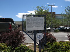
Nevada Historical Marker #243
On March 17, 1897, at an arena located on this site, Carson City played host to Nevada's first world championship prizefight, a fourteen-round thriller in which the reigning heavyweight titlist, James J. "Gentleman Jim" Corbett, was dethroned by Robert Fitzsimmons. The Nevada Legislature had only recently legalized prizefighting and the match became the object of scathing criticism from the press and pulpit of other states, but fight fans by the thousands came in. Promoter Dan Stuart put on a clean show and demonstrated that boxing need not be brutal or crooked. Other states were soon to liberalize their own prizefight laws and the sport began to assume a degree of respectability it had not enjoyed in the past. In later years, Nevada was to be the scene of several other world championship fights.
, Carson City, NV, United States
Subjects


Nevada Historical Marker #256
Historic Transportation. The historic road corridors from the Truckee Meadows northwestward into the Honey Lake area contains a tangle of intertwined routes following the course of valleys, portions of an emigrant trail cutoff, toll roads, county roads and casual parallel routes developed to bypass blockages such as mud holes. Construction of the paved precursor to U.S. 395 and recent freeway construction along this same corridor have obliterated much of the earlier road system, cutting it into isolated segments. The road is associated with the continuing history of transportation in the state of Nevada, reflecting the process of road improvement and economic and demographic change. HONEY LAKE 1856-1863 In 1856, the early settlers of the region, the Honey Lakers, proposed the territory of Nataqua, encompassing the land along the eastern Sierra from Susanville to Carson Valley. The 1859 silver strikes in the Comstock Lake generated a prosperous market for the ranchers' livestock and produce. Freight wagons and stagecoaches ran regularly over the rutted road from the Honey Lake area to Virginia City and strengthened the settlers' attachment to eastern Sierra settlements rather than those in California. The Honey Lake ranchers felt so strongly about their independence and connection to the Great Basin environs, they fought the 1863 Sagebrush War attempting to block their annexation to Plumas County, California. EMIGRANT TRAIL 1851-1855 In 1851, James Pierson Beckwourth (1798-1866), the son of Sir Jennings Beckwith and a slave, located and constructed a wagon road connecting the California Emigrant Trail in the Truckee Meadows to Marysville, California via Sierra Valley (portions of Highway 70). Beckwourth, a trapper and trader, hoped to earn his fortune with the opening of the road; however, he was never reimbursed as promised by the mayor or Marysville for road construction. The trail served for a few years as an alternative pass through the Sierra; it became a byway for local traffic after 1855. ROADSIDE STATIONS AND RANCHES 1850s This marker is located at the Peavine Ranch, an overnight stop for the travelers along the road from the Truckee River to ranches near Honey Lake. The ranch advertised a well-stocked table and bar and first class beds. Purchased in 1862 by Fielding Lemmon, it was initially part of real estate and mining promotion as platted on this 1867 map, but Peavine grew instead into a prosperous livestock operation. Several other ranches were located along the road, yet, for nearly a hundred years regional growth centered around downtown Reno and Sparks. Over time, most of the ranches and stage stops were replaced by small isolated communities, then larder communities, and eventually suburbs. HIGHWAY SYSTEM 1930s-PRESENT The Three Flags Highway gave way to U.S. 395, which was an extension of Virginia Street in Reno. In the 1970s a four-lane system was proposed. The highway generally follows the same transportation corridor and still cuts through the Peavine Ranch property. THREE FLAGS HIGHWAY 1923-1930s One of the first federally funded highways in Nevada was a macadam road from Reno to the Nevada/California border. The Nevada Highway Commission was organized in 1917. Federal money was mandated for Nevada in 1921 and construction started in April 1922 for the Three Flags Highway, the road linking Canada, the United States, and Mexico. Portions of the road still remain. TOLL ROADS 1850s-1860s Prior to state and federally constructed highways, a stage and toll road between Honey Lake and Virginia City was more or less maintained under a succession of private owners such as Myron C. Lake. In 1861, Lake traded property in Honey Lake Valley for the log toll bridge across the Truckee River with Charles W. Fuller of Susanville. Lake applied for a franchise to improve, maintain and construct a toll road from three miles south of this bridge to the California/Nevada border excluding passage through town streets of Reno. The early road, approximately 20 miles long, was in a constant deplorable condition and impassable at times.
N Virginia St, Reno, NV, United States

Nevada Historical Marker #7
Dayton. Dayton, one of the earliest settlements in Nevada, was first known as a stopping place on the river for California–bound pioneers. Coming in from the desert, they rested here before continuing westward.In 1849, Abner Blackburn found a gold nugget at the mouth of Gold Canyon and prospecting began in the canyon to the north. Ten years later, this led to the discovery of the fabulous ore deposits at Gold Hill and Virginia City. Called by several different names in its early years, the place became Dayton in 1861, named in honor of John Day who laid out the town.For many decades Dayton prospered as a mill and trading center. It remained the county seat for Lyon County until 1911.
Lincoln Hwy, Dayton, NV, United States
Nevada Historical Marker #3
West End Of Hastings Cutoff. Across the Humboldt Valley southward from this point a deeply incised canyon opens into a valley. Through that canyon along the South Fork of the Humboldt River ran the disaster-laden route called the Hastings Cutoff. It joined the regular Fort Hall route running on both sides of the Humboldt here. The canyon was first traversed in 1841 by the Bartleson-Bidwell Party, the earliest organized California emigrant group. In 1846, Lansford Hastings guided a party through this defile of the South Fork and out along the Humboldt. The ill-fated Reed Donner Party followed later the same year.By 1850, the dangers of the cutoff route were recognized and it was abandoned.
Dwight D Eisenhower Highway, Elko, NV, United States

Nevada Historical Marker #4
Junction House. One of the busiest crossroads of pioneer Nevada converged at this point, serving many major toll roads of the area. The earliest emigrants from the east crossed through Truckee Meadows at this point, and by 1853, the intersection was known as Junction House, was the first permanent settlement in this valley and a stopping place for thousands. Junction House, later called Andersons, was a station for toll roads of the 1860s including the turnpike to Washoe City, the Myron Lake Road to Oregon, the Geiger Road to Virginia City and the important Henness Pass route to California.Governor Sparks bought the property in the late 1890s, and most recently it belonged to cattleman William Moffat.
South Virginia St, Reno, NV, United States

Nevada Historical Marker #44
Carson City. Nevada's State Capital, one of the state's oldest communities, was established in 1851 as Eagle Station, a trading post and ranch on the Carson Branch of the California Immigrant Trail, by Frank and Warren L. Hall, George Follansbee, Joe and Frank Barnard and A. J. Rollins. The station and surrounding valley took their name from an easgle skin stretched on the wall of the trading post. In 1858, Abraham Curry purchased much of the Eagle Ranch after finding that lots in Genoa were too expensive. Together with his friends, Jon Musser, Frank Proctor and Ben Green, Curry platted a town he called Carson City. Curry left a plaza in the center of the planned community for a capitol building should a territorial state seat of government eventually be located in his town. In March 1861, Congress created the Nevada Territory. Seven months later in November, Carson City became the capital of the territory due to the efforts of Curry and William M. Stewart, a prominent lawyer. When Nevada became a state three years later, Carson City was selected as the state capital, and by 1871, the present capitol building was completed in the plaza Curry had reserved for it.
, Carson City, NV, United States

Nevada Historical Marker #1
Empire And The Carson River Mills. When the Comstock Lode was discovered in 1859, the problem of reducing the ore from the fabulously rich Virginia City mines had to be solved. Mills were built in Gold Canyon and Six Mile Canyon, in Washoe Valley, at Dayton, and on the Carson River which offered the most abundant source of water to operate the mills.On the east shore of the river near the town of Empire the first small mill, built in 1860, was later enlarged to become the Mexican. The site of this mill lies to the southwest. Other large mills were then constructed farther downstream, spurring the growth of the town of Empire. Ore was hauled to the mills at first by wagon and later by the famous Virginia and Truckee Railroad built in 1869. Fortunes in gold and silver were produced in over 40 years of operation by the Carson River mills including the Mexican, Yellow Jacket, Brunswick, Merrimac, Vivian, and Santiago. Traces of Empire and its mills can still be seen today.
, Carson City, NV, United States
Nevada Historical Marker #2
Pioneer Memorial Park. This part of the Pioneer Cemetery includes the last resting place of Frank Baud and other of the pioneers who founded Winnemucca, earlier known as French Ford. Baud arrived in 1863 and is one of the men credited with naming the town Winnemucca after the famous Northern Paiute chieftain. Baud came with Louis Lay from California to work on the Humboldt canal, a project headed by Dr. A. Gintz and Joseph Ginaca who devised the plan to link Golconda and Mill City by means of a 90-mile canal and provide water for the mills in the area. It was never completed. Baud later became a merchant, helped build the Winnemucca Hotel with Louis and Theophile Lay, was the first postmaster, and gave the town a schoolhouse before his death in 1868.
Pioneer Park, Winnemucca, NV, United States

Nevada Historical Marker #5
Pioche. Silver ore was discovered in this range of mountains in 1864, but no important development took place until 1869 when mines were opened and the town of Pioche was founded. Pioche soon became the scene of a wild rush of prospectors and fortune seekers. It gained a reputation in the 1870s for tough gunmen and bitter lawsuits. Miners had retrieved over five million dollars in ore by 1872, but by 1900, Pioche was nearly a ghost town. Designated as the seat of Lincoln County in 1871, Pioche survived hard times as a supply and government center for a vast area. Beginning in 1937, Pioche enjoyed two decades of profitable lead-zinc mining.
NV-321, Pioche, NV, United States

Nevada Historical Marker #6
Eldorado Canyon. Eldorado Canyon, the site of a mining boom, runs east from here to the Colorado River. Prospectors began digging for gold and silver here about 1859, forming the Colorado Mining District. The three largest mines, the Techatticup, Wall Street, and El Dorado Rand Group, yielded over $6,000,000.This portion of the Colorado River was navigable before the construction of Hoover Dam, allowing steamboats and barges to freight goods 350 miles from the Gulf of California to the mouth of Eldorado Canyon and upriver. The steamboat era peaked in the 1860s but continued to the turn of the twentieth century.In 1867, the US. Army established an outpost at Eldorado Canyon to secure the riverboat freight and to protect miners in the canyon from Native Americans. The military abandoned the camp in 1869. In the 1870s the mines flourished again, producing ore until World War II.
, Boulder City, NV, United States

Nevada Historical Marker #163
Dayton Chinatown. Dayton is the site of Nevada’s first China Town. By the mid-nineteenth century, hundreds of thousands of immigrants from China, along with immigrants from Japan and Korea, moved to the United States, They were pushed by economic disruption in their home countries and pulled by the promises of gold and employment in the Rocky Mountain West.The Dayton Chinese were hired by Edward Rose in August 1857 to dig the four-mile Rose Ditch from the mouth of the Carson River west of town to the miners working the placers at the entrance to Gold Canyon. Despite discrimination, the promise of jobs compelled the Chinese to stay. They mined in Gold Canyon and settled along the Carson River in this area. The community continued to be an important hub for Chinese Americans in Nevada into the 1880s.
Silver St, Dayton, NV, United States

Nevada Historical Marker #8
Austin. Austin sprang into being after William Talcott discovered silver at this spot on May 2, 1862. Talcott came from Jacobsville, a stage stop six miles to the west on the Reese River. He was hauling wood out of Pony Canyon, directly below, when he made the strike that set off the famous “Rush to Reese.” A town called Clifton flourished briefly in Pony Canyon but fast growing Austin soon took over and became the Lander County seat in 1863. Before the mines began to fail in the 1880s Austin was a substantial city of several thousand people. From Austin, prospectors fanned out to open many other important mining camps in the Great Basin.
Lincoln Highway, Austin, NV, United States
Nevada Historical Marker #9
Copper Country. The famed open-pit copper mines of eastern Nevada, including the Liberty Pit, largest in the state, are located two miles south of this point. Through the first half of the twentieth century, this area produced nearly a billion dollars in copper, gold, and silver. The huge mounds visible from here are waste rock, which was removed to uncover the ore.Two miles east of here, near Lane City, was the Elijah, the first mine discovered in the Robinson Mining District. Lane City, originally called Mineral City, was settled in 1869 and had a population of 400. At Mineral City was the Ragsdale Station, one hotel, and a stage station.
Lincoln Highway, Ruth, NV, United States
Nevada Historical Marker #10
Sand Mountain. Sand Mountain dominates the Salt Wells Basin and is visible from Mt. Rose peak in the Carson Range 82 miles to the west. The dune is important to off highway vehicle enthusiasts, biologists, Native Americans, and geologists. Sand Mountain is a sinuous transverse dune derived from Ice Age Lake Lahontan beach sands piled here by southwesterly-trending winds. The dune is the Stillwater Northern Paiutes’ Panitogogwa, a giant rattlesnake traveling to the northeast with the wind to its back. The snake can be heard as it moves toward its hole, a phenomenon geologists associate with “singing” sand dunes. The Sand Mountain blue butterfly is only found here where it is depends on the Kearney buckwheat plant. The dunes clearly marked the location of nearby Sand Springs, improved and mapped in 1859 as a potential emigrant stop by Army Lieutenant James H. Simpson. Sand Springs later served as the location of the Sand Springs Pony Express Station in 1860 and the terminus of the 1866 Fort Churchill and Sand Springs Toll Road.
, Fallon, NV, United States
Nevada Historical Marker #11
Eureka. “Eureka!” a miner is said to have exclaimed in September 1864 when he discovered rich ore here – and thus the town was named. Eureka soon developed the first important lead-silver deposits in the nation, and during the furious boom of the 1880s, it had 16 smelters, over 100 saloons, a population of 10,000 and a railroad – the colorful Eureka and Palisade – that connected with the transcontinental line 90 miles to the north.Production began to fall off in 1883, and by 1891, the smelters closed, their sites marked by the huge slag piles at both ends of Main Street.
Lincoln Highway, Eureka, NV, United States
Nevada Historical Marker #12
Nevada’s Birthplace. Carson Valley is the Birthplace of Nevada. By 1851, people settled at a place they called Mormon Station, renamed Genoa in 1856. With the early establishment of a post office and local government, the community can lay claim to the title of “Nevada’s first town.”Thousands of emigrants moved over the old road skirting the west bank of the Carson River as they prepared to cross the Sierra, feeding their livestock on grass cut along the river. At Genoa; at Mottsville, settled in 1852; and at Sheridan, settled by Moses Job about ’54; emigrants stopped to enjoy produce of the region’s first gardens. Pony Express riders used this route in 1860, switching a year later to the shorter Daggett Trail, now Kingsbury Grade.
Genoa Lane, Genoa, NV, United States

Nevada Historical Marker #13
The Comstock Lode. Near this spot was the heart of the Comstock Lode, the fabulous 2 ½ mile deposit of high-grade ore that produced nearly $400,000.00 in silver and gold. After the discovery in 1859, Virginia City boomed for 20 years, helped bring Nevada into the union in 1864 and to build San Francisco.Several major mines operated during the boom. Their sites are today marked by large yellow dumps, several of which are visible from here – the Sierra Nevada a mile to your left, the Union, Ophir, Con Virginia and, on the high hill to the southeast, the combination. The Lode was worked from both ends, north up Gold Canyon and south from the Sierra Nevada Utah mines.
D Street, Virginia City, NV, United States

Nevada Historical Marker #14
Goldfield. For a twenty-year period prior to 1900, mining in Nevada fell into a slump that cast the entire state into a bleak depression and caused the loss of a third of the population.The picture brightened overnight following the spectacular strikes in Tonopah and, shortly afterwards, in Goldfield. Gold ore was discovered here in December 1902 by two Nevada-born prospectors, Harry Stimler and Billy Marsh. From 1904 to 1918, Goldfield boomed. The city had a railroad that connected to Las Vegas and a peak population of 20,000, making it Nevada’s largest community at the time. Between 1903 and 1940 a total of $86,765,044 in precious metals was produced here.
East Crook Avenue, Goldfield, NV, United States

Nevada Historical Marker #15
Tonopah. Jim Butler, District Attorney of Nye County, is credited with the turn-of-century discovery, which ended a twenty-year slump in Nevada’s economy. American Indians originally used the name Tonopah for a small spring in the nearby San Antonio Mountains, long before Butler camped in this area in May 1900. Tonopah became the richest silver producer in the nation and replaced Belmont as the Nye County county seat in 1905. The mines spawned a railroad, several huge mills, and a bustling population of approximately 10,000.The mines faltered in the 1920s, but Tonopah achieved long-lasting fame because of the prominent financial and political leaders it produced. Many camps and communities followed in the wake of Tonopah’s boom, most of which have become ghost towns.
Erie St, Tonopah, NV, United States

Nevada Historical Marker #16
Mineral County. Nevada’s earliest maps show Walker Lake. Jedediah Smith, the first English-speaking American in what is modern-day Nevada, passed near here in 1828 during his remarkable trip across the Great Basin. Peter Skene Ogden traveled through the region in 1829, and then John C. Frémont arrived in 1845 with his guide, Joseph Walker, for whom the lake is named.Until its creation in 1911, Mineral County was part of Esmeralda. The first Esmeralda County seat was at Aurora but it was moved to Hawthorne in 1883, two years after the Carson and Colorado Railroad was built. Goldfield took the county seat in 1907, but Hawthorne became a government seat once again with the creation of Mineral County. The county includes several well-known mining towns, including Aurora, Belleville, Candelaria, Luning, Marietta, Mina, and Rawhide as well as other smaller mining camps.
, Walker Lake, NV, United States
Nevada Historical Marker #17
Pershing County. Here was a key point on Nevada’s earliest road, the famed Humboldt Trail that brought 165,000 immigrants west in the 1840s and 1850s. Travellers named this rich valley the Big Meadows. They stopped here for water and grass before continuing south to cross the dreaded Forty Mile Desert, the most difficult segment on the trail to California.Mining began here in the 1850s. George Lovelock, merchant, rancher and prospector, gave his name to the county seat. The coming of the railroad in 1869 brought new growth to the area. Pershing County, established in 1919, was previously part of Humboldt County.
Western Avenue, Lovelock, NV, United States

Nevada Historical Marker #18
Pyramid Lake. America’s most beautiful desert lake is a remnant of ancient Lake Lahontan which covered some 8,4513 square miles in western Nevada during the ice age. Caves and rock shelters along its shore have yielded evidence of Numu (Paiute) people living here for thousands of years. John C. Fremont came upon the lake on January 10, 1844 and named it for the pyramid shaped island just off the east shore. The Numu call the pyramid formulation Wono. The Pyramid Lake Indian Reservation was created in 1859. The history of the Numu people living here has been one of contention with encroaching settlers. With the Numu victory in the first battle of Pyramid Lake, May 12, 1860 more European American men died than in any prior engagement west of the Mississippi. Anaho Island, just to the south of the pyramid, was established as a national wildlife refuge in 1913 and is today one of the largest white pelican nesting grounds in North America.
Pyramid Lake Highway, Reno, NV, United States

Nevada Historical Marker #19
Ragtown. Ragtown was never a town, but the name of a most welcome oasis and hamlet. This mecca on the banks of nearby Carson River received its name from the appearance of pioneer laundry spread on every hand bush around. The Forty-Mile Desert, immediately to the north, was the most dreaded portion of the California Emigrant Trail. Ragtown was the first water stop after the desert. To the thirst-craved emigrants and their animals, no site was more welcome than the trees lining the Carson River. Imagine, if you will, the moment when the animals first picked up the scent of water--the lifted head, the quickened pace, and finally the mad, frenzied dash to the water's edge. Then, rest and repair for the arduous crossing of the Sierra Nevada that lay ahead. In 1854, Asa Kenyon located a trading post near Ragtown. Here he offered goods and supplies to the trappers. During the 1850's and 1860's, Ragtown was one of the most important sites on the Carson branch of the California Trail.
Reno Highway, Fallon, NV, United States
Nevada Historical Marker #20
Columbus. The remnants of Columbus are located on the edge of the Columbus salt marsh, five miles to the southwest.The town was initially settled in 1865, when a quartz mill was erected at the site. This was a favorable location for a mill, because it was the only spot for several miles around where water was in sufficient quantity for operation.The full importance of Columbus was not recognized until 1871, when William Troop discovered borax in the locality. Shortly thereafter, four borax companies were actively engaged in working the deposits on the marsh.Columbus probably enjoyed its most prosperous time in about 1875, when the population was reported to have reached 1,000. That year, the town had many kinds of business establishments, including a post office and a newspaper, The Borax Miner.In 1881, about 100 people were left after the borax operations had practically ceased. All mining and milling stopped entirely shortly after that time.
Columbus Rd, Columbus, NV, United States
Nevada Historical Marker #21
The Humboldt Canal. The Humboldt Canal, sometimes termed the Old French Canal, coursed southwestward from Preble, near Golconda, toward Mill City. The present highway crossed it at this point, from whence it ran southerly toward the Humboldt County Courthouse on Bridge and West Fifth Streets.The canal was conceived in 1862 by Gintz and Joseph Ginaca. The waterway, with a projected cost of $160,000, was to be sixty-six miles long, fifteen feet wide and three feet deep, and with a fall of thirty-five feet. Its primary purpose was to supply water for over forty stamp mills planned at and above Mill City, but it was also designed for barge traffic and some irrigation water supply.Construction of the canal began in 1863. Louis Lay, a French emigrant from California, excavated the first segment. Winnemucca City founder Frank Baud, another Frenchman, worked on the project as a teamster.About $100,000, largely French capital, was expended in building the Humboldt Canal to the Winnemucca area. Because of engineering errors and severe seepage problems between Winnemucca and Mill City, that section was never completed or used.Several portions of the old canal are still visible in the Golconda area, in various sections of Winnemucca, and at Rose Creek, south of the city.
E 2nd St, Winnemucca, NV, United States

Nevada Historical Marker #22
Humboldt River. Peter Skene Ogden encountered the Humboldt River on November 9, 1828 during his fifth Snake Country expedition. Entering Nevada near present-day Denio, Ogden came southward along the Quinn River and the little Humboldt River. Emerging on the Humboldt main stem near this site, Ogden explored hundreds of square miles of the Humboldt’s course, left records of his trailblazing in his journal, and drafted the first map of the area. Ogden gave the name “Unknown River” to the Humboldt at this time, as he was unsure where it went. After the death of his trapper Joseph Paul, Ogden renamed the stream Paul’s River, then Swampy River, and finally Mary’s River, after the Native American wife of one of his trappers. In 1833, the Bonneville-Walker fur party named it Barren River. Ogden’s or Mary’s River were commonly used names for the Humboldt prior to the 1848 publication of a map of John C. Frémont.The Humboldt was the only natural arterial across the Great Basin. It funneled thousands of emigrants along its valley enroute to the Pacific Coast during the period 1841-1870.
Mills Rd, Golconda, NV, United States
Nevada Historical Marker #23
Humboldt House. Humboldt House, also known as Humboldt Station, was originally the point of departure for Humboldt City, Prince Royal, and the mines in that vicinity. In September 1866, it became a stage stop for the historic William (Hill) Beachey Railroad Stage Lines.As the Central Pacific Railhead advanced from eastern California, it reached Humboldt House in September 1868. From 1869 to 1900, Humboldt House was well known as one of the best eating-houses on the Central Pacific Railroad. It was truly an oasis in the great Nevada desert, with good water, fruit, and vegetables. The large grove of trees to the west marks the site of this famous hotel.Between 1841 and 1857, 165,000 Americans traveled the California emigrant trail past here. In 1850, on the dreaded Forty Mile Desert southwest of present-day Lovelock, over 9,700 dead animals and 3,000 abandoned vehicles were counted.HISTORICAL
Dwight D Eisenhower Highway, Imlay, NV, United States
Nevada Historical Marker #24
Olinghouse. Named for a former teamster-turned-sheepman, Elias Olinghouse, who settled in a quiet canyon at the base of the Pah Rah mountain range to get away from it all. As prospecting activities increased about him, Olinghouse was caught up in the whirl of things, buying several claims and erecting a small stamp mill in 1903 to process ores.The district was first prospected in 1860; it was not organized, however, until 1899. Shortly thereafter, the region reached its peak of activity, producing $410,000 in gold and silver values between 1898 and 1903.Both electric and telephone service were installed in 1903, and in 1907 the standard-gauge Nevada Railroad arrived. This short-lived railroad was completed from a junction on the Southern Pacific near Wadsworth to Olinghouse in February of 1907; regular operations ceased on November 1, 1907. Aside from its short life, the Nevada Railroad Company was distinguished by having the first Shay-geared locomotives to be used in Nevada.Sporadic activity has continued at Olinghouse until the present time. Total production is estimated to have been $520,000.
unnamed road, Wadsworth, NV, United States

Nevada Historical Marker #25
Nevada’s Capitol. Completed in 1871, Nevada’s splendid Victorian-era Capitol was built of sandstone from the quarry of the town’s founder, Abe Curry. The octagon annex was added in 1907, the north and south wings in 1915. Notable features are its Alaskan marble walls, French crystal windows, and elegant interior.
, Carson City, NV, United States
Nevada Historical Marker #26
Forty Mile Desert. The Forty Mile Desert, beginning here, is a barren stretch of waterless alkali wasteland. It was the most dreaded section of the California Emigrant Trail. If possible, travelers crossed it by night because of the great heat.In 1843, the Walker-Chiles Party became the first wagon train to use the route. Regardless of the desert’s horrors, this became the accepted trail, as it divided five miles southwest of here into the two main routes to California - the Carson River and Truckee River trails.Starvation and thirst preyed upon people and animals every mile. A survey made in 1850 illustrated appalling statistics - 1,061 dead mules, almost 5,000 horses, 3,750 cattle, and 953 graves. The value of personal property loss was set at the time at $1,000,000.The heaviest traffic occurred between 1849 and 1869. The trail was still used after completion of the Central Pacific Railroad in 1869, although it saw declining traffic after that.
US-95, Fallon, NV, United States

Nevada Historical Marker #27
Grimes Point. Grimes Point, one of the largest and most accessible petroglyph sites in Northern Nevada, contains about 150 basalt boulders covered with more than 1,000 petroglyphs. Nevada petroglyphs were of magico-religious significance, insuring the success of large game hunts and were located near seasonal migration routes.Running east and west along the ridge, on the hill above the petroglyphs, there is evidence of an aboriginal drift fence for driving deer or antelope. This required concentrated group action in construction and operation.The act of making a petroglyph was a ritual performed by a group leader before each hunt. Evidence suggests that there existed a powerful taboo against tampering in places, for purposes, and by persons other than those directly associated with the hunt.Petroglyphs probably date between 2500 and 500 years ago.
, Fallon, NV, United States
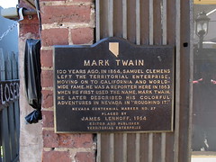
Nevada Historical Marker #28
Mark Twain. 100 years ago, in 1864, Samuel Clemens left the territorial enterprise, moving on to California and worldwide fame. He was a reporter here in 1863 when he first used the name, Mark Twain. He later described his colorful adventures in Nevada in “Roughing It.”
C Street, Virginia City, NV, United States
Subjects

.JPG)
_in_Palisade,_Nevada.JPG)

Nevada Historical Marker #29
Chinese In Nevada. 1864-1964 This honors the heroism and hardihood of the thousands of Chinese Americans who played a major role in the history of Nevada. From across the Pacific, the Chinese came to California during the Gold Rush of ′49 and on to the mountains and deserts of this state where they built railroads, cut timber, and performed countless tasks. Sizable Chinese communities grew up in Virginia City and other towns. Their contribution to the progress of the state in its first century will be forever remembered by all Nevadans.
Victorian Ave, Sparks, NV, United States

Nevada Historical Marker #30
Reno. Before the arrival of the European Americans, the Washoe and Paiute people inhabited the Truckee Meadows. The Stevens-Murphy emigrant party passed through the area in 1844, and settlement began in the early 1850s. Charles William Fuller established a river ferry across the Truckee in the fall of 1859 and completed a bridge and a hotel by the spring of 1860. Myron C. Lake acquired Fuller’s holdings in 1861, rebuilt the bridge, and established Lake’s Crossing. In 1868, Lake offered land for a depot to the Central Pacific Railroad and the town was laid out. The community’s name honors a Civil War officer, General Jesse Lee Reno.Reno’s transcontinental railroad connection and its rail link to the Comstock Lode helped lay the foundation for the economy, as did the lumber industry and the surrounding ranches and farms.The community’s reputation as a divorce center began in 1906 and gambling was legalized in 1931.
South Virginia Street, Reno, NV, United States

Nevada Historical Marker #31
Old Spanish Trail. Stretching for 130 miles across Clark County, this historic horse trail became Nevada’s first route of commerce in 1829 when trade was initiated between Santa Fe and Los Angeles. The trail was later used by the wagons of the “49ers” and by Mormon pioneers. Concrete posts marking the trail were erected in 1965.
West Mesquite Blvd, Mesquite, NV, United States
Nevada Historical Marker #32
Old Spanish Trail. Stretching for 130 miles across Clark County, this historic horse trail became Nevada’s first route of commerce in 1829 when trade was initiated between Santa Fe and Los Angeles. The trail was later used by the wagons of the “49ers” and by Mormon pioneers. Concrete posts marking the trail were erected in 1965.NEVADA
E Washington Avenue, Las Vegas, NV, United States

Nevada Historical Marker #33
The Old Spanish Trail 1829 1850. Stretching for 130 miles across Clark County, this historic horse trail became Nevada’s first route of commerce in 1829 when trade was initiated between Santa Fe and Los Angeles. The trail was later used by the wagons of the “49ers” and by Mormon pioneers. Concrete posts marking the trail were erected in 1965.
Village Blvd, Blue Diamond, NV, United States

Nevada Historical Marker #34
The Old Spanish Trail 1829 1850. Stretching for 130 miles across Clark County, this historic horse trail became Nevada’s first route of commerce in 1829 when trade was initiated between Santa Fe and Los Angeles. The trail was later used by the wagons of the “49ers” and by Mormon pioneers. Concrete posts marking the trail were erected in 1965.
, Mountain Springs, NV, United States
Nevada Historical Marker #35
Las Vegas Old Mormon Fort (Nevada’s Oldest Building). Las Vegas had its beginning at this location on June 14, 1855, when thirty-two Mormon missionaries arrived from Utah under the leadership of William Bringhurst. They set to work establishing farm fields that summer, and began to build a 150-foot square adobe fort that September, enclosing eight two-story houses. They cultivated small gardens and fields, planted fruit and shade trees, and tried to convert the local Southern Paiutes.Most of the Mormons departed in 1857, and by 1865, Octavius Decatur Gass began developing the Las Vegas Rancho, using the adobe structures as headquarters. He farmed and raised beef cattle, supplying travellers and miners in the Potosi region.Helen J. Stewart, owner of the property from 1882 to 1902, expanded the ranch to 1,800 acres, which she sold to the San Pedro, Los Angeles & Salt Lake Railroad for the Las Vegas townsite. The Company auctioned the land on May 15, 1905, starting the process of building the Las Vegas around you today.
E Washington Avenue, Las Vegas, NV, United States

Nevada Historical Marker #36
Moapa Valley. Rich in Pueblo-type culture, and noted by the explorer Jedediah Smith in 1826, Moapa Valley is crossed by the Old Spanish Trail.In 1865, Brigham Young sent 75 families to settle the area, to grow cotton for the people of Utah, and to connect Utah with the Pacific Ocean via the Colorado River.Located near the junction of the Muddy and Virgin Rivers, and now under Lake Mead, the “cotton mission” was named St. Thomas for its leader, Thomas Smith. Mormons built a prosperous, self-contained agricultural industry in the valley, which included orchards, vineyards, cotton, grains, and vegetables.The December 1870 survey placed the valley in Nevada, which meant property owners owed back taxes to Nevada. The settlers, now including those in St. Joseph, (old) Overton, West Point, and Logandale, began leaving two months later. They abandoned the results of 7 years of labor, more than 18 miles of irrigation canal, and several hundred acres of cleared land.Other Mormons resettled the land in 1880. The area remains one of the most agriculturally productive in the state.
N Moapa Valley Blvd, Moapa Valley, NV, United States

Nevada Historical Marker #37
Powell Of The Colorado. On August 30, 1869, Major John Wesley Powell landed at the mouth of the Virgin River, about twelve miles south of here, thus ending the first expedition through the Grand Canyon of the Colorado River.The expedition left Green River City, Wyoming Territory, on May 24, 1869. For three months Powell and his men endured danger and hunger to explore, survey, and study the geology of the canyons along the Green and Colorado Rivers.Exhausted and near starvation, the Powell party was fed by the Mormons of St. Thomas, a small farm settlement about eleven miles north of here.The original sites of St. Thomas and the junction of the Virgin and Colorado Rivers are now beneath the waters of Lake Mead.This, and later Powell surveys, stimulated interest in the water conservation problems of the Southwest.
Echo Bay Road, Overton, NV, United States

Nevada Historical Marker #38
Pahranagat Valley. Pahranagat Valley is named after a local Shoshone Native American Tribe. Three local springs fill the valley’s lakes, which farmers have used for irrigation since the mid-nineteenth century.In the late 1860s, outlaws pastured hundreds of head of stolen cattle in the valley meadows. In 1865, ore was discovered in the area. The following year, a stamp mill was established at Hiko, twenty miles to the north to crush the ore. Hiko became the center of activity for the valley and the county seat between 1866 and 1871, when local mining declined and Pioche claimed the county seat.The valley received international notoriety in 1867 when Dan De Quille of the Territorial Enterprise published an article titled “The Rolling Stones of Pahranagat,” about magnetic traveling stones. De Quille was notorious for publishing comedy and satire, sometimes mistaken by his readership for truth. In this case, De Quille described these round stones as having a magical quality that, when scattered on the floor, would immediately began travelling toward a common center. De Quille published similar articles on the stones in 1876, 1879, and 1892.The town of Alamo before you, established in 1900, is the valley’s largest present-day settlement. Watered by Pahranagat Creek, the area includes several ranches and the Pahranagat Valley National Wildlife Refuge.
Great Basin Highway, Alamo, NV, United States

Nevada Historical Marker #39
Panaca. Southern Nevada’s first permanent settlement was established as a Mormon colony by Francis C. Lee and others in 1864. Poor in resources, but rich in people, Panaca has changed little through the years. Although mining at nearby Bullionville and Pioche has had its effect, Panaca remains an agricultural community.The post office was established in 1867, moved to Bullionville in 1874, and returned in 1879. During the 1870s, coke ovens produced charcoal here for the smelters at Bullionville.Originally located in Washington County, Utah, Panaca became part of Nevada by an act of Congress, dated May 5, 1866. As the boundary was not then surveyed, a dispute arose over taxes levied by Lincoln County, Nevada. The matter settled in favor of the Panaca citizenry on December 4, 1871, after a long period of bitter litigation.
Main St, Panaca, NV, United States

Nevada Historical Marker #41
Pueblo Grande De Nevada. Indians of a highly-developed civilization lived throughout Moapa valley from 300-1100 A.D. several hundred ancient pithouses, campsites, rockshelters, salt mines and caves of ancestral Puebloan people make up what is commonly known as “Lost City.” These people cultivated corn, beans, and squash in fields irrigated by river water. They also gathered wild seeds and fruits and hunted widely for deer, antelope, desert bighorn sheep, small mammals, and birds. They wove fine cotton cloth, fired beautifully painted and textured pottery, and mined and traded salt and turquoise to coastal tribes for seashells. Early dwellings were circular pithouses below ground. Later dwellings above ground were single storey adobes having up to 100 rooms.Lake Mead, created by Hoover Dam, flooded the most intensively developed portion of lost city.
South Moapa Valley Blvd, Overton, NV, United States

Nevada Historical Marker #42
Big Smokey Valley. Named for its hazy distances, this valley has witnessed a parade of famous men and stirring events. The valley and its bordering Toiyabe and Toquima ranges are Shoshone territory.Jedediah Smith, intrepid trapper and trail-blazer, was the first European American in the area, crossing the valley’s southern end from the west in 1827. In 1845, John C. Frémont passed through the valley, accompanied by such figures of the American West as Kit Carson and Basil LaJeunesse.In 1859, Captain James Simpson located the “central route” across the valley’s northern end. Thus began the historic decade 1859-1869, which saw Chorpenning’s Jackass Mail, the Pony Express, the Overland Telegraph, and the Concord Coaches of the Overland Mail and Stage Co. crossing the valley.Silver strikes at Austin (1862-1863) initiated the valley’s first mining boom. Numerous bustling mining camps sprang up, including Bunker Hill, Kingston, Geneva, Santa Fe, Ophir Canyon, and Jefferson.Following the 1900 Tonopah silver strike, mining surged again. Two new towns, Manhattan and Round Mountain, started with a brief revival of many earlier camps.
NV-376, Carvers, NV, United States
Nevada Historical Marker #43
Derby Diversion Dam. Derby Dam, constructed under Specification Number 1 and Drawing Number 1 of the U.S. Reclamation Service, now the U.S. Bureau of Reclamation, diverts the flow of the Truckee River for irrigation use. It was the forerunner of such mighty structures as Hoover, Grand Coulee, Shasta, and Glen Canyon Dams.Derby Dam was authorized by Secretary of the Interior E.A. Hitchcock on March 14, 1903. It was part of the Newlands Project, named in honor of Nevada Senator Francis G. Newlands who worked for passage of the Reclamation Act in 1902. Derby takes its name from a nearby Southern Pacific Railroad station of the day.Charles A. Warren & Co. of San Francisco, the contractor, started work on the dam on October 2, 1903, and finished May 20, 1905. Operational water diversions began in 1906.
Dwight D Eisenhower Highway, Sparks, NV, United States

Nevada Historical Marker #45
Humboldt Wells. These springs, seen as marshy spots and small ponds of water in the meadows, are Humboldt Wells, a historic oasis on the California Emigrant Trail. Between 1845 and 1869, hundreds of covered wagon trains camped here, refitted from their arduous journeys and prepared for the grueling 300 mile trek west along the Humboldt Valley. Ruts of the oldEmigrant Trail winding down to the springs can still be seen on the slopes above them and to the northwest.In 1869, the Central Pacific Railroad established a station named Humboldt Wells for the springs located west of the station. In 1873, the Elko County Commission changed the name from Humboldt Wells to Wells.
6th St, Wells, NV, United States
Nevada Historical Marker #46
Pilot Peak. The high, symmetrically shaped mountain seen rising to the north is Pilot Peak, named by John C. Fremont on his expedition of 1845. Previously, the Bartleson-Bidwell party camped here in 1841. These emigrants had traveled one day and night across the Great Salt Lake Desert to find their first water here.In the period 1845-1850, the peak was a famous landmark and symbol of hope and relief to the Reed-Donner Party and all other wagon train pioneers who traveled the 70-odd miles of deadly, thirst-and-heat-ridden steps across the Great Salt Lake Desert. This desert represented the worst section of the infamous Hastings Cutoff of the California Emigrant Trail.STATE HISTORIC
Pilot Rd, West Wendover, NV, United States
Nevada Historical Marker #47
Fort Halleck Site 1867 1886. On July 26, 1867, Captain Samuel Smith established what became Fort Halleck twelve miles to the south near Soldier Creek. In concert with Fort Ruby fifty miles further south, the Army intended the Fort to protect the California Emigrant Trail, the Overland mail route and construction work on the Central Pacific Railroad during conflicts with Goshute and Western Shoshone in that decade.The camp was named for Major General Henry Wager Halleck, a prominent general who served as general-in-chief to the Army from 1862 to 1865. In May 1868, Camp Halleck became a two-company post and the headquarters for the Nevada Military District when Fort Churchill, near Yerington, was abandoned. By 1877, the Fort contained about 20 buildings of wood, adobe, and stone arranged around a rectangular parade ground.Troops from the Fort participated in action against the Modoc Indians in Northern California in 1873; against the Nez Perce uprising in Idaho in 1877; against the Bannocks in Oregon in 1878; and against the Apaches in Arizona in 1885. However, by the 1880s, the need for military stations throughout the American West was much diminished and the Army closed the Fort in December 1886.
NV-229, Elko, NV, United States
.JPG?width=250)
Nevada Historical Marker #48
Tuscarora. This colorful historic camp originated with an 1867 discovery of placer gold by John and Steve Beard. In 1871, W.O. Weed discovered the rich Mount Blitzen silver lodes, two miles northeast of the Beard claims. These and other mines made up the Tuscarora Mining District, which experienced its boom between 1872 and 1884 and ultimately produced between $10 million and $40 million. At its peak, Tuscarora boasted a population of over 3,000, which included several hundred Chinese. The Chinese mostly conducted placer mining at the Beard discovery site, later called Old Town while the main camp developed at the present location of Tuscarora, platted in 1871. Toll roads, crowded with stage coaches and long strings of heavy freight wagons, serviced the camp from railheads at Elko, Carlin, Battle Mountain and Winnemucca. Tuscarora residents shifted their work between mining gold and silver, and ranching in Independence Valley.By 1895, Tuscarora’s production had diminished greatly from its boom days to below $50,000 annually. The camp struggled until 1917, when most of the mining equipment was sold for scrap. This ended operations at Tuscarora until 1987, when Fischer-Watt and Horizon re-opened the Dexter Mine.
, Tuscarora, NV, United States
Nevada Historical Marker #49
Applegate Lassen Emigrant Trail Cutoff. Jesse and Lindsay Applegate headed south from Willamette Valley, Oregon, June 29, 1846, seeking a less hazardous route to that region from the east. On July 21, they came to a large meadow on the Humboldt River, which is now the nearby Rye Patch Reservoir. Thus, they established the Applegate Trail.During the remainder of 1846 and for the next two years, Oregon emigrants successfully traveled this trail.In 1848, Peter Lassen, hoping to bring emigrants to his ranch, acted as a guide to a party of ten to twelve wagons bound for California. He followed a route from here to Goose Lake where he turned southward over terrain that was barely passable. The emigrants suffered great hardships including the loss of many lives and livestock. It became known as the “Death Route.”
Frontage Road, Imlay, NV, United States
Nevada Historical Marker #50
Carlin Canyon. In December 1828, Peter Skene Ogden and his trapping brigade (Hudson’s Bay Company’s Fifth Snake Country Expedition) were the first European Americans to enter here. Joseph Paul, one of Ogden’s trappers, died nearby—the first emigrant to die and be buried in the Humboldt Country.Late in 1845, John Frémont dispatched a group down the Humboldt. They traversed this canyon with difficulty on November 10. In September 1846, the Reed-Donner Party, en route to disaster in the deep snows of the Sierra Nevada, viewed the canyon.The Central Pacific’s Chinese track gangs constructed the transcontinental railroad (now Southern Pacific) through here in December 1868. Subsequently, the canyon became known as Carlin or Moleen Canyon. The Western Pacific, the second transcontinental rail link across Nevada, was constructed in 1907.In 1913, Nevada Route 1, the first auto road, took over the abandoned Central Pacific grade through the canyon. In 1920, Route 1 became the Victory Highway, and in 1926, U.S. Highway 40. In its freeway phase, it is now designated Interstate 80.
Chestnut St, Carlin, NV, United States

Nevada Historical Marker #51
Schellbourne. Schellbourne was a mail station and town, located approximately four miles east of this marker in Stage Canyon, nestled in the Schell Creek mountain range. The Pony Express established a mail station and corral there in 1860, providing mail service to the region until 1861, when the Overland Stage company took over the route. A small military post known as Fort Schellbourne joined the station until 1862, protecting the stage line during the conflicts between whites and the Newe (Goshute and Western Shoshone) Indians.Prospectors discovered silver ore in the mountains immediately to the east of Schellbourne in the early 1870s, and created the Aurum Mining District in 1871. An active mining camp developed with a population of over 500 people. By 1885, the ore had been mostly depleted, with other mining towns like Cherry Creek drawing residents away. The district and adjacent valley were acquired by Uncle Billy” and Eliza Burke as a ranch and hotel. Schellbourne has subsequently operated as the headquarters for various ranches since that time.
White Pine County Rd 18, Ely, NV, United States

Nevada Historical Marker #52
Cherry Creek. The town of Cherry Creek before you was part of a network of mining districts that operated in the nineteenth and twentieth centuries, including the Gold Canyon district in Egan Canyon, five miles to the south.Peter Corning and John Carpenter helped start the town of Cherry Creek when they staked the Tea Cup gold claim in 1872, resulting in a boom and the development of a town. At the town’s peak in 1882, it boasted a population of over 1,800. While production fluctuated, Cherry Creek continued to produce gold and silver ore into the 1940s.Egan Canyon to the south was part of the 1855 route established by Howard Egan and the Mormon Battalion, and surveyed for use in 1859 by the U.S. Army. By 1860, the Pony Express placed a change station at the west opening of the canyon. Between 1861 and 1869, Butterfield’s Overland Mail and Stage established a station here that grew into a small temporary town.In 1863, soldiers from Fort Ruby discovered gold in the canyon, leading to the creation of the town of Egan and a mining district. By 1865 there were three stamp mills in Egan processing ore from the district. Like Cherry Creek, to the north, Egan boomed and busted into the 1920s before mining ceased.
Cherry Creek Rd, Cherry Creek, NV, United States
Nevada Historical Marker #53
Hamilton. The mines of the White Pine district were first established in 1865. Between 1868 and 1875, they supported many thriving towns including Hamilton, Eberhardt, Treasure City, and Shermantown. These communities, now all ghost towns, are clustered eleven miles south of this point.Hamilton and its neighbors thrived as a result of large-scale silver discoveries in 1868. Experiencing one of the most intense, but shortest-lived silver stampedes ever recorded, the years 1868-1869 saw some 10,000 people living in huts and caves on Treasure Hill at Mount Hamilton, at an elevation of 8,000 to 10,500 feet above sea level.Hamilton was incorporated in 1869 and became the first county seat of White Pine County that same year. It was disincorporated in 1875. In this brief span of time, a full-sized town came into bloom with a main street and all the usual businesses. Mine brick courthouse was constructed in 1870.On June 27, 1873, the main portion of the town was destroyed by fire. The town never fully recovered. In 1885, another fire burned the courthouse and caused the removal of the White Pine County seat to Ely.
Lincoln Highway, Ely, NV, United States
Nevada Historical Marker #54
Ward Mining District. The ghost town of Ward, in the foothills of the Egan Range, lies some eight miles west of here. Booming from 1876 until 1882, with a peak population of 1,500, Ward was somewhat of a lawless mining camp. Early killings did occur, but justice was meted out by the vigilante committee and the hanging rope.A million dollars worth of silver was taken from a single chamber of the Ward mine, yet an abandoned house was used for the first school and no movement was ever started to build a church.The town was abandoned by the late 1880s, but new discoveries and better mining methods prompted a resurgence of activity in 1906 and again in the 1960s.
Taylor Cutoff Rd, Ely, NV, United States

Nevada Historical Marker #55
Caliente (Culverwell’s Ranch). Caliente was first settled as a ranch, furnishing hay for the mining camps of Pioche and Delmar. In 1901, the famous Harriman-Clark right-of-way battle was ended when rancher Charles Culverwell, with the aid of a broad-gauge shotgun, allowed one railroad grade to be built through his lush meadows. Harriman and Clark had been baffling eleven years, building side-by-side grades ignoring court orders and federal marshals.The population boom began with an influx of railroad workers, most of them immigrants from Austria, Japan, and the Ottoman Empire. A tent city was settled in August 1903.With the completion of the Las Angeles, San Pedro, and Salt Lake Railroad in 1905, Caliente became a division point. Beginning in 1906, the Caliente and Pioche Railroad (now the Union Pacific) was built between Pioche and the main line at Caliente. The large Mission Revival-style depot was built in 1923, serving as a civic center, as well as a hotel.
Front St, Caliente, NV, United States

Nevada Historical Marker #56
Virgin Valley. Famed western explorer Jedediah Smith visited Virgin Valley in 1826. Captain John C. Fremont passed through here in 1844.The valley served as the right-of-way for the Old Spanish Trail (1829-1848) and for the Mormon Road or southern route of travel to southern California.Pioneers of the Church of Jesus Christ of Latter-Day Saints settled the area of Bunkerville in 1877 and Mesquite in 1880.The Virgin River provided water for the development of the valley’s agricultural resources.
West Mesquite Blvd, Mesquite, NV, United States

Nevada Historical Marker #57
Old Boundary. The 37th degree north latitude is marked at this point as the dividing line between the territories of Utah and New Mexico under the provisions of the Compromise of 1850 which originally organized the land ceded by Mexico in 1848.When the territory of Nevada was carved from western Utah in 1861, this line became the southern boundary of the new territory and continued to serve as such when the territory and state were enlarged by extensions to the east in 1862 and 1866 respectively.In 1867, the Nevada legislature approved the action of Congress to add that portion of the territory of Arizona which lay to the south of this line, west of the 114 west longitude and the Colorado River, and to the east of the boundary of California. This action, taken on January 18, 1867, gave the state of Nevada the permanent boundaries as they are today.
US-95, Beatty, NV, United States

Nevada Historical Marker #58
Old Boundary. The 37th degree north latitude marked at this point the dividing line between the territories of Utah and New Mexico under the provisions of the Compromise of 1850, which originally organized the land ceded by Mexico in 1848.When the territory of Nevada was carved from western Utah in 1861, this line became the southern boundary of the new territory and continued to serve as such when the territory and state were enlarged by extensions to the east in 1862 and 1866, respectively.In 1867, the Nevada legislature approved the action of Congress to add the portion of the territory of Arizona which lay to the south of this line, west of the 114 degree west longitude and the Colorado River, and to the east of the boundary of California. This action, taken on January 18, 1867, gave the state of Nevada the permanent boundaries as they are today.
Great Basin Hwy, Caliente, NV, United States
Nevada Historical Marker #59
Stokes Castle. Anson Phelps Stokes, mine developer, railroad magnate and member of a prominent eastern family, built Stokes Castle as a summer home for his sons. After the castle (or the tower, as theStokes family always referred to it) was completed in June 1897, the Stokes family used it for two months. Since then, with one possible exception, the structure has remained unoccupied.Stokes Castle is made of huge, granite stones, raised with a hand winch and held in position by rock wedging and clay mortar. The architectural model for the castle was a medieval tower Anson Stokes had seen and admired near Rome. This building originally had three floors, each with a fireplace, plate glass windows, balconies on the second and third floors, and a battlemented terrace on the roof. It had plumbing and sumptuous furnishings.Stokes Castle has served for decades as an iconic Nevada building often photographed by enthusiasts of Western history.
Forest Rd 43242A, Austin, NV, United States

Nevada Historical Marker #60
Hawthorne Present Mineral Co. Seat Former Esmeralda Co. Seat. The Hawthorne townsite, selected in 1880 by HM. Yerington, president of the new Carson and Colorado Railroad Co., was a division and distribution point for the railroad originally envisioned to extend to Bodie, in Mono County, California. Mineral development southeast in the Columbus Mining District, redirected the route southerly to California.Originally, to be called Millbrae, Yerington changed the name to Hawthorne, after William A. Hawthorne, a Nevada pioneer lumberman. In 1878, Hawthorne located a mine on Mt. Grant and started a ranch on Cat Creek. He worked for Yerington in 1880 as road superintendent on the company’s Bodie Toll Road, later serving as Justice of the Peace at Hawthorne.On April 14, 1861, the first train arrived loaded with prospective buyers for the new town lots. In 1883, Hawthorne took the Esmeralda county seat from declining Aurora, but later lost it in 1907 to booming Goldfield. In 1911, Hawthorne again became a county seat, when Mineral County was created.In 1926, a destructive munitions explosion in the East caused the Navy to select Hawthorne for a new ammunition depot. In 1928, Nevada-born and Hawthorne-raised Governor Balzar, turned the first shovel of dirt and dedicated the new depot, which was officially commissioned in 1930.
10th St, Hawthorne, NV, United States

Nevada Historical Marker #61
Moundhouse. Mound House was located one-half mile north of this point. Originally constructed in 1871 as a station and siding on the Virginia and Truckee Railroad, it served for some time simply as a wood and water stop. In 1877, a post office was established. Mound House came into its own in 1880, when the V & T began construction of a narrow-gauge railroad from here to the mining camps of western Nevada and the Owens Valley region of California. Named the Carson & Colorado, it turned Mound House into a booming shipping point.The Southern Pacific Railroad purchased the C & C from the V & T 1900, just prior to the Tonopah silver strike. In 1905, the Southern Pacific built a short line from its new station at Hazen, on the main line, to intersect the C & C at Fort Churchill. The Hazen cutoff took most of the booming Tonopah-Goldfield business away from the V & T.From 1900 to 1920, extensive gypsum mining and milling operations, to produce plaster, were carried on immediately northwest of Mound House.The narrow-gauge line was abandoned from Mound House to Fort Churchill in 1934 and the V & T track from Carson City to Virginia City in 1938. Within a few years, Mound House had disappeared.
, Mound House, NV, United States

Nevada Historical Marker #62
Truckee River. Native Americans settled for thousands of years in the Truckee Valley. Their camps were on these flats near the river. They used fish blinds near here and left petroglyphs on boulders in the area.The Truckee River runs from Lake Tahoe to Pyramid Lake, and was first discovered by Captain John C. Frémont in January 1844.The Stephens-Murphy-Townsend party in 1844 also followed the Truckee River into the Sierra, and crossed the mountains via Donner Pass. Two years later, the ill-fated Donner party rested in the Truckee Meadows, at present Reno, but they tarried too long and were caught by the Sierra snows. Despite the Donner tragedy, many emigrant trains to California, particularly from 1849 until 1852, traversed the Truckee route.In 1868, the Central Pacific Railroad followed the Truckee’s course. From the 1920s to the 1950s, the surrounding meadows echoed with the heavy exhausts of the giant Southern Pacific, cab-ahead, articulated, steam locomotives. During the same period, the Emigrant Trail, and the early toll roads, were developed into the Lincoln and Victory highways, and then into U.S. 40 and 1-80, today’s freeway.
Dwight D Eisenhower Highway, Mogul, NV, United States

Nevada Historical Marker #63
Truckee River. The Truckee River, seen below, runs from Lake Tahoe to Pyramid Lake. The river’s first recorded discovery was by Captain John C. Frémont in January 1844. He camped by its terminal at Pyramid, and then followed it to the big bend at Wadsworth. Captain Frémont named the stream the Salmon-Trout River. At the end of his 1845 sojourn in Nevada, he followed it into the Sierra and crossed Donner Pass.Beginning with the Stephens-Murphy-Townsend party in 1844, the Truckee River became a route for California emigrants until the advent of the Central Pacific Railroad in 1868-1869 brought the wagon train period to a close. After the Southern Pacific took over the railway in 1899 and relocated much of its Nevada alignment, the old Central Pacific roadbed between Sparks and Wadsworth was deeded to Washoe County in 1904 for road purposes. In 1917, the road became a portion of state road 1, which in 1920 became the Nevada section of the victory highway. In 1925, when federal highway names were replaced by a numerical system, the Victory Highway became U.S. highway 40. In 1958, after reconstruction, this route became the initial section of interstate 80 across Nevada. The river provides water for Reno, Sparks, the Fallon agricultural area and Pyramid Lake.
, Sparks, NV, United States
Nevada Historical Marker #64
Ophir. Well up into the canyon above, the massive stone foundations of a costly and splendid stamp mill as well as the stone walls of an elegant office and mansion are visible. This is the site of Ophir, now a ghost town.In 1863, S. Boulerond discovered ore at Ophir. In 1864, the Murphy Mine opened and became the leading local producer. In 1865, a 20-stamp mill was completed costing over $200,000. This included the first experimental Stetefeldt furnace ever built. When the Murphy Mill was built, the town of Toiyabe City was established, growing to a population of 400. Through poor management, the work in the mines declined in 1869. Ophir was almost deserted. In the 1880s, the mines were reactivated, and Ophir had another period of prosperity. By the 1890s, the town was deserted but some mining activity at the Murphy Mine continued sporadically into the 20th century.More than $3,000,000 worth of gold and silver were mined from the Murphy vein and from surrounding properties. Iron, copper and arsenic were also found in the area.Ophir managed to have all the accouterments of a large community, including a school, a church, various lodges, and, of course, several saloons.
Tonopah-Austin Rd, Round Mountain, NV, United States
_in_Palisade,_Nevada.JPG?width=250)
Nevada Historical Marker #65
Palisade. Located in the tank-like depths of Palisade Canyon, Palisade—first named Palisades—was surveyed and laid out by the Central Pacific Railroad in February 1870. During the 1870s, it rivaled Elko and Carlin as a departure point on the Central Pacific for wagon, freight, and stage lines to Mineral Hill, Eureka, and Hamilton.In October 1875, with completion of Eureka and Palisade Railroad, Palisade became the northern terminus and operating headquarters for this little, ninety-mile narrow-gauge line stretching southward to Eureka. Between 1875 and 1930, the town was the principal transfer and shipping point on the Central Pacific (which later became the Southern Pacific) and on the Western Pacific Railroad after its 1909 completion.At its peak, the town boasted a population of 300. It was a self-contained community, and railroading was its business. There were passenger and freight stations, sidings on both the Southern Pacific and Western Pacific Railroads, and a large ore transfer dock between the narrow gauge and standard gauge lines. All Eureka and Palisade (Eureka-Nevada after 1912) headquarters facilities were situated here.After the narrow-gauge line ran its last train in September1938, Palisade went into a long decline. The post office was finally closed in 1962.
Eureka/Carlin Rd, Carlin, NV, United States
Nevada Historical Marker #66
Jacobsville. The site of Jacobsville is one-half mile north. George Washington Jacobs, the first sheriff of Lander County, founded the town on the banks of the Reese River in 1859. Jacobsville was the Overland Stage and mail station and became a Pony Express stop in 1860. In the early 1860s, it had a population of about 400 people and boasted of having the first telegraph relay station, a post office, courthouse, three stores and two hotels.Jacobsville was the first county seat of Lander County which extended over most of northeastern Nevada. The county seat was moved to the more populated town of Austin the same year it was established in Jacobsville. The only remnants of the town are a few stones used in the foundations. The Reese River, just west of here, was discovered by the exploring party of John Reese in 1854.
Lincoln Highway, Austin, NV, United States
Nevada Historical Marker #68
Wadsworth. From 1868 until 1884, the Central Pacific’s Truckee Wadsworth Division was located on this site. In 1882, work was started on a new site across the river, and by 1883, a new roundhouse, shop, and other buildings were completed there. A fire on April 15, 1884, fanned by heavy wind, destroyed the remaining railroad buildings as well as the town. Damage exceeded $100,000. Lack of adequate water contributed to the extensive damage. After another fire in 1902, the railroad planned to move to a new site. In 1904, division facilities moved west to an entirely new location, which became Sparks, Nevada.
Main St, Wadsworth, NV, United States
Nevada Historical Marker #69
Jarbidge. As early as 10000 years ago, Native American hunting parties camped near horn to hunt game. About a thousand years ago, Shoshone-speaking people entered the region, where they continue to live today. The name Jarbidge comes from a Shoshone word meaning “a bad or evil spirit”.Dave Bourne discovered gold in this isolated area in 1909 and production eventually totaled 59 million. Population size varied, but in the early l920s, the Jarbidge district replaced fading Goldfield as the premier gold-producing area in Nevada. The Jarbidge mines railed beginning in the tale 1920s.On a stormy December 5, 1916, the last stagecoach robbery and murder in the history of the West took place in Jarbidge Canyon, ¼ mile south of the town.
Charleston Jarbridge Rd, Jarbidge, NV, United States

Nevada Historical Marker #70
Bliss Mansion. BUILT BY DUANE L. BLISS LUMBER & RAILROAD MAGNATE 1879. In its time the most modern & largest home in Nevada. Entirely constructed of clear lumber & square nails. First home in Nevada entirely piped for gas lighting.
, Carson City, NV, United States

Nevada Historical Marker #71
Methodist Church Of Carson City. Dedicated in 1867, this church serves a congregation that dates to 1859. Like many other buildings in Carson City, the stone used in its construction was quarried at the nearby State Prison. Reverend Warren Nims (Pastor 1863-1866) was responsible for much of the original construction. Altered extensively over the years, the structure, with its octagonal porch posts and pointed-arch windows, is one of Nevada’s oldest religious structures.
, Carson City, NV, United States

Nevada Historical Marker #72
Nevada Children’s Home. The Nevada Orphans’ Asylum, a privately funded institution, was opened in Virginia City in 1864 by the Daughters of Charity. By 1870, most of its functions were taken over by the Nevada State Orphans’ Home at Carson City, authorized in 1869 by the legislature and constructed on this site. The first child was admitted October 28, 1870.In 1903, the first building gave way to a larger one, constructed of sandstone from the state prison quarry east of Carson City. This edifice served until 1963 as Nevada’s home for dependent and neglected children. In 1951, its name was changed to the Nevada State Children’s Home. The stone building was in turn replaced in 1963, in accordance with the modern concept of family-sized groups housed in cottages. The facility closed in 1992.
, Carson City, NV, United States

Nevada Historical Marker #73
Unknown Soldiers. Victims of the influenza epidemic of 1918, ten soldiers died and were buried here without identity. During World War I, troop trains ran regularly through Montello. As soldiers became ill en route, they were unloaded at the nearest hospitals. The Southern Pacific Railroad kept a doctor at Montello who checked every train en route. III passengers were treated in a makeshift hospital at the town’s hotel.The graves were unmarked for years but through the persistent efforts of Mr. and Mrs. Kimber of Montello, and the 40 & 8 of Las Vegas, the previously unmarked graves, although still unidentified as to name, were marked in 1975.Unfortunately, fires had destroyed the original government records, making identification impossible.
Front Street, Montello, NV, United States
Nevada Historical Marker #74
Wellington. Following the mining boom in the Aurora District in 1860, Jack Wright and Leonard Hamilton built a bridge across the West Walker River and established a stage station at this location. Wagons and stages were repaired and horses shod. The station soon became a trading center for nearby ranches and farms.In 1863, Daniel Wellington bought Wright and Hamilton’s interests and the place became known as “Wellington’s Station”. The Wellington Hotel, located about a half mile south of the station, was constructed by wagonmaster Zadok Pierce in 1875. Over the years it has served as a livery stable, freight station, general store, and post office.
Wellington Cutoff, Wellington, NV, United States

Nevada Historical Marker #75
Federal Government Building (1888 1970). Following the mining boom in the Aurora District in 1860, Jack Wright and Leonard Hamilton built a bridge across the West Walker River and established a stage station at this location. Wagons and stages were repaired and horses shod. The station soon became a trading center for nearby ranches and farms.In 1863, Daniel Wellington bought Wright and Hamilton’s interests and the place became known as “Wellington’s Station”. The Wellington Hotel, located about a half mile south of the station, was constructed by wagonmaster Zadok Pierce in 1875. Over the years it has served as a livery stable, freight station, general store, and post office.
, Carson City, NV, United States

Nevada Historical Marker #76
Eagle Valley. Centrally located between one of the first Nevada settlements at Genoa and the gold and silver of the Comstock Lode, Eagle Valley, site of present Carson City, was a vital link inland communications.One of the key California emigrant routes, the Carson branch of the California Emigrant Trail crossed the Sierra Nevada at Kit Carson Pass and came through Eagle Valley roughly along Sage Drive, a block east of this point.The first overland telegraph, colloquially known as Fred Bees “Grapevine” was completed from Placerville to Carson City in 1859. In this area, the line followed what is now highway U.S. 395. The Pony Express (1860-1861) and the Butterfield-Wells Fargo Overland Stages (1862-1868) followed the same route.The Virginia & Truckee Railway in its extension to Carson Valley and Minden in 1906 used the route about six blocks east of Bigelow Drive.
, Carson City, NV, United States

Nevada Historical Marker #77
Dat So La Lee. Famed Washoe basket maker, Datsolalee, is buried in this cemetery along with many other Washoe weavers. Also known as Louisa Keyser. Dat So La Lee, and Dabuda, over 120 of her major documented baskets were made expressly for sale to Arts and Crafts collectors from 1895 until her death in 1925 under patronage of the Cohn family. Datsolalee’s baskets are prized by collectors and displayed in museums across the country.Utilitarian, straight-walled, decorated coiled willow basketry is a Washoe tradition extending back thousands of years. Datsolalee brought international fame to the spherical Washoe degikup willow basket and highlighted the form with innovative decorative motifs in bracken fern and redbud Fibers. She and her patrons promoted this craft to the public, elevated it to an art form, and, most importantly, motivated basketry production by other tribal members during a period when the Washoe were recovering from mid-nineteenth- century loss of their homelands and aboriginal life ways.
, Carson City, NV, United States
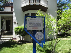
Nevada Historical Marker #78
Orion Clemens Home. Orion Clemens, secretary to territorial Governor James W. Nye, lived in this house with his wife, “Mollie,” from 1864 to 1866. Samuel, his brother who was a reporter for the Territorial Enterprise, stayed here periodically until leaving the territory in May 1864. He became famous as “Mark Twain.”
, Carson City, NV, United States
Subjects
Nevada Historical Marker #80
Eureka Courthouse. The Eureka County Courthouse, designed by George Costerisa, cost about $38,000 to construct. Built in 1879-80 of locally-fired brick and of sandstone quarried nearby, the Italianate style courthouse remains a fine example of boomtown Victorian opulence. This relic, a scene of many famous trials, reflects the glory days from 1864 to 1890 when Eureka was the first important lead-silver district in the United States.
Lincoln Highway, Eureka, NV, United States

Nevada Historical Marker #81
Grand Army Of The Republic Tree. This tree was planted in soil from Civil War battlefields and dedicated to the memory of the Grand Army of the Republic by the national commander in chief June on 10, 1913. It was dedicated by Isaac Crist Camp No. 28, Sons of Union Veterans of the Civil War, and Johana Shine Tent No. 82, Daughters of Union Veterans of the Civil War in Reno, Nevada, October 18, 1969.
East 9th St, Reno, NV, United States
Nevada Historical Marker #82
Diamond Valley. The first known explorer of Diamond Valley was Captain John C. Frémont who mapped the area to aid western migration in 1845. Before Frémont, Shoshone and Paiute Indians had gathered nature’s bounty here.Colonel J.H. Simpson mapped a route through the valley in 1859. The Simpson route, through the north end of the valley, immediately became the Pony Express route from 1860-1861. The Overland Telegraph replaced the Pony Express and also crossed the valley.Early freight toll roads were operated across the valley as lead and silver mining camps boomed in the 1860s. Needs of the mining camps gave rise to a limited livestock and dairy industry. In 1957, a large underground lake was tapped to supply water for irrigation.
Eureka/Carlin Rd, Eureka, NV, United States
Nevada Historical Marker #83
Rock Creek (Cold Springs Station). Rock Creek was an important stagecoach stop on the Overland Mail & Stage Company’s historic line along the Simpson route between Salt Lake City and Genoa, Nevada, which was operated by John Butterfield (1861-1 866) and later Wells, Fargo & Company (1866-1869). Fresh horses, blacksmith services, and wagon-repair facilities were available here.The Pony Express constructed the Cold Springs station in 1860 on the sagebrush bench eastward across the highway. To the north are the ruins of a telegraph repeater and maintenance station which serviced this segment of the transcontinental line, which was completed between Sacramento and Omaha in 1861. The line was abandoned in August 1869. The coming of the transcontinental railroad and its parallel telegraph line along the Humboldt River to the north spelled the demise of both the telegraph line and the stage route here.
, Fallon, NV, United States
Nevada Historical Marker #84
Jedediah Strong Smith. From May to June 1827, explorer and trapper Jedediah Smith found a route from California’s central valley to the Great Salt Lake Valley in Utah. He became the first European American to completely cross what is now Nevada.Because Smith’s journal and map have never been found, his exact route is unknown. Based on Smith’s own statements about his difficult trip, modern historians and geographers have pieced together the most plausible route. Smith crossed the Sierra Nevada at Ebbetts Pass, swung southeast along or across the headwaters and middle reaches of the Walker River, and passed into central Nevada’s open spaces south of Walker Lake.Smith entered Smoky Valley on its southwest side in June 1827 and crossed the valley in a northeasterly direction. He then paralleled the future Simpson survey, route of the Pony Express and Overland Stage, along modern U.S. Highway 50.He entered Utah at Ibapah.
Great Basin Highway, Ely, NV, United States
Nevada Historical Marker #85
Sutro. Sutro was a town, a tunnel, and a man. The well-planned community was headquarters for the Sutro Drainage Tunnel.German-born Adolph Sutro came to the Comstock in 1860. He advocated a drainage tunnel, visualizing development of Comstock ore with this access. By 1865, his vision gained approval of state and federal legislation. However, the mining interests, having at first supported the tunnel, became strongly opposed.When construction began in 1869, it was first financed by the mine workers since the tunnel would presumably improve mine safety. Later, the funding came from international bankers. Miners completed the main tunnel in 1878 and then extended lateral excavations, providing drainage, ventilation and access to many Comstock mines. The work on the tunnel from its lower end created a town of 600-800 and boasted of a church, post office and its own weekly newspaper, plus Sutro’s Victorian mansion and other fine residences. Adolph Sutro soon sold his interest in the tunnel company and returned to San Francisco, where he served as mayor.
California Emigrant Trail, Dayton, NV, United States

Nevada Historical Marker #86
Tule Springs. Tule springs is one of the few sites in the United States where evidence suggests the presence of man before 11,000 B.C.Scientific evidence shows this area, once covered with sagebrush and bordered with yellow-pine forests, had many springs. These springs were centers of activity for both big game animals and human predators. Evidence shown at these fossil springs shows the presence, 14,000 to 111000 years ago, of several extinct animals: the ground sloth, mammoth, prehistoric horse, and American camel. The first Nevada record of the extinct giant condor comes from Tule Springs.Early man, perhaps living in the valley as early as 13,000 years ago, and definitely present 11,000 years ago, was a hunter of the big game.Small populations of desert culture people, from about 7,000 years ago to the historic period, depended upon vegetable foods and small game for subsistence.Late Pleistocene geological stratigraphy in few other areas is as complete and well known.
Floyd Lamb Park, Las Vegas, NV, United States

Nevada Historical Marker #87
Savage Mansion (C. 1861). This elegant mansion, designed in the French Second Empire style, served as a residence for the superintendent, as well as a mine office for the Savage Mining Company. The first floor served as the mine office while the upper two stories provided a residence for many successful superintendents. Ulysses S. Grant, 18th President of the United States and “General of the Armies,” spoke to the townspeople from the second floor balcony on October 27, 1879, after a town parade in his honor.
D Street, Virginia City, NV, United States

Nevada Historical Marker #88
Sparks. Engaged in straightening and realigning the old Central Pacific trackage across Nevada, the Southern Pacific Company moved its shops and headquarters from Wadsworth to this location in 1904. The railroad set aside five city blocks for its employees’ residences. Each railroader paid $1.00 for a lot. They had to build a house within 120 days and file their deed of ownership. The company also cut their houses in Wadsworth into sections, loaded the parts on train cars and shipped the houses free of charge to Sparks. The railroad moved its employees, their houses, animals and personal items on July 4, 1904.Sparks, originally known as East Reno, New Town Tract and Harriman, came into official existence. In 1905, the state legislature incorporated the town, named it in honor of John Sparks, rancher and governor of the state of Nevada.Sparks boasted one of the largest roundhouses in the world during the steam era, the Nevada base for a vast stable of steam locomotives. The famous cab-in-front locomotive type known as Mallets, were the huge steamers hauling both freight and passengers over the steep grades of the Sierra Nevada between Roseville, California and Sparks.
Prater Way, Sparks, NV, United States

Nevada Historical Marker #89
Paradise Valley. Hudson Bay Company’s Peter Skene Ogden traversed Paradise Valley in November 1828. Settlers came to Paradise Valley in 1863. Conflicts with local Native Americans started the next year, causing the establishment of Camp Winfield Scott (1866-70) four miles from here. Paradise Valley farms supplied the nearby Nevada and Idaho territory mines.In the original town of Scottsdale (1866), John C. Kemler built the first hotel, now used as a residence. Renamed Paradise City (1869), the town was a mining supply center from 1878 until 1920. Later when livestock raising predominated, the town was again renamed, this time “Paradise Valley.”
North Main St, Paradise Valley, NV, United States
Nevada Historical Marker #90
Delamar, “The Widow Maker” 1893 1909. John and Olivia Ferguson discovered gold twelve miles south of here around 1891. The original name of the camp they established was Ferguson. However, it was eventually renamed "Delamar” after John DeLamar, an entrepreneur who bought the best mining claims in 1893 for $150,000. Eventually, over 1500 residents settled in this isolated place. The town contained a newspaper, hospital, school, churches, saloons, stores, a theater and professionals. Entertainment included brass bands, dance orchestras, and stage attractions at the opera house.Water came from Meadows Valley Wash 12 miles away. All other materials were hauled through the mountains by mule team 150 miles from a railroad head at Millard, Utah. For 16 years, most of the bullion was hauled out in the same manner.The dry milling processes used prior to the introduction of wet methods created a fine silica dust, or “death” dust, causing the deaths of many residents and gave the town its nickname, “The Widow Maker".Delamar produced $25,000,000 in gold and was Nevada’s leading producer at the turn of the twentieth century.
, Caliente, NV, United States

Nevada Historical Marker #91
Stewart Indian School. Originally known as the Carson Indian Training School, Stewart Indian School was operated by the U.S. Bureau of Indian Affairs to provide vocational training and academic education for American Indian students from throughout the West for nearly a century.W.D.C. Gibson, the first superintendent, renamed the boarding school in honor of U.S. Senator William Morris Stewart of Nevada. Stewart was the principal figure in obtaining congressional authorization and funding for the institution.In the early 1920s Superintendent Frederick Snyder initiated a building program at the school.Students worked with stone masons, some from the Hopi Tribe, to construct the distinctive stone structures that still grace this campus, which is listed in the National Register of Historic Places.
Snyder Ave, Stewart, NV, United States

Nevada Historical Marker #92
Candelaria And Metallic City. The ghost towns of Candelaria and Metallic City are seven miles west of here.Candelaria was reported to be named after a mine of the same name, located in the mid-1860s, and is derived from the Catholic Church’s Candelmas Day. Metallic City lies ¾ mile to the south of Candelaria.In 1880, Candelaria was the largest town in the immediate area and boasted three doctors, three lawyers, two hotels, six stores, and ten saloons. Water piped from Pinchower Creek and Trail Canyon in the mid to late-1880s caused the price of water to drop from $1.00 to $0.05 per gallon.The leading mine, the Northern Belle, was first located in 1864, but was not developed until 1870. It is reported to have produced an estimated $7 million, mainly in silver.
Candelaria Road, Coaldale, NV, United States

Nevada Historical Marker #93
Panaca Mercantile. This building, popularly known as the Panaca Co-op, was constructed of adobe in 1868. The “Panaca Cooperative Mercantile Institution” comprised more than one hundred stock holders—to meet barter, merchandising, and marketing needs. Wagons from Salt Lake drawn by 6-mule teams carried stock to Panaca, returning with produce from the region.
Lincoln County High School, Panaca, NV, United States
Nevada Historical Marker #94
The Winters Ranch Rancho Del Sierra. This large Gothic-style structure, completed about 1864, was the ranch home of Theodore and Maggie Winters and their seven children. Originally this area was settled by Mormons, and the ranch was purchased from Mormons by Winters and his brother, from the proceeds of the Comstock. Theodore Winters immediately set out to enlarge his property, and built the present mansion. The ranch, at one time, consisted of around 6,000 acres.Winters raised outstanding race horses. He also had a large dairy operation and raised beef cattle, work horses, and sheep.Theodore Winters was active in politics and was elected as a territorial representative in 1862.
Carson-Reno Highway, Washoe Valley, NV, United States
Nevada Historical Marker #95
Battle Mountain. Battle Mountain’s name derives from the mountain range to the southwest where in the 1850s some California emigrants were allegedly ambushed by a band of Native Americans.As a town, Battle Mountain sprung into existence in January 1870. In October 1868, the railroad established the Reese River siding here, and made Argenta, five miles eastward, its principle station and point of departure for the busy mining camps to the south. However, early in 1870, the station at Argenta was moved to this location, and the Reese River siding was renamed Battle Mountain Switch. Stage and freight roads north and south teemed with “mud wagon” stages and massive freight wagons.From 1880 to 1938, Battle Mountain was the operating headquarters for the Central Nevada Railway, as well as the Battle Mountain and Lewis Railroad from 1881 to 1890. The town’s first copper boom developed in 1897, in the Galena (Battle Mountain) range. Battle Mountain steadily outgrew the mining town of Austin to the south, until voters moved the county seat here in 1979.
Front Street, Battle Mountain, NV, United States

Nevada Historical Marker #96
Round Mountain. One of the early-1900s gold camps, Round Mountain, was distinct for a variety of reasons. First, it was productive for more than 60 years. However, there were other aspects of Round Mountain that also set it apart.Gold occurred here in free, visible, metallic form. Many small, high-grade veins were easily mined with hand tools while larger, lower-grade veins provided ore for milling plants. Placer gold occurred in economically recoverable amounts in the peripheral gravels at the base of the mountain, which were first dry washed. Water piped across the valley floor from two mountain creeks helped recover the gold from the gravels by hydraulic mining for ten years. Still later, heavy equipment was used to mine the deeper gravels. A significant benchmark in local history occurred in 1929 when early promoter and operator, Louis D. Gordon, consolidated the many claims into Nevada Porphyry Gold Mines, Inc.
Tonopah-Austin Rd, Round Mountain, NV, United States
Nevada Historical Marker #97
Manhattan “The Pine Tree Camp”. The Manhattan Mining District northeast of here was first organized in 1867. The place name persisted in local use and was adopted in 1905, when John Humphrey found gold at the foot of April Fool Hill near the old stage route. A typical boom followed. A post office opened late in 1905 and the camp soon had a telegraph, and telephones, utilities, and businesses. Transport was to Tonopah and the railroad at Sodaville.The 1906 earthquake halted mining investment. As a result, most of the productive work here was done by lessees. The gold strikes were in ore and placer deposits, and by 1909, there were thirteen mines and sixteen placers. Some of the operations were the big four: Litigation Hill Merger, Stray Dog, September Fraction, and White Caps. Hydraulic placering started in 1909. In 1938, dredging began and continued for thirteen years. Over $10,000,000 was produced.
NV-376, Manhattan, NV, United States

Nevada Historical Marker #98
Osceola 1872 1940. Osceola, most famous of the White Pine County gold producers, was one of the longest-lived placer camps in Nevada.The gold-bearing quartz belt found in 1872 was 12 miles long by 7 miles wide. Placer gold was found in 1877 in a deep ravine indenting the area. Miners first used the simple process of the common 49” rocker. Hydraulic monitors later were used to mine the gold from the 10’ to 200’ thick gravel beds. One gold nugget found was valued at $6,000.Osceola was a good business town because of its location near the cattle and grain ranches and gardens in the Spring and Snake Valleys.Famous district mines were the Cumberland, Osceola, Crescent and Eagle, Verde, Stem-Winder, Guilded Age, Grandfather Snide, Red Monster, and the Saturday Night.The camp produced nearly $5 million, primarily in gold, with some silver, lead, and tungsten.
US-50/White Pine County Rd 39, Ely, NV, United States
Nevada Historical Marker #99
Taylor. Silver and gold were discovered by Taylor and John Platt in 1873 in what was to become Taylor, a typical mining community supported chiefly by the Argus and Monitor Mines. In seven years, the town boasted a population of 15,000 people, seven saloons, three general stores, an opera house, a Wells Fargo office, and other businesses. By 1886, Taylor was the center of county activity, a social highlight being the annual 4th of July celebration.Mining continued intermittently until 1919. At that time, a 100 ton cyanide plant at the ArgusMine gave the area new life, but production declined when the price of silver plummeted. World War II renewed mining activity temporarily. Local mines yielded more than $3 million in silver, gold, copper, and lead.
Great Basin Highway, Ely, NV, United States
Nevada Historical Marker #100
Nevada Northern Railway. Mark Requa’s Nevada Consolidated Copper Company laid 150-mile of track from Cobre, on the Southern Pacific line, to Ely in 1905-06 to haul ore from the Copper Flat mines west of Ely.Ore was loaded into railroad gondolas at Copper Flat for the trip to the smelter at McGill, over a double-track trestle that was 1720 feet long. The trestle burned in 1922 and was replaced with an earth-fill span.Passenger service and the “school train” carrying McGill youth to Ely High School ended in 1941. With the closing of local copper mines in 1983, the railroad ceased operations. Currently, part of the line serves the Nevada Northern Railway Museum for live steam rides. The East Ely shop complex for the Railway was listed as a National Historic Landmark District in 2006.
Aultman St, Ely, NV, United States

Nevada Historical Marker #101
Millers. As a result of mining excitement at Tonopah in 1901 and subsequent construction of the Tonopah and Goldfield Railroad, Millers was first founded in 1904 as a station and watering stop on that line. The name honored Charles R. Miller, a director of the railroad and former governor of Delaware. He was also vice-president of the Tonopah Mining Company and was instrumental in having its 100-stamp cyanide mill built here in 1906. In 1907, the town boomed with the construction of the T. & G. R.R.’s repair shops and another large mill. The population grew to 274 in 1910, when the town boasted a business district and post office. By 1911, the railroad shops and a mill had been moved away, and Millers began to decline. It was abandoned in 1947 when the railroad went out of business.
Veterans Memorial Highway, Miller's, NV, United States

Nevada Historical Marker #102
Goodsprings Mining District 1856 1957. Ore deposits readily recognized in the faulted and folded limestone deposits of this district remained unworked until 1856, when Mormons began work at Potosí, establishing perhaps the oldest underground mine in Nevada.Named for cattleman Joseph Good, the open springs area was developed into the mining-ranching community of Goodsprings by A.G. Campbell.With completion of the Los Angeles-Salt Lake Railroad in 1905 and the narrow-gauge Yellow Pine Railroad from Jean to Goodsprings in 1911, transportation costs of the local oxidized zinc minerals were reduced. The peak year of operations was reached in 1916 when Goodsprings had 800 residents.This district, with the greatest variety of minerals in Nevada, produced a total of $25 million, primarily in lead and zinc, with lesser amounts of gold, silver, copper, molybdenum, vanadium, nickel, cobalt, platinum, palladium, and uranium.
West Spring St, Goodsprings, NV, United States

Nevada Historical Marker #104
The Camel Corps. In 1855, Congress authorized $30,000.00 for camels as frontier military beasts of burden because of their adaptability to desert heat, drought, and food.Lt. Edward F. Beale surveyed the wagon route from Fort Defiance, New Mexico, to the Colorado River near the tip of present-day Nevada, testing the fitness of these camels. They crossed the Colorado River into what is today Nevada, north to Fort Mohave, October 18, 1857.The experiment was not practical, but several of Beale’s camels hauled commercial freight from Sacramento to the Nevada territory. Others carried salt, ore, and supplies through central Nevada.Careless treatment, domestic stock incompatibility and new transportation methods ended use of camels. Some were reportedly seen years later wandering in southwest deserts, making them a fixture of western folklore.
Laughlin Highway, Laughlin, NV, United States

Nevada Historical Marker #105
Golconda. Golconda, a one-time Utah territory mining town and a landmark on the California Emigrant Trail, was famous for its hot springs. The Hot Springs Hotel was a swanky resort with doctors on staff.n 1868, Golconda became an ore shipping station on the new Central Pacific Railroad. Renewed mining activity in 1897 resulted in the building of the narrow gauge Golconda and Adelaide Railroad south to the Adelaide mine. Golconda grew to 500 inhabitants by 1899, but the next year the mine and mill closed and railroad service ceased.
Old Highway 40, Golconda, NV, United States
Nevada Historical Marker #106
Elko. On December 29, 1868, representatives of the Central Pacific Railroad started laying out lots for the future town of Elko. By 1870, the thriving town had 5,000 people. There was an immense volume of freight and passenger traffic over the stage line roads north and south from the Railhead at Elko to mining areas.The University of Nevada was located in Elko in 1874, and remained here until 1885, when it moved to Reno.By the early 1870s, Elko became the marketing and economic center for northeastern Nevada’s range livestock empire. In the 1870s and I 880s, great ranching principalities were built on Elko county’s vast rangelands. These ranches were ruled over by such powerful and colorful cattle kings as L.R. “Broadhorns” Bradley, Nevada’s second governor and its first ‘cowboy” governor; the French Garat family; the Spanish Altubes; and John Sparks, governor of Nevada in the early years of the twentieth century.Elko remains the economic hub of Nevada’s greatest range area. At the same time, it has also become a recreation tourism center in northeast Nevada and home to the internationally famous Cowboy Poetry Festival.
Idaho Street, Elko, NV, United States

Nevada Historical Marker #107
Elko Airport. On April 6, 1926, Varney Air Lines pilot Leon Cuddeback carried one bag of mail and landed his tiny Curtiss Swallow biplane at Elko, Nevada, completing the first scheduled Air Mail run in the United States.The single-engine 90 horsepower aircraft had taken off from Pasco, Washington, stopped in Boise, Idaho for fuel and mail, and then completed the 460-mile flight to Elko. The Varney contract was awarded October 27, 1925, at a rate of B cents an ounce. Varney sold to Boeing, which merged with United Airlines in 1931.
Murray Way, Elko, NV, United States
Nevada Historical Marker #108
Ruby Valley Pony Express Station. This small building was originally located 60 miles to the south, where it served the Pony Express from April 1860 to 1861. It was moved to this location in 1960.
Idaho Street, Elko, NV, United States
Nevada Historical Marker #109
Lamoille Valley. Because heavy grazing and traffic denuded the grass from the main Fort Hall route of the California Emigrant Trail along the Humboldt River, many emigrants left the river near Starr Valley. They skirted the east Humboldt Range and the Ruby Mountains along a Shoshone Indian path, rested their livestock in Lamoille Valley, and returned to the Humboldt River.John Walker and Thomas Waterman first settled the area in 1865. Waterman named the valley after a place in his native Vermont. In 1968, Walker erected the Cottonwood Hotel Store and Blacksmith Shop in the valley, and the settlement became known as the “The Crossroads.” Here wagons were repaired and food and supplies could be obtained. The original buildings, and the most recent 20-bedroom Lamoille Hotel, creamery, flour mill, and dance hall are gone.
Lamoille Highway, Lamoille, NV, United States
Nevada Historical Marker #110
Wagon Jack Shelter. The base of this cliff is the site of Wagon Jack Shelter, excavated in 1958 by Robert F. Heizer and Martin A. Baumhoff through the University of California, Berkeley. The archaeologists named the shelter in honor of Wagon Jack, a Western Shoshone Indian who may have camped here while working at the Eastgate Ranch around 1900. Wagon Jack was purportedly a rabbit boss, leader of communal jackrabbit drives, in neighboring Smith Creek Valley.A curved wall formerly extended from the cliff face and probably represented the perimeter of a prehistoric brush-covered shelter. A variety of chipped stone projectile point styles were recovered from this site reflecting a succession of prehistoric cultures. Eastgate Series arrow points were first described from these Eastgate archaeological sites. Bones of bighorn sheep dominated the animal remains accompanied by a few deer and pronghorn bones. Four stone tools or fragments of tools were associated with grinding seeds, pinenuts, and other dried foods. A radiocarbon date from the bottom of this site indicates occupation beginning around 3,150 years ago.
, Eastgate, NV, United States
Nevada Historical Marker #111
Edwards Creek Valley. Abundant grass and brush found near springs and intermittent streams in Edwards Creek Valley were important ecological areas for Native Americans. Shoshone Indians wandered seasonally to gather wild seeds and small game and settled here in winter camps. Later, Northern Paiutes also lived in the valley.In 1854, Col. John Reese discovered a route through Edwards Creek Valley that was shorter than the Humboldt trail. Established by surveyor James Simpson in 1859, it was followed by the Pony Express, the Overland Telegraph, and the overland mail stages. An 1862 Austin gold rush passageway too, the route remained as the region’s principal commercial artery until 1880.
, Eastgate, NV, United States
Nevada Historical Marker #112
Carlin. Carlin, the oldest town in Elko County, was established as a railroad division point in December 1868 by the Central Pacific Railroad. When the railroad tracks reached the Carlin meadows, always a favorite stopping place for wagon trains along the California Emigrant Trail, construction crews laid out a townsite and built a large roundhouse and shops Central Pacific officials named the town after William Passmore Carlin, a Union general who served his country with distinction during and after the Civil War.During the 1870s and early 1880s, Carlin competed with Elko, Palisade, and Winnemucca for the staging and freighting business of the many mining camps north and south of the railroad. In 1965, the town became the principle shipping point for the nearby Carlin Gold Mine, the second largest gold-producer in the U.S.Carlin is still a principle division point on the Union Pacific Railroad line. During the period from 1906 until the early 1950s, Carlin was an important icing station in Nevada for refrigerator cars on both the Southern and Western Pacific Railroads (Western Pacific reached Carlin from the east in 1908, but freight and passenger service was not inaugurated over this transcontinental line until 1910).
West Hamilton St, Carlin, NV, United States

Nevada Historical Marker #113
Wabuska. Wabuska (perhaps a Washoe Indian term, for white grass) was first established in the early 1870s as a station on the stage and freight road from Wadsworth on the Central Pacific to the roaring mining camps of Aurora, Bodie, Candaleria, Columbus, and Bellville.In 1881, the town served as the principal Mason Valley supply and distribution center on the newly constructed narrow gauge Carson and Colorado Railroad. Southern Pacific purchased the railroad and converted it to standard gauge at the beginning of the twentieth century. Tonopah and Goldfield mining booms greatly increased freight and passenger traffic.When copper was discovered in Mason Valley, the town became the northern terminus of the new Nevada Copper Belt Railroad, built 1909-1911. Wabuska waned with declining mining activity in the 1920s.
, Wabuska, NV, United States

Nevada Historical Marker #114
Franktown. Orson Hyde, probate judge of Carson County, Utah Territory, founded Franktown in the Wassau (Washoe) Valley in 1855.A sawmill became an important enterprise in furnishing timber to the Comstock mines after 1859. The Dall Mill, a quartz mill of sixty stamps, employed hundreds of workers. Fertile farms surrounded the town.With the completion of the railroad from Carson City to Virginia City in 1869, the milling business rapidly lost its importance and the once prosperous town declined.
Bowers Mansion Rd, Washoe Valley, NV, United States

Nevada Historical Marker #115
Potosi. The desire of local Mormon settlers for economic self-sufficiency led to mining by missionaries for lead at Potosí. In 1858, Nathaniel V. Jones was sent to recover ore from the “mountain of lead” 30 miles southwest of the mission at Las Vegas Springs. About 9,000 lbs. were recovered before smelting difficulties forced the remote mine to be abandoned in 1857. Potosi became the first abandoned mine in Nevada.In 1861, California mining interests reopened the mine, and a smelter and rock cabins for 100 miners made up the camp of Potosi. Even more extensive operations resulted after the transcontinental Salt Lake and San Pedro R.R. (now the union pacific) was built through the county in 1905.During World War I, Potosi was an important source of zinc.
, Potosi, NV, United States
Nevada Historical Marker #116
Searchlight. Initial discoveries of predominately gold ore were first made at this location on May 6, 1897. G.F. Colton filed the first claim, later to become the Duplex Mine. The Quartette Mining Company, formed in 1900, became the mainstay of the Searchlight district, producing almost half of the area’s total output. In May 1902, a 16 mile narrow-gauge railroad was built down the hill to the company’s mill on the Colorado River.On March 31, 1907, the 23.22 mile Barnwell and Searchlight Railroad connected the town with the then main Santa Fe line from Needles to Mojave. By 1919 trains travelled over the B. and S. Railroad only twice a week. A severe washout on September 23, 1923, halted traffic completely. Train service was never restored.Searchlight is the birthplace of U.S. Senator Harry Reid (b.1939) who became the first Nevadan to serve as the Senate Majority Leader, a position he assumed in 2007.
Veterans Memorial Highway, Searchlight, NV, United States

Nevada Historical Marker #117
Kingsbury Grade. Originally named Georgetown Trail, the Dagget Pass Trail and Pass was named after Charles Dagget who acquired the land at the base of the road in 1854. In 1859— 1860, David Kingsbury and John McDonald received a franchise from the Utah Territory to operate the toll road. At the time, the area was part of the Utah Territory.The men spent about $70,000 to construct a wagon road to meet the demand for a more direct route from California to the Washoe mines and to shorten the distance between Sacramento and Virginia City by ten miles. The new 16 foot wide road, supported in some places by granite retaining walls on both sides, made the passage easier for travelers on this main route from California. Merchants and teamsters frequently traveled this road moving goods and people in and out of Nevada.In 1863, some of the tolls were 50 cents for a man and horse and $2.00 for a horse and buggy. That year the estimated tolls collected were $75,000.
, Gardnerville, NV, United States
Nevada Historical Marker #118
Luther Canyon (Fay Canyon). Luther Canyon, west of this site, takes its name from Ira M. Luther, who from 1858-1865 had a sawmill there. The house behind the marker was his home. In 1861, he was a delegate to the second Nevada Territorial Legislature. After 1865, the canyon came to be known as Horse Thief Canyon, because of the “business” of John and Lute Olds, owners of the next ranch south. Besides operating a station along the Emigrant Trail for a number of years, they rustled horses from emigrants. The animals were sent up the canyon to drift over the ridge into horse thief meadows. After resting and feeding the horses, they were driven down to Woodfords Canyon to sell to other emigrants. A prospector called Sawtooth was allegedly murdered and buried in the barn south of the Luther house. Sam Brown, a notorious bad man, was shot and killed in front of the Olds barn in 1861 by a man he threatened. “Lucky Bill” Thorington, implicated in a murder in California for which he was hanged by vigilantes in 1858, had a ranch two and a half miles to the south.
, Gardnerville, NV, United States
Nevada Historical Marker #119
Reuel Colt Gridley “Citizen Extraordinaire”. This simple stone structure, opened to the public in late 1863, was originally operated as a general merchandise store by the firm of Gridley, Hobart, and Jacobs. Gridley is best remembered for his 1864 wager that prompted the auctioning of a sack of flour for donations to the “Sanitary Fund,” the Civil War forerunner of the American Red Cross. The flour was sold again and again throughout Nevada and California, then taken east and eventually auctioned at the St. Louis Sanitary Fair in 1864. In all, it raised about $275,000 for the fund. Gridley died almost penniless six years later.
Water Street, Austin, NV, United States

Nevada Historical Marker #120
Walley’s Hot Springs. Like many Nevada hot springs, the ones located as Walley’s Hot Springs dot a fault break along which the mountains rise.In 1862, along this Carson branch of the emigrant trail, David and Harriet Walley developed a $100,000 spa eleven beds, a ballroom, and gardens. The thermal water (l36 to 160 degrees F) became well known as a cure for “rheumatism and scrofulous afflictions.”Walley’s Hot Springs sold for a mere $5,000 in 1896, but operated until 1935 when it burned down. Its formal cool cellar was integrated into the complex during a 1970s renovation.In 1962, trial hydrothermal power holes were drilled here as deep as 1,250 feet and found thermal water with a maximum temperature of 181 degrees.
Foothill Road, Genoa, NV, United States

Nevada Historical Marker #121
Mottsville. This is the site of the settlement on the emigrant trail known as Mottsville, where Hiram Mott and his son Israel settled in 1851. Their homestead was the scene of an impressive number of firsts in Carson County, Utah Territory: 1851: Israel Mott’s wife, Eliza Ann Middaugh, was the first woman settler of European descent. 1854: Mrs. Israel Mott opened the first school in her kitchen. The Mott’s second child, Louise Beatrice, was the first female child of European descent to be born. 1856: Judge W. W. Drummond held the first session of the United States District Court of the third district of Utah Territory in the Mott barn built in 1855. 1857: The third child of the Motts died and was buried in the yard. This tiny grave was the first in what became the first cemetery. The cemetery is all that marks the site of Mottsville today.
, Mottsville, NV, United States
Nevada Historical Marker #122
Sheridan. In 1861, a blacksmith shop, a store, a boarding house, and two saloons comprised the village of Sheridan. The village had grown up around Moses Job’s general store, established prior to 1855. The Surveyor General, in his 1889-90 biennial report, stated that Sheridan was the metropolis of the Carson River West Fork farmers. The Sheridan House, erstwhile boarding abode, has been converted to a dwelling. It may be seen across the road. It is all that remains of the “metropolis.”Moses Job, an irrepressible man, climbed the peak above this location, planted the American flag and with a shout named the peak after himself. Job’s Canyon is above, and to its left is Job’s Peak. To its right is Job’s Sister.
, Gardnerville, NV, United States
Nevada Historical Marker #123
Cradlebaugh Bridge. This marker is currently awaiting reinstallation.The remains of Cradlebaugh Bridge, built in 1861, by William Cradlebaugh, stand ¼ mile west of here. This bridge shortened the distance from Carson City to Aurora in the then- booming Esmeralda Mining District.There were two routes from Carson City south to the bridge where they joined, crossed the river, and headed into the desert. One followed the westside of the Carson River. The foothill alternate went via Jacks Valley and the old John James Ranch, then around the hill to the bridge. Five miles south of Cradlebaugh Bridge the road passed Desert Station, a lively hostelry, and beyond, the Twelve Mile House enroute to Esmeralda.The road and bridge were purchased by Douglas County in 1895 for $5,000.
, Minden, NV, United States

Nevada Historical Marker #124
Boyd Toll Road. William H. Boyd was granted a Utah Territory franchise December 19, 1861 to provide a road to join Genoa to the Cradlebaugh toll road, the trunkline to the mining district of Esmeralda. Boyd’s toll road is still visible to the northwest and southeast from this marker. When the telegraph line from Placerville through Genoa was strung along it in 1863, the Boyd Road was also called “Telegraph Road.” It was purchased by Douglas County from Henry Van Sickle and Lawrence Gilman in 1876 for $2,650.
, Minden, NV, United States

Nevada Historical Marker #125
Twelve Mile House. Proposed Text, Marker Text Plate in Prodution:Twelve Mile House was an important stop on the road to the Esmeralda mining camp of Aurora. Mile houses like this one were critical places for rest and supplies along early western road systems before railroads made most mile houses and stations obsolete. Twelve Mile House was part of a network of similar stations that ran from Genoa to Aurora, including another station on the eastern side of the Pine Nut Mountains called Double Springs.Thomas Wheeler built this important hostelry in 1859 where the East Fork of the Carson River emerges from Long Valley to the south. The Twelve Mile House was so named because it was located twelve miles from Genoa and twelve miles from the Cradlebaugh Bridge across the Carson River. It lay at an important crossroads in the southeast part of Carson Valley, with roads from Twelve Mile House leading southeast to Goldfield, south to Woodfords, west to Fairview, northwest to Minden, Gardnerville, and Genoa, and north to Cradlebaugh Bridge and Carson City.
, Gardnerville, NV, United States

Nevada Historical Marker #126
Double Springs. Double Springs, also known as Round Tent Ranch or Spragues, was a station on the road through the south end of the Pine Nut Mountains located at a pair of nearby springs. The road provided access between Carson and Walker valleys, both ranching and dairy regions in western Nevada, Double Springs also saw many travelers on their way to Esmeralda County. At one time, a toll road ran from this area west to the Kingsbury Road that still connects to Lake Tahoe.About four miles north along the highway is the former location of Mammoth Ledge, also known as Carter’s Station. That site served as the post office for the Eagle Mining District, and the polling place in 1861 of the Mammoth Precinct of Douglas County. Stations like these provided water, supplies, and rest for travelers prior to the popularization of the automobile.
, Gardnerville, NV, United States
Nevada Historical Marker #127
Courthouse Site 1865 1909. Dayton was the first seat of Lyon County and had one of the first courthouses built in Nevada. Finished in 1864, local residents celebrated the new two-story brick building and its Italianate styling as an important architectural benchmark for a new state.On the afternoon of May 15, 1909, the two-story brick building burned and the county seat was moved to Yerington two years later. Utilizing the ruins, the Nevada legislature funded the construction of a high school that opened in 1918. The school closed in 1959 and the building became an elementary school, then a junior high school and is now the Dayton Valley Community Center.
Pike Street, Dayton, NV, United States

Nevada Historical Marker #128
The Great Train Robbery. The West’s first train robbery occurred near this site on the night of November 4, 1870. A gang of men concocted an elaborate scheme to rob the Central Pacific Railroad as the train passed through Verdi. John Chapman traveled to Oakland, California to learn when the train left for Verdi. He telegraphed a coded message to “Sal” Jones in Reno, who alerted five men waiting near Verdi. Two men rode to an area just south of Mogul today, and they placed rocks across the train tracks.When the train stopped in Verdi for the night, the soon-to-be-robbers boarded the train, decoupled the passenger coaches and commandeered the engine, mail and express cars. The gang forced Engineer Henry Small to drive to the blockage, there they tricked the guard to opening the locked express car door. The robbers broke open the strong boxes and divided the $41,600. The men rode off in different directions. All were eventually caught and all but about $3,000 was recovered.
South Verdi Rd, Verdi, NV, United States

Nevada Historical Marker #129
Gardnerville. Early Gardnerville served the farming community and teamsters who hauled local produce to booming Bodie. The first buildings were a blacksmith shop, a saloon, and the Gardnerville hotel. The latter was moved by Lawrence Gilman in 1879 from the emigrant trail between Genoa and Walley’s Hot Springs, where it was known as Kent house, to this site, the homestead of John M. Gardner.Just as Genoa was the center for British (largely Mormon) settlers after 1851, so Gardnerville, after 1879, became the center for 1,870 Danish immigrants, who founded the Valhalla Society in 1885 and met in Valhalla Hall, one block south.Starting in 1898, Spanish and French Basque shepherds tended some 13,000 sheep in Carson Valley, which increased to 25,000 by 1925, when the Basques began acquiring their own sheep and land. After 1918, several Basques in Gardnerville opened inns which flourished during Prohibition in the 1920s.
Highway 395, Gardnerville, NV, United States

Nevada Historical Marker #130
Minden. Minden, the seat of Douglas County since 1916, was named for a town in Westphalia, Germany, where the founder of H.F. Dangberg Land and Livestock Company, was born in 1829. The company established Minden in 1905 to provide terminal facilities for the Virginia and Truckee Railway, which was then extending a branch line southward from Carson City. The passenger and freight depot was situated at this point.Principal promoter of the town, and its related development, was H.F. Dangberg Jr., secretary of the company and son of the founder.
Highway 395, Minden, NV, United States

Nevada Historical Marker #131
Dresslerville. In 1917 State Senator William F. Dressler gave this 40-acre tract to Washo Indians, then living on ranches in Carson Valley. After a school was opened in 1924, it became a nucleus of settlement. Before the intrusion of Caucasians in 1848, Washo lived in winter in the Pinenut Hills where they stored autumn harvested pinenuts. In summer, they lived in the Lake Tahoe Basin fishing the tributary streams and gathering roots and berries. In fall, they hunted jackrabbits and gathered seeds in Carson Valley. Their only form of organization was that of kinship. These stone age people lived in daily communion with giants, monsters, animals whose characteristics were interchangeable with those of people, and with water babies, "having the bodies of old men and the long hair of girls," who lived in the lakes of the High Sierra.
, Gardnerville, NV, United States

Nevada Historical Marker #132
Mackay Mansion. Once the residence of John Mackay, this elegant mansion also served as the office for the Gould & Curry Mining Company. Mackay, an Irish-born immigrant, was the richest man the Comstock ever produced. Built in the 1860s, this building survived the "Great Fire of 1875" and was the headquarters for Mackay, Fair, Flood, and O'Brien - "Silver Kings" of the Comstock.
D Street, Virginia City, NV, United States
Nevada Historical Marker #133
Fish Lake Valley. This valley was settled when the palmetto mining district was discovered in 1866. In the 1870’s the Griffing & Wyman’s, as well as the Pacific Borax Works, were extracting borax at Fish Lake.The Carson and Columbus stage line ran northward to aurora and Carson City, making connections with log springs in the Sylvania district and Lida. Several local ranches supplied food to the freight industry and mining communitiesA post office was opened at Fish Lake Valley in 1881.This marker commemorates the life and times of W.O. Harrell, known as “Harrell, the irrepressible,” citizen extraordinaire of fish lake valley in the 1870’sSTATE HISTORIC
Blue Bird Road, Dyer, NV, United States

Nevada Historical Marker #134
Tran Sierran Pioneer Flight. The first authenticated air flight over the Sierra Nevada was successfully completed when four U.S. Army planes touched down here on an improvised field.Originating at Mather Field, Sacramento, and led by Lt. Col. Henry L. Watson, the squadron was made up of three Liberty-powered Dehavillands and one 90 hp Curtiss Trainer.The fliers, personally welcomed by Governor Emmet D. Boyle, were Watson, Lts. Ruggles, Curtis, Krull, Schwartz, and Haggett, and Sgt. Conway. Haggett introduced an added surprise by landing his small trainer, unannounced, some minutes after the main flight.The flight concluded in Reno that afternoon.Governor Boyle flew as a passenger in one of the planes on its return flight to Sacramento, thus making him the first civilian ever to cross the Sierra in flight.
, Carson City, NV, United States
Nevada Historical Marker #135
New Pass Station. The rocks composing the walls of this stage station and freighter stop were in neat array and roofed with bundles of willow twigs in July 1861, when John Butterfield’s Overland Mail & Stage Company began traversing this Central or Simpson Route between Salt Lake City and Genoa, Nevada.The spring on the hill was inadequate for both humans and horses. However, Division Superintendent Thomas Plain’s support ranch, one mile to the west, kept this important team-watering and replacement-stop operating.Completion of the first transcontinental railroad spelled the eventual demise of the Overland Stage line. Butterfield sold out to Wells, Fargo & Company in 1866, which suspended all operations on the Central Route in February 1869. The company continued to operate their diverted equipment on other lines until the early 1870s.STATE HISTORIC
Austin Highway, Austin, NV, United States

Nevada Historical Marker #136
Toquima Cave. Toquima Cave is an extraordinary Great Basin Native American archaeological site. Toquima Cave’s walls and ceiling are covered with pictographs in a variety of abstract and geometric designs painted with white, red, yellow, and black pigments. The meanings of these ancient designs may be as ceremonial markers, depictions of hallucinations, and art. Western Shoshone Indians historically occupied this region, and their ancestors most likely painted the Toquima Cave pictographs. Toquima Cave is located in a basalt outcrop on the east side of Pete’s Summit in the Toquima Range about 12 miles to the east. The cave is accessed by a half-mile hiking trail from the US Forest Service Toquima Cave Campground. In order to protect the pictographs from vandalism, visitors are separated from the cave walls by a cage-like structure.
, Austin, NV, United States

Nevada Historical Marker #137
Hickison Summit. About one mile northwest lies a natural pass between two low buttes, which prehistorically, the aborigines may have used as a site of ambushing migratory deer herds. Three petroglyph panels are located in the pass. Concerted cooperative efforts of several families were necessary for successful trapping, killing and processing the deer. Petroglyphs suggest magical or ritual connection with hunting activities. They were added seasonally by the group's religious leader or shaman, as omens to insure a successful hunt.
Lincoln Highway, Austin, NV, United States

Nevada Historical Marker #138
Belmont. Belmont sits at an elevation of 7,400 feet. A spring flowing year round made this a gathering site of the Shoshone Indians for rabbit drives and celebrations.In 1865, silver ore discoveries led to the development of an attractive tree-shaded mercantile community. East Belmont became the mining and milling center. A wide range of nationalities worked the mines, operated businesses, and provided services. At its height, Belmont had schools, churches, a post office, and a newspaper, as well as a Chinatown, a red-light district, and a racetrack. The town was the Nye County seat from 1867 to 1905, and a courthouse survives from this period.Belmont had a reputation as a rowdy town. Incidents of saloon brawls, vigilante actions, shootings, hangings, and feuds made the town notorious. Well known Nevadans such as Jack Longstreet, Tasker Oddie, Jim Butler, and Andrew Maute all participated in local early history.Silver production totaling four million dollars was from high grade but shallow ore. By 1890, most mines ceased to be profitable and were forced to shut down. Belmont’s population dwindled as most residents left for new discoveries in nearby mining towns.
Belmont Courthouse State Historic Site, Manhattan, NV, United States
Nevada Historical Marker #139
Old Spanish Trail (The Journey Of The Dead Man). Early Spanish traders named the fifty-five dry miles separating Las Vegas and the Muddy River the Journada Del Muerto (Journey of The Dead Man). This longest stretch without water along the Old Spanish Trail was littered with the skeletons of animals and parts of wagons abandoned along the sandy desert. Most experienced travelers made the trip at night.John C. Frémont crossed the Journada in 1844 and commented: “We ate the barrel cactus and moistened our mouths with the acid of the sour dock. Hourly expecting to find water, we continued to press on to midnight, when after a hard and uninterrupted march of 16 hours, our wild mules began running ahead; and in a mile or two we came to a bold running stream (the Muddy River).”
, Moapa Valley, NV, United States

Nevada Historical Marker #140
The Garcés Expedition. Seeking to open a land route between the missions of Sonora and California, Fray Francisco Hermenegildo Garcés, OFM, a Franciscan missionary priest and explorer, was the first European to enter the present boundaries of Nevada. He departed mission San Xavier Del Bac near Tucson in October of 1775, and by late February of 1776, the Spanish Franciscan friar had reached the Mohave villages located just south of this location on the banks of the Colorado river. Garcés was now traveling in areas never before seen by a non-native American.Relying on Native American guides, he walked from village to village. The Mohave agreed to lead him to the pacific coast along a route used for trade purposes. It was from this general location, on March 4, 1776, accompanied by four natives, that Garcés left the banks of the Colorado and set out across the Mojave Desert; he reached Mission San Gabriel Arcángel 20 days later. Upon his return, he again visited the Mohave villages in this vicinity in May of 1776. His route followed a much older prehistoric trail used to bring shells and other trade goods to the tribes of the desert and mountain west. On July 19, 1781, in a Quechan revolt against Spanish forces, Father Garcés was killed at La Purisima Concepción Mission near the Yuma crossing. Padre Garcés’ body was later interred in the Franciscan church of the Colegio De La Santa Cruz, Querétaro, Mexico.“Greater love hath no man than this - that a man lay down his life for his friends.” Excerpts from Father Garcés’ diary“I proceeded three leagues on the course northwest with some turns to the west-northwest. I observed this locality to be in 35° 01', and I named it San Pedro De Los Jamajabs. In this situation and that below there are good mesas for the foundation of missions, and though they are near the river, they are free from inundation”. Father Garcés’ Entrance into Nevada (March 3, 1776) “March 4, on which was made the observation noted on the 3rd day. I departed, accompanied by three Jamajab Indians and by Sevastian, on a course southwest, and at two leagues and a half arrived at some wells [which I named Pozos De San Casimiro]. There is some grass”. Father Garcés’ Departure from Nevada (March 4, 1776)
, Laughlin, NV, United States

Nevada Historical Marker #141
Old Spanish Trail Armijo’s Route. On January 8, 1830, the first pack train to pass from Santa Fe, New Mexico to Los Angeles crossed Las Vegas Valley. Antonio Armijo, a merchant in Santa Fe, commanded the train and roughly sixty men. The successful completion of the journey opened a trade route between the two Mexican provinces of New Mexico and California.Following the “longest, crookedest, most arduous pack mule route in the history of America,” Armijo’s party and others brought woolen goods to Los Angeles and returned to Santa Fe driving herds of valuable mules and horses. Later termed the Old Spanish Trail, this route was the principal means of transportation between the two Mexican territories, until the end of the Mexican War in 1848.
Lake Mead Parkway, Las Vegas, NV, United States

Nevada Historical Marker #142
Old Spanish Trail (Mountain Springs Pass). This portion of the Old Spanish Trail was discovered in January 1830, by Antonio Armijo during his first trip from Santa Fe to Los Angeles. The springs just north of this marker provided excellent water and fed meadows of luxuriant grass for draft animals. Two days were required to travel between Las Vegas and Mountain Springs Pass. The trip was broken at Cottonwood Springs, the site of Blue Diamond, where an early start was usually made in order to climb the pass by nightfall. Early travellers often referred to the area as Piute Springs, but the present title has been used for over a century. The altitude made Mountain Springs one of the favorite camping spots on the trail.
Nevada State Rd 160, Las Vegas, NV, United States
Nevada Historical Marker #143
Sarah Winnemucca Hopkins (1844 1891). Proposed Text, Marker Plate in Production:Sarah Winnemucca, whose Paiute name was Thocmentony (Shell-flower), was the daughter of Chief Winnemucca, and granddaughter of Captain Truckee, a friend and supporter of Captain John C. Frémont. Sarah Winnemucca sought understanding between her people and European Americans when the latter settled on Paiute homelands. Sarah lectured, wrote a foundational book in American Indian literature, and founded the non-government Peabody School for Native children outside of Lovelock, Nevada. She worked tirelessly to remedy injustice for her people and to advocate peace. Here at Fort McDermitt she served as an interpreter and teacher. Because of her importance to the nation’s history, Sarah Winnemucca Hopkins was honored in 2005 with a statue in the National Statuary Hall of the U.S. Capitol.STATE HISTORIC
North Road, Fort McDermitt, NV, United States
Nevada Historical Marker #144
Fort Mc Dermitt. Established in 1865, Fort McDermitt was first called Quinn River Camp #33 on the East Fork, then renamed in honor of military district commander Lt. Col. Charles McDermitt, who died while fighting Native Americans. The fort consisted of several adobe, stone, and frame buildings surrounding a square. Its purpose was to protect the Virginia City-Quinn River Valley-Oregon road. Twenty-four years of operation made it the longest-serving active army fort in Nevada. Its troops participated in the Modoc War and in conflicts with the Bannock and Shoshone Tribes. It was the last of the Nevada army posts in service when converted into an American Indian reservation school in 1889.
Veterans Memorial Highway, Fort McDermitt, NV, United States

Nevada Historical Marker #145
Unionville (Pershing County). Southern sympathizers settled in Buena Vista Canyon in 1861 after the discovery of silver ore. Appropriately called Dixie, their camp’s name changed to Unionville in 1862, when the will of the neutral and northern factions of the population prevailed. The town was designated as the seat of Humboldt County, which was itself the product of Buena Vista mining activity. Unionville lost this distinction to Winnemucca in 1873.By the late 1870s most of the local ores were depleted, but it remained a pleasant place, enjoying more amenities and less violence than most mining towns in spite of strong political feelings.Today, Unionville retains its picturesqueness.
, Unionville, NV, United States
Nevada Historical Marker #146
Mc Dermitt Indian Reservation. In the mid-1860s many Paiutes returning from Oregon’s Indian reservation, joined some from the pyramid lake Indian reservation (home of the “cui-ui eaters”) because of poor treatment and the dishonest dealings of U.S. Indian agents. These Native Americans settled about fort McDermitt, where they aided the local military against bannocks and others resisting settlers who were taking over.Nearby mercury mines furnished employment for Native Americans adjusting to the life style of the settlers. Likewise, today a local precision assembly industry utilizes the dexterity skills of the Indians today. Red and green clays from the canyon are now made into pottery.
Fort McDermitt Indian Reservation, Fort McDermitt, NV, United States
Nevada Historical Marker #147
People Of The Humboldt. Nevada lies within the Great Basin where rivers drain into lakebeds and sinks, never reaching an ocean. The broad valley around this location contains two of these terminal lake basins or “sinks” one for the Humboldt River arising in northeastern Nevada and the other for the Carson River flowing from the Sierra Nevada to the southwest. Near the end of the Ice Age, much of this region was beneath the waters of Lake Lahontan. As Lahontan’s water receded, two lake basins formed, separated by a massive gravel bar to the north. Archaeologists have concluded that over the last 12,000 years, Native Americans occupied the region, prospering when the valley supported extensive wetlands.From about 9800 years ago, Native Americans utilized Leonard Rock shelter, a National Historic Landmark, and other caves carved from the bedrock by Lake Lahontan’s waves. Remnants of stored tools and food recovered from the caves include nets, fishhooks, dried fish, water bird remains, duck decoys, and basketry made from willows or tule. Lovelock Cave, above Humboldt Lake to the northeast, is a legendary battle site where tradition maintains two bands of Numa (Northern Paiutes), the Koop Ticutta (Ground Squirrel Eaters) and the Sai Ticutta (Tule Eaters) warred against one another. When European American explorers entered the area in the 1830s, the area was dominated by vast wetlands that still supported Numa (Northern Paiute) villages.STATE HISTORIC
, Fallon, NV, United States

Nevada Historical Marker #148
The Two Battles Of Pyramid Lake. On May 12, 1860, Northern Paiute warriors, fighting to retain their way of life, decisively defeated a volunteer army from Virginia City and nearby settlements. The battle began with a skillful Numu (Paiute) Native American ambush north of Nixon and with the engagement continuing along the plateau on the opposite side of the Truckee River almost to the present site of Wadsworth.On June 2, 1860, a larger force of volunteers and regular U.S. Army troops engaged Numu warriors in battle along the tableland and mountainside. Several hundred warriors, attempting a delaying action to allow their women, children, and elders to escape, fought with such courage and strategy that the attacking forces were held back during the day until the Numu could withdraw.Numu war leader, Numaga (young Winnemucca) desired only peace, but he fought back to defend his people.
NV-447, Nixon, NV, United States
Nevada Historical Marker #149
High Rock Canyon. This Marker has been removedThe presence of man from 3,000 B.C. to the gold-rush days is recorded on high canyon walls. Prehistoric man left his rockshelters, campsites, and petroglyphs in this historically rich, remote, volcanic area.Northern Paiute Indians roamed these lands when John C. Fremont first journeyed through high rock canyon in 1843. The Applegate brothers blazed their trail from Oregon through the canyon to the Humboldt River in 1846. Peter Lassen partially followed this route in 1848, and gold seekers crowded the trail in 1849.STATE HISTORIC
, Gerlach, NV, United States

Nevada Historical Marker #150
Nevada’s First State Park. Along with most Americans, Nevadans by the 1920’s began to demand greater access to the outdoors, precipitating early efforts on the part of the legislature to designate state lands for recreational use. Building on those efforts, a 1931 land exchange transferred 8760 acres of federal land to the state at Nevada.In 1934, that land was officially dedicated as Valley of Fire, Nevada’s first state park. The following year, Nevada’s legislature established this and three other parks at Beaver Dam, Cathedral Gorge and Kershaw-Ryan. These parks owe much of their early infrastructure to the work of Civilian Conservation Corps crews led by Thomas W. Miller of Reno, who also served as the first chairman of the State Parks Commission. By 2015, Valley of Fire State had grown fourfold, and is recognized internationally for its outstanding scenic, geologic, and archaeological features.
Balanced Roack, Overton, NV, United States

Nevada Historical Marker #151
Duck Valley Indian Reservation. Established in 1877 by President Rutherford B. Hayes, this reservation is situated on the ancestral lands of the Western Shoshone Indians. The reservatino includes 300 square iles in Nevada and Idaho and is hom eto Northern Paiutes as well. Peaceful and cooperative, the residents have developed their culture from Stone-age levels to Contemporary American, but many still retain ancient handicraft skills. Most residents are ranchers producing hay, wheat, and cattle. Duck Valley Indian Reservation is covered by the Shoshone-Paiute Tribal Council elected by the residents.
Sho Pai Drive, Owyhee, NV, United States

Nevada Historical Marker #152
Gerlach. Situated between Black Rock Desert on the east and Smoke Creek Desert on the west, the townsite of Gerlach lies in country occupied for thousands of years.John C. Frémont traveled through these Northern Paiute lands when he camped here in 1843 and named ‘Boiling Springs’ ¼ mile north of town.This was also emigrant country; the Noble Road left the Applegate-Lassen Trail at Black Springs, went past this site, and proceeded southwest through Smoke Creek Desert toward Susanville. The town was established after the construction or the Western Pacific Railroad 1905-1909.
Main St, Gerlach, NV, United States
Nevada Historical Marker #153
Jarbidge Community Hall. Gold discoveries by Dave Bourne in 1909 created the town of Jarbidge.With 1,500 population in Jarbidge Canyon by 1910, citizens built this pioneer-type community hail with a “floating” maple floor. Support from the Nevada Commission for Cultural Affairs and the community funded the restoration of the building.STATE HISTORIC
Charleston Jarbridge Rd, Jarbidge, NV, United States
Nevada Historical Marker #154
Belleville. Founded in 1874 by Alsop J. Holmes, Belleville flourished by milling ore from Holmes’ Northern Belle Mine at Candelaria. The mill, located just east of here, made its first bullion-bar shipment (worth $9,200) in April 1875.Belleville was also the terminus and work camp of the Carson and Colorado Railroad that reached the town in December 1881. At that time Belleville’s population peaked at about five hundred and included an assay office, an express office, a telegraph station, a livery stable, a schoolhouse, two hotels, several restaurants and blacksmith shops, and seven saloons.By the late 1880s pipes delivered water to Candelaria and allowed local mills to begin operation, reducing the need for shipping costs. Belleville could not survive the competition and was deserted by 1892.STATE HISTORIC
Mina-Basalt Cutoff Rd, Columbus, NV, United States

Nevada Historical Marker #155
Silver Peak. Silver Peak is one of the oldest mining areas in Nevada. A 10-stamp mill was built in 1865, and by 1867, a 20-stamp mill was in operation. Mining camp lawlessness prevailed during the late 1860s and over the next 38 years, Silver Peak had its ups and downs. In 1906, the Pittsburg Silver Peak Gold Mining Company bought a group of properties, constructed the Silver Peak Railroad, and built a 100-stamp mill at Blair the following year.Silver Peak was, at times, one of the leading camps in Nevada, but by 1917 it was abandoned. The town burned in 1948 and little happened until the Foote Mineral Company began extraction of lithium from under the floor of Clayton Valley.
, Coaldale, NV, United States
Nevada Historical Marker #156
Gold Point. Gold Point was initially called Lime Point for the nearby lime deposits found in 1868. Processing difficulties in the 1880s discouraged silver mining locally.Goldfield ore discoveries in 1902 stimulated area mining interest. In 1908 miners discovered high grade chlorargyrite, a form of silver chloride known as hornsilver. The town’s name was changed to Hornsilver, and a typical mining camp developed. A newspaper, post office, stores, and saloons began operations, and a town of over 225 wood-frame buildings, tents, and shacks appeared.The camp assumed the name Gold Point after 1930 when more gold was being mined than silver. Miners were drawn away to essential World War II industries in October 1942, and major mining ceased at Gold Point.
NV-266, Goldfield, NV, United States
Nevada Historical Marker #157
Lida. Known as a gathering point for Shoshone and Northern Paiute Indians, Lida Valley was the site of early prospecting in the 1860s.Later prospectors organized a mining district in 1867 and laid out the town in 1872. Soon stores, shops, stables and a post office were established. Some ore was milled locally, yet high grade ore ($500-$1,000 per ton) was treated at Austin or Belmont. After 1880 mining declined.Lida revived and thrived for three years during the turn-of-the-century Goldfield boom, but declined again in 1907. Mining efforts resumed a few years later and a small community existed here until World War I.
, Lida, NV, United States
Nevada Historical Marker #158
Palmetto. Thinking that local Joshua trees were related to palm trees, the 1866 prospectors named the mining camp Palmetto. Although a local 12-stamp mill worked the silver ore, the town died for lack of profitable material. New discoveries in the late 1860s brought Palmetto back to life, but once again meager deposits caused its demise.New prospecting in 1903 caused Palmetto to grow to a town of 200 tents on a platted town site. At its peak in 1906, the commercial street contained all the necessary mining camp businesses.Local miners drifted away in autumn, 1906. Mining, on a lease basis, has been minimal since that time. An important talc deposit lies nearby.STATE HISTORIC
, Sylvania, NV, United States

Nevada Historical Marker #159
Ione. Ione Valley had a dense and permanent aboriginal population, dating back about 5,000 years. Unusual property arrangements and agricultural methods were practiced later by the Shoshone and Northern Paiute Indians. Silver was discovered in 1863, and in 1864 Ione City was named first county seat of newly created Nye County. Over 600 people worked in this prosperous town until Belmont wealth attracted most of the miners in 1865, and the county seat in 1867. Alternately prosperous and poor, yet never completely deserted, Ione suffered mining depressions, milling difficulties, and the loss of miners to richer strikes throughout its history.
NV-844, Austin, NV, United States

Nevada Historical Marker #160
Panaca Spring. The large constant flow of warm water from this spring created the desert oasis of Meadow Valley. First noted by Manley’s ill-fated Death Valley Party in 1849, the site was cultivated in 1858 by Brigham Young’s White Mountain Mission Men, who sought a desert refuge should a federal invasion of Utah occur. The site was abandoned that same year, when the federal government quelled the Mormon resistance.Dependent on these spring waters, Mormons built the first permanent settlement in southern Nevada at Panaca in 1864. For 80 years, all domestic needs depended on this water.The Meadow Valley Mining District, including the Pioche area, was organized in 1864 with its center at Panaca Spring.
North 5th St, Panaca, NV, United States

Nevada Historical Marker #161
Churchill County Courthouse. Churchill County was created by the Territorial Legislature in 1861 but attached to Lyon County for judicial and revenue purposes. Churchill County was organized in 1864 and La Plata served as county seat. In 1868, the local government moved to Stillwater where it remained until March 5, 1903 when Fallon claimed the title.The Neo-Classical Churchill County Courthouse was constructed in 1903 on property donated by Warren and Addie Williams and John Oats. Contractor W.B. Wyrick built the wood building for $7,300 from plans and specifications by Reno architect Benjamin Leon. The building was completed and accepted by county commissioners F.L. Small, Charles L. Allen and E.S. Harriman on February 2, 1904.The building is the only monumental wooden courthouse built in Nevada. It has been in continuous use since opening.
West Williams Ave, Fallon, NV, United States

Nevada Historical Marker #162
Camp Mc Garry. The U. S. Army operated Camp McGarry twelve miles northeast of here at Summit Springs near Summit Lake on the Old Applegate Trail from 1865 to 1868.Troops protected the Idaho-California mail and stage roads and the nearby trails in Nevada and Oregon. The army constructed officers quarters, a mess hall, barracks, and a 100-horse stone barn near here.In 1866, Camp McGarry was made headquarters of the district of Nevada. In autumn 1868, troops were moved to Camp Winfield Scott, north of Paradise Valley, Nevada, and Camp McGarry, largest military reservation in Nevada, comprising 75 square miles, was abandoned.In 1871, the land transferred to the Bureau of Land Management and was eventually used as an American Indian reservation.
County Road 217, Gerlach, NV, United States

Nevada Historical Marker #164
Button Point. In 1873, Frank Button and his uncle Isaac Button drove cattle to the area to begin ranching operations in the rich, fertile valleys of northern and eastern Humboldt County.Under their famous Double Square brand, they raised thousands of fine horses on the 4,000 square miles of ranchland. Although the original ranch was sold in 1884, Frank Button continued his ranching activities in this area, and later served as the postmaster in Button Point and as the Chairman of the Board of Humboldt County Commissioners.
Mills Rd, Winnemucca, NV, United States

Nevada Historical Marker #165
Nevada Test Site. Tests of devices for defense and for peaceful uses of nuclear explosives have been conducted here since the 1950s. The nation’s principal nuclear explosives testing laboratory was located within this 1,350 square mile, geologically complex area in the isolated valleys of Jackass, Yucca, and Frenchman flats. Selected as the North American test site in 1950, the first test took place on Frenchman Flat in January 1951. Today, the Nevada Test Site is one of the nation’s most important expressions of the Cold War.Archeological studies of the Nevada Test Site have revealed continuous occupation over the past 9,500 years. Several American Indian cultures are represented. Southern Paiutes were the most recent group to occupy the area.
, Mercury, NV, United States

Nevada Historical Marker #166
Bowers Mansion. BUILT— 1864 RESTORED —1967 Bowers Mansion recalls the wealth of the Comstock Bonanza. Lemuel S. “Sandy” & Eilley Orrum Bowers were probably the first millionaires produced by the famous find in Gold Canyon. As strangers, they had adjoining claims. After a rich vein was struck, they were soon married and had this mansion built.Misfortune followed fortune and soon all was lost. The richness of their vein gave out, a new mill was destroyed, financiers balked, and then Sandy died in 1868. Maneuvering to make the property self sustaining, Eilley struggled on. Finally, in 1878, she lost the property by foreclosure to Myron C. Lake. After that, the properly had a succession of owners including Henry Ritter, who managed it as popular resort from 1903 to 1946. Eilley Orrum Bowers died in poverty and unwittingly, she and Sandy left a legacy to Nevada.
Bowers Mansion Rd, Washoe Valley, NV, United States
Nevada Historical Marker #167
Valmy. Overlooking the old California Emigrant Trail, Valmy was named after the Battle of Valmy, fought during the French Revolution in 1792. Established in 1910 by the Southern Pacific Railroad Company, Valmy served during the steam era as a water and fuel stop for the railroad.Treaty Hill to the northwest marks a division point between the Northern Paiute lands to the west and Shoshone lands to the east. For generations the scene of battles over two springs. Treaty Hill marks the site where peace was wrought by compromise, when Native Americans peacefully divided springs and territory between the warring tribes.The first post office here was established as Stonehouse on November 26, 1890. The name was changed to Valmy March 24, 1915.
Marigold Mine Road, Valmy, NV, United States

Nevada Historical Marker #168
Arrowhead Trail (1914 1924). Las Vegas promoters claimed to be the originators of this all-weather route between Los Angeles and Salt Lake City. From the beginning, the Arrowhead Trail was a “grass roots” effort, including promotion by various chambers of commerce and volunteer construction by local citizens. However, it was Charles H. Bigelow, from Los Angeles, who gave the trail publicity. Between 1915 & 1916, he drove the entire route many times in the twin-six Packard he named “Cactus Kate.”The trail, which extends near here, was built in 1915 and completed the section between St. Thomas and Las Vegas. In its day it denoted a milestone of progress.
Valley of Fire Highway, Overton, NV, United States

Nevada Historical Marker #169
Glendale School (1864 1958) “Oldest Remaining School Building In Nevada”. Glendale, as a settlement, preceded Reno and was destined to be the metropolis on the Truckee River until the Central Pacific Railroad was induced to bypass the community for a station at Lake’s Crossing (Reno). E. C. Sessions, the first teacher, organized the school and taught in his home until this building opened in 1864. Archie Bryant built the structure at a cost of $1,446 and it remains as a testament of his craftsmanship. The original School Board of Trustees consisted of John F. Stone, William Steele, and N. C. Haslund. Over the years, many Nevadans attended the Glendale School. Perhaps the most notable student was U.S. Senator Patrick A. McCarran.The school building moved from its original site in 1976 and finally came to rest at this location in 1993.
Victorian Ave, Sparks, NV, United States
Nevada Historical Marker #170
Eureka Sentinel Building. Constructed in 1879 at a cost of $10,000, the Sentinel Building was designed by architect C.M. Bennett. The Eureka Sentinel was published here from 1879 to 1960. Three generations of the Skillman family, Archibald, Edward, and Willis, edited the newspaper. The last editor, Edward J. Moyle, had been with the Sentinel for over fifty years before he took over the editorial chair in 1944.
North Monroe St, Eureka, NV, United States

Nevada Historical Marker #171
Chief Tecopa Peacemaker Of The Paiutes. Chief Tecopa was a young man when the first European Americans came to Southern Nevada. As a leader among the Southern Paiutes, he fought with vigor to save their land and maintain a traditional way of life. He soon realized if his people were to survive and prosper, he would have to establish peace and live in harmony with the foreigners.During his life, which spanned almost the entire nineteenth century, his time and energy were devoted to the betterment of his people until his death here in Pahrump Valley.Chief Tecopa is honored for the peaceful relations he maintained between the Southern Paiutes and the settlers who came to live among them.
Chief Tecopa Cemetery, Pahrump, NV, United States
Nevada Historical Marker #172
Tybo (Silver — Lead — Zinc Camp). Eight miles northwest of this point lies what was formerly one of the leading lead-producing districts in the nation. Producing erratically from ore discovery in 1866 to the present (the last mill closed in 1937), Tybo managed to achieve an overall creditable record.Tybo, in its infancy, was known as a peaceful camp, but later strife between the Irish, Cornish, and central Europeans changed its reputation. Later, these groups banded together to drive away a company of Chinese woodcutters. The town was not unique in having three residential sections each with its ethnic group. However, all children went to the same brick school.
US-6, Tonopah, NV, United States

Nevada Historical Marker #173
Beatty. Beatty was the center of three short-lived, so-called “gold” railroads that were spawned by early 1900s strikes in Tonopah, Goldfield and Rhyolite. The town was referred to as the “Chicago of the West”.Between 1906 and 1907, railroad companies constructed the Las Vegas and Tonopah from Las Vegas through Beatty and Rhyolite to Goldfield, the Bullfrog Goldfield Railroad from Goldfield to Beatty and Rhyolite, and the Tonopah and Tidewater from Ludlow, California to Tonopah. The last of these used the Bullfrog Goldfield tracks to Beatty and Rhyolite until 1914. The rails were torn up at Beatty beginning on July18, 1942.
South Second St, Beatty, NV, United States
Nevada Historical Marker #174
Blair. The Pittsburgh-Silver Peak Gold Mining Company bought the major mines in the area in 1906. Land speculators at nearby Silver Peak bought up the land. As a result, the mining company surveyed a new townsite north of Silver Peak and named it Blair. The company built a 100-stamp mill in 1907. The company also constructed the 17 ½ mile Silver Peak railroad from Blair Junction to the Tonopah & Goldfield main line.By 1920, Blair was all but deserted. The remnants of stone buildings and mill foundations are the only survivors of the once thriving, but short-lived, mining town.
, Silver Peak, NV, United States

Nevada Historical Marker #175
Stewart Nye Residence. This house was built about 1860 of local sandstone for William Morris Stewart who lived here until 1862. He sold it to the territorial governor of Nevada, James W. Nye. The two men were elected as Nevada’s first United States senators after the territory achieved statehood in 1864. Stewart served from 1864 to1875 and again from 1887 to 1905. Nye served from 1864 to 1873. Both men were originally from New York.The house later became the home of Nevada Supreme Court Chief Justice George F. Talbot. In 1917 he sold the house and block to the Catholic diocese and it served as the rectory for the Catholic Church. It was subsequently sold for commercial use.
West King St, Carson City, NV, United States

Nevada Historical Marker #176
The Surveyors. The federal government historically has supported numerous surveys for the purpose of measuring the domain which extended, after 1848, to the Pacific. These surveys sought railway routes, military relationships, water transport and wagon roads. The survey activity was extended to all territories, but not to states. Nevada, in part, was the site of two notable surveys. Honey Lake to Fort Kearny Wagon Road, completed in 1860 by Captain Lander, and the route surveyed by Lieutenant Simpson, Camp Floyd to Genoa, in 1859. Military engineers engaged in this activity included Stansbury, Marcy, Whipple, Beale, Simpson and Lander. The name of Captain F. W. Lander stands out as a contributor to Nevada’s history. He has been memorialized in the name of a prominent Nevada county. Nearby Simpson Park Mountains are named for Lieutenant Simpson.
, Austin, NV, United States
Nevada Historical Marker #177
Desert Well Station (Overland Mail And Stage Station). Located approximately one mile south are the remains of a typical stage station of the period 1843 to 1869, an era of transition between the arrival of the first emigrant wagon trains and the completion of the transcontinental railroad.Desert Well Station, which was later known as Nelsons, achieved a measure of fame when Mark Twain wrote of his experience there in Roughing It. The original site featured two wells, an inn, and corrals. One of the wells was used exclusively by camels brought to the Nevada desert to haul salt to the mines on the Comstock.
Cheyenne Drive, Stagecoach, NV, United States

Nevada Historical Marker #178
Hazen. Hazen was named for William Babcock Hazen, who served under General Sherman in his “march to the sea.” The town, established in 1903 to house laborers working on the Newlands irrigation project south of here, included hotels, saloons, brothels, churches, and schools.In 1905, the first train came through on the new route to Tonopah. The following year, the Southern Pacific Railroad built a large roundhouse here as well as a fine depot. In 1908, Hazen was nearly destroyed by fire.As a tough town, it had no peer in the state. A lynching occurred in Hazen when “Red” Wood was taken from the wooden jail and hanged on February 28, 1905.
, Hazen, NV, United States
Nevada Historical Marker #179
First Air Flight Over Nevada Nevada June 23, 1910. The first air flight in Nevada took place on the old Raycraft Ranch immediately to the west. The flight was of national interest, not only because an air journey had never before been made at such an altitude (4,675 feet), but also because Ivy Baldwin, a nationally-known parachutist and balloonist, would make the flight.This was a trial flight, as stipulated by the Sagebrush Carnival Committee of Carson City. It was followed by exhibition flights on July 3, 4 and 5 at the Carson City racetrack.Baldwin made the flight in a 48-horsepower Curtiss Paulham biplane, reaching a height of 50 feet and covering one-half mile before returning to the starting point.HISTORICAL
, Carson City, NV, United States

Nevada Historical Marker #180
The Warm Springs Hotel And Nevada State Prison. Proposed Text, new Marker Text Plate in Production:Built near this site around 1860, Nevada’s first Territorial Legislature met in the Warm Springs Hotel in 1861. Abraham Curry, noted entrepreneur and co-founder of Carson City, built the hotel from hand-hewn sandstone taken from the quarry southeast of here, now inside the old Nevada State Prison complex. An imposing edifice in its day, the hotel was one of several buildings throughout Carson constructed of this unique sandstone.The sandstone quarry remained a significant piece of the prison’s operation from the 1860s to the 1950s as prisoners cut stone for prison buildings and for other nearby state facilities, such as the State Capitol and the U.S. Mint, now the Nevada State Museum. Prison administrators hoped that work in the quarry, or the prison farm three miles south, would rehabilitate prisoners to return to society.In 1862, Abe Curry leased a portion of the hotel to the Nevada Territory to hold prisoners. Two years later, the State of Nevada purchased the property for use as a prison. The title to the property was disputed for years afterwards and finally settled by the Legislature in 1879.During 1867, a fire destroyed the portion of the hotel the state purchased from Curry. After the fire, the State of Nevada rebuilt the prison campus, beginning a tradition of redeveloping the prison that continued into the 1980s. The prison continued to operate until 2012 and was listed in the National Register of Historic Places in 2015.
, Carson City, NV, United States
Nevada Historical Marker #181
Washo Indians. This marker has removed; on Maintenance List for ReplacementLong before the coming of emigrant wagon trains, this site overlooked the lands of the Washo Indians. A valley, a town, and a county still bear their name. A nearby trail marks their ancient route from the lowlands to Lake Tahoe and California. The Washo language is distinct from both Shoshone and Paiute. For many years, the Washo people remained isolated, roaming their native high Sierra and descending into the valleys for winter. Their pine nut ceremony is still held before harvest time, with men and women working together at this enterprise. The departure for the pine nut groves is celebrated by singing and dancing during the Pine nut ceremony called Goomsabyi. Their basketry, now world famous, is one aspect of Washo culture that has been preserved for generations. The beautiful work of their most celebrated artist, Dat-So-La-Lee is exhibited at the Nevada State Museum, Carson City, and the Nevada Historical Society, Reno, along with other equally talented basket weavers exhibits.
, Carson City, NV, United States

Nevada Historical Marker #182
Panaca Ward Chapel. One of the oldest buildings in Lincoln County, the Panaca Ward Chapel was constructed of adobe from the swamps west of town in 1867-1868.Built as a Mormon chapel, the building was also used as a school and recreation hall. The chapel is typical of the development in small Mormon pioneer communities in the intermountain West during the mid-1800s.
4th St, Panaca, NV, United States

Nevada Historical Marker #183
Walker River Reservation. Although the area around Walker Lake in the Utah Territory was set aside for “Indian purposes” in 1859, it was not until 15 years later that President Grant signed the executive order formally establishing the Walker River Indian Reservation, on March 19, 1874.Indian agent Calvin Bateman reported on August 31, 1874, that the reservation “is the home of at least six hundred Pah-utes, who if absent at all, are only so temporarily. Here the government has promised them an abiding-place, and justice and honor demand that the compact remain inviolate. I am glad that the executive order ... reaffirms the obligation and sets at rest the question of its perpetuity.”In 1974, over 500 tribal members lived on the reservation. The total land area, including the northern end of Walker Lake, exceeds 300,000 acres, as it did in 1874.
Cottonwood Lane, Schurz, NV, United States

Nevada Historical Marker #184
Ward Charcoal Ovens. These ovens were constructed during the mid 1870’s and are larger and of finer construction than most other ovens found in Nevada. They are 27 feet in diameter and 30 feet high with a capacity of about 35 cords of wood which was burned for a period of 12 days to produce about 50 bushels of good solid charcoal per cord.The charcoal was used in the smelters at nearby Ward, about 30 to 50 bushels being required to reduce one ton of ore.Each filling of one of these ovens required the total tree crop from 5 or 6 acres of land. During the late 1870’s the hills and mountains around many mining camps were completely stripped of all timber for a radius of up to 35 miles.As railroads penetrated the west charcoal was replaced by coke made from coal, and the charcoal industry faded.“The real worth of the old charcoal ovens is their historical function in reminding present day Americans of a now-vanished industry, without which the great silver and lead bonanzas of the early west could not have been harvested.” Nell Murbarger.
Ward Charcoal Ovens State Historic Park, Ely, NV, United States
Nevada Historical Marker #185
Mc Cone’s Foundries. In 1862, Ivy Mead, John McCone and Mr. Tascar established a foundry at Johntown, two miles southeast of here in Gold Canyon. After two years they moved their operation to this point and erected a large granite building. John McCone became the sole proprietor of the foundry in 1866.A fire on May 15, 1872 left nothing standing but the walls of the foundry.McCone then bought the Fulton Foundry built in Virginia City in 1863. McCone made it possibly the largest foundry in the state. The foundry manufactured all the early castings of the Virginia and Truckee Railway. He employed 110 men at its peak.The largest casting poured on the Pacific Coast was made at Fulton’s on December 11, 1880.
Ophir Grade, Virginia City, NV, United States
Nevada Historical Marker #186
Union Hotel & Post Office. The original Union Hotel was located across the street. It was rebuilt here in 1870 after a fire destroyed the old hotel. The former post office site originally housed the dining room and a barber shop. The free standing rock wall is the original wall of the overland stage station and Pony Express stop.
Main St, Dayton, NV, United States
Nevada Historical Marker #187
The Cattle Industry. The numerous valleys of Nevada have supported a vigorous cattle industry since the 1850s. Cattlemen ranged their herds throughout northern Nevada by the 1870s. The completion of the transcontinental railroad in 1869 was the catalyst that created a prosperous industry. Longhorns from Texas were driven to fertile valleys for feeding, and then shipped as far as Omaha and San Francisco to market.As the mining booms subsided, Nevada’s ranches kept the state alive in the nineteenth century. Improvements in breeding stock and winter feeding helped build vast ranching empires for hardworking stockmen.STATE HISTORIC
, Beowawe, NV, United States
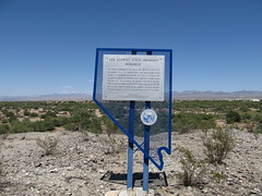
Nevada Historical Marker #188
Von Schmidt State Boundry Monument. This marker commemorates the iron column erected in 1873 at the southernmost tip of the boundary survey line run by Alexey W. Von Schmidt. U.S. astronomer and surveyor. The line dividing Nevada and California was based on preliminary geodetic work by Lieutenant Joseph Christmas Ives. Ives determined the Colorado River end of the proposed oblique California-Nevada boundary. Von Schmidt calculated and ran the first complete survey of the boundary. His solar observations erred slightly, the actual line now being ¾ mile to the north.
Needles Highway, Needles, CA, United States

Nevada Historical Marker #189
Southern Pacific Railroad Yards. Soon after 1900, laborers reworked some 373 miles of the original Central Pacific (now the Southern Pacific) line between Reno and Ogden, Utah. The effort involved shortening the line in some places. One such change took Wadsworth (Nevada), a division terminal, off the main line. During the summer of 1904, the terminal was moved to this location, which became the town of Sparks.The railroad dismantled a huge forty-stall locomotive roundhouse in 1959. The machine and erecting shops are still standing.Had it not been for the railroad yards being moved here, the City of Sparks would not exist.
Victorian Ave, Sparks, NV, United States

Nevada Historical Marker #190
Original Homesite Of A Las Vegas Pioneer “Pop” Squires 1865 1958. Charles “Pop” Squires, often referred to as “the Father of Las Vegas,” lived at this location, with his wife Delphine, from 1931 until his death in 1958.Squires first arrived in the Las Vegas Valley in February 1905. He and his partners established a lumberyard, a tent hotel, a real estate firm, and the First State Bank. In March 1906, “Pop” assisted in the formation of the Consolidated Power & Telephone Company, bringing electricity and phone service to the new town.In 1908, Squires and his wife purchased the community’s only newspaper, the Las Vegas Age. Squires campaigned for the creation of Clark County in 1909. He subsequently worked on incorporating Las Vegas into a city. With his wife and the voice of their newspaper, the couple became advocates for women’s suffrage. As a member of the League of the Southwest and the Colorado River Commission, Squires helped advance plans that eventually led to the construction of Hoover Dam.Upon “Pop’s” passing, Las Vegas Sun reporter Bob Faiss wrote, “It seems strange that Las Vegas, a modern boomtown … should owe so much to the foresight of one man. But there is little we have today that wasn’t given an initial shove by ‘Pop’ Squires.”
South 7th St, Las Vegas, NV, United States

Nevada Historical Marker #191
Verdi. Modern Verdi came into being with the construction of the Central Pacific Railroad through Nevada between 1867 and 1869. Verdi became a major mill town and terminal for the shipment of ties and construction timbers, with a network of logging railways reaching into the forests north and west of here.In 1860, a log bridge was built across the Truckee River near where Verdi is now located. Known as O’Nell’s Crossing, the site served as a stage stop during the 1860s on the heavily traveled Henness Pass Turnpike and Toll Road and the Dutch Flat and Donner Lake Road.In 1864, the Crystal Peak Company laid out a town on the site some two miles from Verdi’s present location. The company owned mining and lumbering interests near the settlement then called Crystal Peak.Verdi remained an active lumbering center into the twentieth century due to the exertion of men like Oliver Lonkey of the Verdi Lumber Company. A fire in 1926, plus depletion of timber reserves, resulted in Verdi’s decline.
3rd St, Verdi, NV, United States

Nevada Historical Marker #192
Buckland’s Station. Samuel S. Buckland was a true pioneer. He settled here in 1859, began a ranching operation, established a station for the Overland Stage Company, and operated a tent hotel. He also constructed the first bridge across the Carson River downstream from Genoa.During 1860, Buckland built a large log cabin and married Miss Eliza Prentice. In that same year, Buckland’s Station served as the assembly point for the volunteer units that took part in the Pyramid Lake War. It was during this period that Buckland’s served as a remount station on the famous Pony Express route.In 1864, Buckland opened a store and dispersed goods to travelers, neighbors, and the soldiers at nearby Fort Churchill. He later constructed the large two-story house, presently located here, from materials obtained at the dismantling of the fort.Buckland and his family are buried at Fort Churchill.
10050 US-95 ALT, Silver Springs, NV, United States

Nevada Historical Marker #193
Historic Flume And Lumberyard. Approximately one-half mile south of this point and west of the present highway lay the immense yard of the Carson-Tahoe Lumber and Fluming Company, the greatest of the Comstock timber companies operating in the Lake Tahoe Basin during 1870-1898.Situated at the terminus of the 12 mile V flume from Spooners Summit in the Sierra Nevada, the lumberyard was approximately one mile long and one-half mile wide. A spur line of the Virginia and Truckee Railroad served the yard. The spur ran adjacent to this site and carried rough lumber to the company’s planing mill and box factory, one-half mile north on Stewart Street. It also transported timbers and cordwood to the Carson yards to be hauled to the Comstock mines and mills.
Office Depot, Carson City, NV, United States

Nevada Historical Marker #194
Gardner’s Ranch. On this site in the period from 1870 until 1918 stood the ornate two-story home of Matthew Culbertson Gardner, rancher and lumberman. The residence was headquarters for Gardner’s 300-acre ranch in the meadows to the southward.Here was located, 1870 to 1898, the Carson-Tahoe Lumber and Fluming Company large lumberyard here. During the 1870s and 1880s, Gardner logged south of Lake Tahoe for the company and built the only standard gauge logging railroad in the Tahoe Basin. He maintained his home here.Gardner died in 1908. The residence was destroyed by a fire August 20, 1918. Many of the old trees on the ground once shaded the Gardner family.
S Carson St (Lincoln Hwy), Carson City, NV, United States
Nevada Historical Marker #195
The Last Spike. On January 30, 1905, near this site, workers drove the last spike that completed the railroad between Salt Lake City, Utah and Los Angeles, California. This was the last “transcontinental” line to southern California and one of the last lines built to the Pacific Coast. Although there was no formal celebration at the time of the last spike, those present gave some recognition to the event.Las Vegas owes its existence to the railroad, then known as the San Pedro, Los Angeles and Salt Lake Railroad. Because the valley had a good supply of water, the railroad company platted the Las Vegas town site and established a division point there.
S Las Vegas Blvd, Las Vegas, NV, United States

Nevada Historical Marker #196
The United States Mint Carson City, Nevada. The original Carson City building is a formal balanced, sandstone block edifice. Two stories high with a centrally located cupola. The sandstone blocks were quarried at the Nevada State Prison.On March 3, 1862, Congress passed a bill establishing a branch mint in the Territory of Nevada.The output of the Comstock Lode coupled with the high bullion transportation costs to San Francisco proved the necessity of a branch in Nevada.From its opening in 1870 to the closing of the coin operations in 1893, coinage amounted to $49,274,434.30.
, Carson City, NV, United States

Nevada Historical Marker #197
Arrowhead Trail Henderson. The name, “Arrowhead Trail” likely originated from the former San Pedro, Los Angeles, and Salt Lake Railroad, which had an arrowhead for a logo. Prior to 1850, New Mexican trading caravans from Santa Fe en route to Los Angeles used this segment of the Old Spanish Trail.Heading south along this trail toward Bishop Mountain, travelers turned through El Dorado pass, and continued to Nelson, Searchlight, Nipton, Wheaton Springs, and on to San Bernardino.This section of the trail was popular as an early automobile road (1916-1924) connecting Salt Lake City and Los Angeles. Local communities along the route promoted its construction and the tourism possibilities of Southern Nevada, including the nearby Valley of Fire, Nevada’s first state park.
Mission Hills Park, Henderson, NV, United States

Nevada Historical Marker #198
Steamboat Springs. These natural hot-springs are notable for their curative reputation. They were acclaimed by President Ulysses S. Grant when he visited in 1879.Early emigrants thought they looked like a distant Steamboat because of their puffing and blowing. Felix Monet located the springs in 1860, and Doctor Joseph Ellis subsequently added a hospital and bathhouses in 1861-1862.Comstock mining and the coming of the Virginia & Truckee Railroad in 1871 caused Steamboat to become a terminal. Materials for the silver mines were transferred to freight wagons for the steep haul to Virginia City at this point. The completion of the tracks abolished the need for a junction, but the resort’s popularity reached its peak with the bonanza days during the 1870s.With the failure of the Comstock mines in the 1880s, attendance at the springs waned. Fires destroyed the luxurious buildings, but the therapeutic waters remained. Health seekers, and conditioning athletes continued to visit here, and the springs even produce mineral muds sought by cosmeticians and race horse owners.
Carson-Reno Highway, Reno, NV, United States
Nevada Historical Marker #199
Camels In Dayton. Camels were imported into the United States for military purposes in the mid-1850’s. Lt. Edward Beale of the U.S. Army tested the animals for possible caravan operations in the deserts of the southwest. The experiment was not successful and the camels were auctioned off. Some were brought here to haul wood and salt to the mines and mills of the Comstock. They were corraled behind this stone hay barn, known as the Leslie Hay Barn. Used extensively between Sacramento and Nevada points for some ten years, they were later abandoned to fend for themselves. Few were seen after the 1880s.
Pike Street, Dayton, NV, United States
Nevada Historical Marker #200
Hall’s Station. Spafford Hall built this station and trading post in the early 1850s to accommodate emigrants bound for California. Hall, who was the first permanent settler here, was severely injured in a hunting accident in 1854 and sold the station to one of his employees, James McMarlin. It became known as McMarlin’s Station. Major Ormsby bought the station sometime between 1854 and 1860. The title was still in his name in 1860 when he died in the first battle of the Pyramid Lake War.A special niche in Nevada’s history is accorded this site as the place where the first recorded dance was held on New Year’s Eve, 1853.The exact site destroyed by borrow pit.
Shady Lane, Dayton, NV, United States
Nevada Historical Marker #201
Wonder. Located 13 miles to the north is the camp of Wonder, a major mining center in the early years of the 20th Century. Thomas J. Stroud and several others made the first locations in April 1906, and later that year, the Wonder Mining District was organized.Wonder’s boom from 1906 to 1915 was brief, but spectacular. Stores and saloons were in operation by mid-summer 1906, and a school was begun in 1907. Bench Creek provided water for the camp and an ice plant and a swimming pool made lire somewhat more bearable. During a brief span of years, the Nevada Wonder Mining Company produced some $6 million in silver, gold, copper, and zinc.Wonder’s most prominent native daughter is Eva Adams (1908-1991), Administrative Assistant to Senator Patrick A. McCarran for many and the second woman appointed as the Director of the U.S. Mint during the Kennedy and Johnson administrations.
, Fairview, NV, United States

Nevada Historical Marker #202
Fairview 1905 – 1917. Fairview was part of the renewed interest in mining, triggered by the strikes in Tonopah and Goldfield. Discoveries in 1905 of a rich silver float led to a boom that lasted through 1906 1907. A substantial town that boasted 27 saloons, hotels, banks, assay offices, a newspaper, a post office, and a miner’s union hall soon came into being. By 1908, the boom had passed and production leveled out. During 1911, the Nevada Hills Mining Company began an era of profitable milling that lasted until 1917. Production amounted to 3.8 million dollars in silver values.George Wingfield and George Nixon, prominent Nevada mining promoters of the time, bought some of the first claims in Fairview to give impetus to a boom.
, Fairview, NV, United States

Nevada Historical Marker #203
Bullionville. Bullionville began early in 1870 when John H. Ely and W. H. Raymond, removed their five-stamp at Hiko and placed it at to this point. The enterprise prospered and during the next two years most of nearby Pioche’s mills were located here because of the proximity to water. The town grew rapidly and by 1875 it had five mills, a population of 500, and the first iron foundry in eastern Nevada. During the same year a water works was constructed at Pioche, which eventually led to the relocation of the mills. Although a plant was erected here in 1880 to work the tailings deposited by the former mills, this failed to prevent the decline of Bullionville.
, Panaca, NV, United States

Nevada Historical Marker #204
Jackrabbit. Local legend attributes the discovery to the locator picking up a rock to throw at a jackrabbit and finding himself holding high-grade silver. The JackRabbit District, named for the mine, was located in 1876 by Isaac Newton Garrison. Early mine production of the camp, at one time named Royal City, was about ten tons per day, carrying native silver in flakes, yielding about $40 per ton - sometimes as high as $2,000 per ton. Mineral production declined during the 1880s, but when a fifteen-mile narrow gauge railroad was opened in 1891 between the Jackrabbit Mine and Pioche, mining soon increased. After 1893 the mines fell silent except for several short periods of activity in 1906-1907 and 1912-1914.
, Pioche, NV, United States

Nevada Historical Marker #205
Crystal Springs. Crystal Spring was used as a watering place and campsite on an alternate route of the Mormon Trail in the mid-nineteenth century. The town site was designated as the provisional County Seat for Lincoln County in 1866. With the intention of organizing the new county, Governor Henry G. Blasdel left Carson City in April 1866, accompanied by over 20 people. After a perilous journey through Death Valley, California, they ran out of supplies and food. One man died; the others survived on lizards and other desert animals. The Governor and another man raced to Logan City to obtain supplies and returned lathe party so they reached Crystal Spring. The Governor found that the region lacked the number of voters necessary to meet the requirements to become a county. A year later the county government was organized at Hiko.
, Hiko, NV, United States

Nevada Historical Marker #206
Hiko. As early as 1865, a camp was established here, and during the spring of 1866, W. H. Raymond and others laid out the townsite. The name Hiko is apparently based on a Shoshone term for “white man” or ‘white man’s town. Raymond purchased a five-stamp mill and had it shipped via the Colorado River to Callville and then hauled by oxen the 140 miles to this site. In November 1866, milling began on Pahranagat ores and soon after, Hiko became the first county seat of Lincoln County. In March 1867, Raymond spent nearly $900,000 developing the region before the enterprise failed. The mill was moved to Bullionville in 1870. Hiko consequently declined in population and importance, which accelerated following the removal of the county government to Pioche in February 1871.
, Hiko, NV, United States

Nevada Historical Marker #207
Carson Valley. Carson Valley below, now a broad expanse of cultivated and pasture lands, was originally a strip of meadow along the banks of the river where 49’ers, following the California branch of the Emigrant Trail, rested their stock and bought vegetables from the Mormon Station owners.After discovery of the Comstock Lode (1858) settlers extended the natural meadows by irrigation to provide hay, meat and butter for the miners in Virginia City and neighboring towns.From 1870, German, Danish and Swiss immigrants enlarged the area still more to supply produce to booming Bodie and, after 1905, to supply Tonopah and Goldfield.Good range and agricultural practices have allowed Carson Valley to continue to be one of Nevada’s finest agricultural areas.
, Stateline, NV, United States
Nevada Historical Marker #208
International Hotel. FIRST COMMERCIAL BUILDINGCONSTRUCTED IN AUSTIN1863This structure was built of lumber from the first International Hotel, constructed in Virginia City.David E. Buel constructed the hotel after being refused a free lot in Clifton at the mouth of the canyon below. Buel, Frederick Baker, W.C. Harrington, and John Veatch located and recorded the original townsite of Austin.STATE HISTORIC
Main St, Austin, NV, United States

Nevada Historical Marker #209
Chollar Mine. First located in 1859, the Chollar was consolidated with the Potosi in 1865. As the Chollar-Potosi, it was one of the leading producers on the Comstock. The Nevada mill was erected here in 1887 to process low-grade Chollar ore. It was the last to use the Washoe pan process, but the first on the Comstock to generate and utilize electric power.
F Street, Virginia City, NV, United States

Nevada Historical Marker #210
N.C.O. Railroad Depot 1910. In the 1880s, the Nevada-Oregon Railway (N-C-C) line began operations north to Beckworth, California. In 1884, the new owners, the Moran brothers, renamed the line the Nevada-California-Oregon Railway. They extended the tracks to Lakeview, Oregon, making this line one of the largest narrow gauge railroads in the west.This railroad depot was built in 1910. Architect Fredric DeLongchamps designed the building. He incorporated several architectural styles in the station. The entry porch is in the mission style; the roof eaves are from the Italianate style; and the arched windows and doorways follow the Romanesque Revival style.In 1917, the Western Pacific Railroad purchased the N.C.O. Line from Reno to Herlong, California and standard gauged it. The depot continued to serve the traveling public until 1937.
East 4th Street, Reno, NV, United States

Nevada Historical Marker #211
Old Geiger Grade. Marker damaged by collision. Placed on priority repair list 2017.In the canyon below is the Old Geiger Grade road. Constructed by Dr Davison M. Geiger and John H. Tilton in 1862, this old toll road was the most direct connection between the Comstock Lode and the Truckee Meadows, until replaced by the present, New Deal-era highway in 1936.Concord stages, mud wagons, and ten-mule freighters carried thousands of passengers and millions of dollars in precious cargo across this section of the Virginia Range. There are many stories of unpredictable winds, snows, landslides, and the everlasting danger of lurking highwaymen involving this precipitous stretch of road. Dead Man’s Point and “Robber’s” Roost, two of the most famous features of the road, can be seen from this marker.
Geiger Grade, Reno, NV, United States

Nevada Historical Marker #212
Galena. Galena began as an important lumbering center and mining camp. In 1860, R. S. and Andrew Hatch laid out the town and organized a mining district. The Hatch brothers’ quartz mill and smelter were among the earliest erected on this side of the Sierra. The gold deposits from the local mines contained a lead sulphide named “Galena,” which caused the mining operations to be unprofitable, but the mills continued to operate, processing ores from the Comstock mines.Eleven sawmills were operating by 1863, and Galena boasted stores, lodging houses, a justice court, a school which doubled as a community hall, saloons, and dozens of homes. The severe winter of 1864-1865 interrupted freighting to Virginia City, and the ensuing mining depression forced the Galena mills to close. After two disastrous fires in 1865 and 1867, Galena was abandoned.
Callahan Rd, Reno, NV, United States

Nevada Historical Marker #213
Lakeview. As early as 1863, two hotels with appurtenant stables were located here. In 1872, one hotel became a station on the newly-completed Virginia & Truckee Railroad between Carson City and Reno.Crossing under the highway are three inverted siphon pipelines furnishing water from the Sierra Nevada watershed to Virginia and Carson Cities. Work was first undertaken in 1873 on the 76 mile box flume and pipeline system with the construction of a maintenance station here. The Virginia and Gold Hill Water Company’s historic water-gathering and transportation complex immediately became world famous.As early as 1881, Lakeview became a lumber storage area for timber cut in the Lake Tahoe Basin. In 1887, shipping activity was accelerated as lumber was fed to the yard by a V-flume originating above present Incline Village. From here timber products were shipped to the Comstock mines and other points via the V. & T.R.R cars. Activity ceased in 1896.
, Lakeview, NV, United States

Nevada Historical Marker #214
Rafael Rivera. This historical marker commemorates the valor and service of pioneer scout Rafael Rivera, the first European American of record to view and traverse Las Vegas Valley, who scouted for Antonio Armijo’s sixty-man trading party from Abiquiu, New Mexico. In January 1830, young Rivera ascended Vegas wash twenty miles east of this marker and blazed a route to the Mojave River in California by way of the Armargosa River.Rivera’s pioneering route became a vital link in the Old Spanish Trail, with Las Vegas Springs an essential stop on this popular route to Southern California. John C. Frémont mapped the trail in 1844. Three years later, following an extension of the course to Salt Lake Valley, the route became known in this area as the Mormon Trail. Today the Old Spanish Trail closely parallels Interstate route #15.
Mountain Vista St, Las Vegas, NV, United States
Nevada Historical Marker #215
Lahontan Dam. Lahontan Dam, completed in 1915, is the key feature of the Newlands irrigation project that turned Lahontan Valley into one of Nevada’s most productive farming and ranching areas. With the completion of the dam’s powerhouse, the electrical energy needs of Churchill County and the surrounding area were met.The Project was one of the first authorized under the Federal Reclamation Act of 1902 and the 1903 construction contract for Derby Dam and the Truckee Canal was the first entered into by the U.S. Reclamation Service, later the Bureau of Reclamation.This undertaking, originally named the Truckee-Carson Project, was renamed the Newlands Project in 1919, in honor of U.S. Senator Francis G. Newlands of Nevada, an ardent supporter of federal reclamation projects and legislation that made them possible. Operations were transferred to the Truckee-Carson Irrigation District in 1926.
, Fallon, NV, United States
Nevada Historical Marker #216
Stillwater. Stillwater’s beginning predates Nevada’s advent to statehood by two years. Named for large pools of tranquil water nearby, the town originated as an overland stage station in 1862, was granted a post office in 1865, and became Churchill’s third county seat in 1868. The community population peaked in 1880, and when the county seat was removed to Fallon in 1904, barely 30 residents remained.Although their community center has disappeared, the valley’s lush fields and abundant crops attest to the untiring efforts of Stillwater’s pioneer ranchers and their descendants who met the desert’s challenge with dedication and determination.The Stillwater National Wildlife Refuge of 163,000 acres of wetland habitat and natural breeding and feeding groups for waterfowl was created in 1949. The Stillwater Indian Reservation adjoins the Refuge.
, Stillwater, NV, United States
Nevada Historical Marker #217
Tate’s Stage Station 1886 1901. Long after the railroads came to Nevada and branch lines were extended towards the heartland of the state, horse-drawn stages continued to transport people and mail from railhead to the hinterlands.The principal routes were covered by such well-known lines as Overland Mail and Stage Co., William Hill Beachey Railroad Stage Lines, Butterfield’s, Wells, Fargo and Co., Pioneer Stageline, Carson and Columbus Stage Line, and other lesser-known lines.Thomas Tate sub-contracted mail routes in central Nevada for over thirty years. In 1886, he and his wife established a station due east as an overnight stop between the county seats of Austin and Belmont. Stages met here and exchanged passengers and mail and obtained fresh horses. Tommy’s wife fed and lodged the passengers, in what became a local social center. Ester Tate organized the first school in the area.The Tates maintained this station until 1901. Belmont lost the Nye County seat in 1905.
, Carvers, NV, United States

Nevada Historical Marker #218
Geiger Station. Seven-tenths of a mile east of this marker was Geiger’s Station, the largest station on the Geiger Grade Toll Road, the main thoroughfare between the Comstock Lode and the ranches of the Truckee Meadows. Located at the site were a toll house, three blacksmith shops, three barns, several corrals, and an inn named Magnolia House. During the boom years of the Comstock Lode, the 1860s and 1870s, the station was crowded with freight outfits, stagecoaches, and weary teamsters. Passing travelers could stop at the inn for a drink or a quick meal.Following the extension of the Virginia & Truckee Railroad to Reno in August 1872, the toll road fell into disuse, and a few years later it became a public highway. Magnolia House continued operating until 1915. Social activity at the inn included dances, attracting residents from Virginia City, nearby valleys, and the Truckee Meadows.
Toll Road, Reno, NV, United States

Nevada Historical Marker #219
Glenbrook. Lumbering operations in the Glenbrook area of Lake Tahoe began in 1861. Consolidation of V-flume systems in and near Clear Creek Canyon by 1872 made it possible to float lumber, cordwood, and sawed material from Spooner’s Summit to Carson City and to eliminate wagon hauling over the 9-year-old Lake Bigler Toll Road (King’s Canyon Road).In 1873, the new Carson & Tahoe Lumber & Fluming Company, under Duane Bliss, assumed all operations, becoming the largest Comstock wood and lumber combine. It controlled over 50,000 acres of timberland, operating 2 to 4 sawmills, 2 Tahoe Lake steam tugs to tow logs, 2 logging railroads, the logging camps employing 500 men and a planing mill and box factory in Carson City. Timber depletion and reduced Comstock mining closed the company in 1898; it had taken 750,000,000 board feet of lumber and 500,000 cords of wood from Tahoe basin forests during its lifetime.
Glenbrook Road, Glenbrook, NV, United States

Nevada Historical Marker #220
The Fight Of The Century. On this site on July 4, 1910, Reno hosted ‘The Fight of the Century,” a heavyweight championship boxing match between John Arthur Jack Johnson, the African American title holder, and James J. ‘Jim’ Jeffries, a former champion seeking to regain the title he had vacated in 1904. Jeffries had refereed a previous championship bout between Marvin Hart and Jack Root at this site on July 3, 1905, but the promotion of the ex-champion as “The Great White Hope’ focused worldwide attention on his 1910 contest with the talented Johnson, known as the “Galveston Giant.” Gamblers had their money on Jeffries, but Johnson easily handled his opponent and Jeffries’ trainers called the fight in the fifteenth round to save their man from the disgrace of a knockout.Organized by famed promoter Tex Rickard, the fight brought over 30,000 fans to Reno, some 22,000 of whom packed the arena here on the day of the fight.
E 4th Street, Reno, NV, United States

Nevada Historical Marker #221
Sand Harbor (1881 1896). History records Sand Harbor as playing an important role in the operations of the Sierra Nevada Wood and Lumber Company, one of three large companies supplying lumber and cordwood to the Comstock mines during the late 19th century. Walter Scott Hobart organized the company, and John Bear Overton was its general manager.The steamer “Niagara” towed log rafts from company land at the south end of Lake Tahoe to Sand Harbor. Here the logs were loaded on narrow-guage railway cars and taken two miles north to a sawmill on Mill Creek.Lumber and cordwood were started on the way to Virginia City via an incline tramway 4,000 feet long, and rising 1,400 feet up the mountainside where the material was transferred to water flumes and transported to Lakeview just north of Carson City.The tramway has been described as “The Great Incline of the Sierra Nevada”.
, Incline Village, NV, United States
Nevada Historical Marker #222
Tannehill Cabin One Of Eureka’s First Houses. The Tannehill brothers built this cabin for a residence in 1864 and lived here about a year before selling their mining interests to a New York company in 1866. The cabin subsequently went through a number of owners, including the firm of Nathan & Harrison, one of the area’s first mercantile establishments in the late 1860s.Fires, floods, and the ravages of time have spared the structure, and local residents take justifiable pride in the fact that they have been able to save it.
Lincoln Highway, Eureka, NV, United States

Nevada Historical Marker #223
Devil’s Gate. It gives ... “a forcible impression of the unhallowed character of the place.” J. Ross Browne . 1860This rugged reef of metamorphic rock was once one of the famous landmarks of the Nevada Territory. In June of 1850, John Orr and Nicholas Kelly unearthed a gold nugget nearby, the first ever found in Gold Canyon. For the next ten years, the can was the scene of placer mining and one of the first stamp mills in the Territory was erected just to the south of Devil’s Gate during the summer of 1860.During the brief Paiute War of May, 1860, the people of Silver City built a stone battlement atop the eastern summit and constructed a wooden cannon for protection.Devil’s Gate marks the boundary line between Storey and Lyon Counties. Through this narrow gorge paraded thousands of the most adventurous souls of the mining West as they made their way to the gold and silver mines of the Comstock Lode.
, Silver City, NV, United States

Nevada Historical Marker #224
Kyle (Kiel) Ranch. Established by Conrad Kiel in 1875, this was one of only two major ranches in Las Vegas valley throughout the 19th century. The Kiel tenure was marked by violence. Neighboring rancher Archibald Stewart was killed in a gunfight here in 1884. Edwin and William Kiel were found murdered on the ranch in October 1900.The San Pedro, Los Angeles and Salt Lake railroad purchased the ranch in 1903 and later sold it to Las Vegas banker John S. Park, who built the elegant white mansion.Subsequent owners included Edwin Taylor (1924-39), whose cowboy ranch hands competed in national rodeos, and Edwin Losee (1939-58), who developed the Boulderado Dude Ranch here, a popular residence for divorce seekers.In the late 1950s, business declined and the ranch was sold. In 1976, 26 acres of the original ranch were purchased jointly by the City of North Las Vegas and its bicentennial committee as a historic project.
Kiel Ranch Historic Park, Las Vegas, NV, United States

Nevada Historical Marker #225
Spooner Area (Logging And Lumbering Period: 1868 – 1895). This area bears the name of Michele E. Spooner, a French Canadian entrepreneur, who, along with others, was instrumental in establishing the wood and lumber industry which supplied the needs of the Comstock mines and mills.In 1868 Spooner became a partner with Oliver and John Lonkey, the Elliot brothers, Henry M. Yerington, William Fairburn and Simon Dubois in the Summit Fluming Company and operated a shingle mill and sawmill. In 1870 Yerington, Bliss & Company took over the summit fluming company.In 1873 another sawmill was erected at Spooner Meadows. Later in 1873, all the mills were taken over by the Carson & Tahoe Lumber and Fluming Company. This company, headquartered at Glenbrook, went on to become the largest of the three huge companies supplying wood and lumber to the Comstock.
, Glenbrook, NV, United States

Nevada Historical Marker #227
Lake Mansion Home Of Myron C. Lake Founder Of Reno 1877. Built by Washington J. MarshEntrant: National Register of Historic Places
Court St, Reno, NV, United States

Nevada Historical Marker #228
The Great Fire Of 1875. The most spectacular calamity to befall Virginia City had its origins within fifty feet of this marker. Early on the morning of October 26, 1875, a coal oil lamp was knocked over in a nearby boarding house and burst into flames. Strong winds spread the blaze and thirty-three blocks of structures were leveled. The losses included St. Mary in the Mountains Catholic Church, the Storey County Courthouse, Piper’s Opera House, the International Hotel, city offices and most of Virginia City’s business district. The offices and hoisting works of nearby mines were also destroyed.After the fire, Virginia City established a new hydrant system and erected a number of new hose houses including this structure.
A Street, Virginia City, NV, United States
Nevada Historical Marker #229
Oil From Shale. Directly south of this point and across the valley floor are the remains of a short-lived extraction plant, which reached the peak of its productive capacity in the early twenties. Driving of the main shaft began in 1916. Of several tries at extracting oil from shale, this was the only successful operation in Nevada.Robert M. Catlin, Sr. spent many years experimenting on the extraction of crude oil from these beds before beginning the commercial production of oil. After a production period of less than two years, the plant was closed in the fall of 1924. Hi-Power Catlin Oil was too expensive to complete with the fossil oils of that day.Easily 50 years ahead of his time, Catlin gave Elkoans and Nevadans a dream and the community an oil boom in the Roaring Twenties.
West Idaho Street, Elko, NV, United States

Nevada Historical Marker #230
Mount Rose Weather Observatory. Two miles to the northwest of this point lies Mt. Rose. On the 10,778 foot summit, Dr. James Edward church of the University of Nevada established one of America’s first high-altitude meteorological observatories on June 29, 1905. At the observatory, he carried out his famed snow studies and developed the modern science of snow survey. Dr. Church’s Nevada system of snow survey is used throughout the world today to predict seasonal water flow from precipitation stored as snow pack. In his honor, the north summit of Mt. Rose has been named “Church Peak.”
Mount Rose Highway, Reno, NV, United States

Nevada Historical Marker #231
Star City. Located in the Star Mining District some seven miles west of here, Star City was established in 1861 when rich silver ore was discovered in the area. During the boom years of 1864 and 1865, the town boasted 1,200 residents, two hotels, three general stores, a wells-Fargo office, a church and a dozen or more saloons. The Sheba Mine, the district’s biggest operation, had produced about $5,000,000 in silver by 1868, the year the rich ore began to run out. Three years later, only seventy-eight inhabitants remained in Star City. All that remains today are crumbling foundations, rusted mill equipment and memories.
Unionville Road, Imlay, NV, United States
Nevada Historical Marker #232
Reunion In Unionville. Across the road and down about 300 feet was the original Unionville School. Built in 1862, this adobe building was the first public structure in Humboldt County. Used by such organizations as the Union League, Knights of the Golden Circle, the Free Masons, and the Ancient and Honorable Order of E Clampus Vitus, it served the community until its demolition in 1871.Exactly 109 years later, members of the E.C.V. gathered here to hold a reunion in commemoration of this propitious event. To the rear of this marker is the site where Samuel Clemens allegedly lived briefly before going to Virginia City in 1862 and taking the name Mark Twain.
Unionville Road, Imlay, NV, United States
Subjects
Nevada Historical Marker #233
Dayton Cemetery. Founded in 1851, this is one of the oldest constantly maintained cemeteries in Nevada. The trail to the California Mother Lode passed directly in front and the wagon tracks can still be seen with careful observation.In 1849, the emigrants discovered gold in Gold Canyon and a trading post was opened here. In the 1850s, a permanent settlement was established. In 1861, the town was officially named Dayton in honor or John Day, a surveyor who agreed to plot the town on the condition the place would be named after him. That year, Lyman Crockett, later state treasurer, and Judge Calvin Hall located this cemetery. On December 9, 1861 Crockett dug the first grave. Two of his children are buried here. James Finney (“Old Virginny”) after whom Virginia City is named, is buried here. Many people buried here are Italian Americans, as this ethnic group dominated much of Dayton’s early history. Recognizing the potential of the land and the irrigating value of the Carson River, Italian Americans made this area the breadbasket for the Comstock.
Cemetery Road, Dayton, NV, United States

Nevada Historical Marker #234
Moana Springs. Opened as a resort on October 29, 1905, Moana Springs took its name from a famous Hawaiian spa. In addition to a large bath house with a pool fed by hot springs, Moana had a stately hotel, a clubhouse, baseball diamond and picnic grounds. Constructed and initially operated by Charles T. Short, (who gave the resort its name), Al North and John N. Evans, Moana was acquired by Louis W. Berrum in 1913 and remained in his family for the next four decades. Served by Berrum’s Nevada interurban trolley line from 1907 to 1920, Moana hosted dances, rodeos, boxing matches, trapshoots, circuses and aviation exhibitions. The City of Reno purchased Moana in 1956 and the remaining buildings were demolished the next year to make way for a new recreational complex.
West Moana Lane, Reno, NV, United States

Nevada Historical Marker #235
Camp Nye 1864 1865. Established one-half mile to the north in October 1864, Camp Nye served as the home base for the men of companies “D” and “E,” 1st Nevada Volunteer Cavalry. During the Civil War, troopers from Camp Nye took an active role in struggles with American Indians, and Company “D” suffered the only two combat deaths incurred by Nevada units during the war in a battle at Table Mountain in the Tuscarora Range in Elko County on May 20, 1865. Camp Nye was deactivated in August 1865. Time has obliterated all vestiges of the barracks, stables and other facilities.
Kings Canyon Road, Carson City, NV, United States

Nevada Historical Marker #236
Piper’s Opera House. This building, the most significant vintage theatre in the West, was erected by John Piper in 1885. Third in a succession of theatres which he operated on the Comstock, Piper’s Opera House, with its original scenery, raked stage, and elegant proscenium boxes, is a remarkable survivor of a colorful era in American theatrical history. Many popular nineteenth-century touring stars and concert artists appeared here.
B Street, Virginia City, NV, United States
Nevada Historical Marker #237
Carson And Colorado R.R. Freight Depot. This is the first railroad building to be constructed in Hawthorne. It is the remnant of the narrow-gauge Carson and Colorado Railroad built south from Mound House, near Virginia City in 1881. Railroad officials laid out the town in the desert and the first lots were auctioned off on April 14, 1881. The line was subsequently extended into Owens Valley, California, with rail service to Hawthorne coming to an end when the town was bypassed in 1905. In later years, this building served as the general store of J. E. Adams and Senator John H. Miller, a bar and restaurant with a bingo parlor, and a banquet hall, until acquired by the Hawthorne Elks Lodge in 1946.
5th Street, Hawthorne, NV, United States

Nevada Historical Marker #238
Huffaker’s. Before the arrival, 1858, of Granville W. Huffaker driving 500 head of cattle into the Truckee Meadows, the principal settlers were Mormons. The Comstock Lode and its mining needs focused attention on the valley. Huffaker established his ranch in 1859. Langton’s stage line and the first post office were functioning by 1862. For ten years, Huffaker’s was a most active stage-stop and a center for a community. The schoolhouse was constructed in 1868. Bachelors of a jolly nature gathered here for dancing, horse-racing and “land squabbles”. The Athenian Literary Society flourished for the more cultured. In 1875, the “Bonanza Kings” completed their pacific lumber and flume operation from the Lake Tahoe Basin. For fifteen miles, trestled logs were propelled “by waters rushing faster than any train”. At the terminus of the flume, the Virginia and Truckee Railroad opened a depot and telegraph office and constructed a spur where workers transferred timber.
South Virginia St, Reno, NV, United States

Nevada Historical Marker #239
Stonehouse. Native Americans and passing emigrants once camped here and the stone house was erected in the 1860s by officials of the Overland Stage Company as a dining and overnight rest stop. The Central Pacific Railroad line passed through this section of Humboldt County in 1868, and the nearby springs provided water for engines. A small community flourished here for a number of years to serve the needs of railroaders and neighboring ranchers, and a post office operated here from November 1890 to March 1915.
Dwight D Eisenhower Highway, Valmy, NV, United States

Nevada Historical Marker #240
Coney Island. Opened to the public on June 20 1909, Coney Island was among the most elaborate amusement parks of its day. Otto G. Benschuetz, founder and owner, landscaped the grounds, put in a children’s playground, a bandstand for outdoor concerts and a dance pavilion which also served as a skating rink and theatre. Coney Island also had an artificial lake complete with boats, covered landings and bath houses. The park’s heyday passed with Benschuetz’s death in 1912. An aircraft assembly plant occupied the site in the early “twenties” and an auto court was established here later. The pavilion was destroyed by fire in 1927 and a second blaze in 1930 took other structures. All the remaining buildings were torn down when Interstate 80 was constructed in the 1960’s.
Galletti Way, Reno, NV, United States

Nevada Historical Marker #242
Southern Nevada Consolidated Telephone Telegraph Company Building. This building was the communications center of Goldfield from 1908 until 1963. The Consolidated Telephone-Telegraph Company Building was one of the few spared by a fire that destroyed 53 blocks of the downtown area in 1923. Today, this building survives as an unspoiled expression of the work of turn-of-the-century craftsman, and serves as an example of the business life in the Tonopah-Goldfield area from the years when the mines were producing millions and bringing new prosperity to Nevada. From 1904 to 1910, the gold mines of the region boomed. With more than 15,000 people, Goldfield was the largest city in Nevada during that period, having four railroads and other modern conveniences. The town was damaged by a flash flood in 1913 and mining was in decline, so many people left the area. The fire of 1923 caused the remaining residents to leave. Today the largest employer in Goldfield is Esmeralda County.
East Ramsey Ave, Goldfield, NV, United States
Nevada Historical Marker #244
Dinner Station. Dinner Station stands as a reminder of Nevada’s stagecoach era. Established in the early 1870s by William C. (Hill) Beachey as a meal stop for the Tuscarora and Mountain City Stage Lines, it was originally known as Weilands. The name later changed to Oldham’s Station when a change of ownership took place. A frame structure accommodated the traffic, but a fine two-story stone house, outbuildings, and a corral were built following a fire in the 1880s. Early in the twentieth century, both automobiles and horse-drawn stages stopped at Dinner Station and it became one of the most popular county inns of the time. After 1910, when automobiles became more common, the station ceased to be used.
Mountain City Highway, Elko, NV, United States

Nevada Historical Marker #246
The Great Incline Of The Sierra Nevada. Located on the mountain above are the remnants of the “Great Incline of the Sierra Nevada”. Completed in 1880, this 4,000 foot long lift was constructed by the Sierra Nevada Wood and Lumber Company. A unique steam-powered cable railway carried cordwood and lumber up 1,800 feet to a v flume which carried the lumber down to Washoe Valley where it was loaded on wagons for use in the mines of the Comstock.Driven by an engine on the summit, 8,000 continuous feet of wire cable, wrapped around massive bull wheels pulled canted cars up a double tract tramline. This engineering feat would transport up to 300 cords a day from the mill located in what is now Mill Creek.
Tahoe Boulevard, Incline Village, NV, United States

Nevada Historical Marker #247
Site Of Nevada’s First Public Library. In 1895, Washoe County District Attorney, Frank H. Norcross, later a Chief Justice of the Nevada Supreme Court and a Federal Judge, began a drive to establish Nevada’s first free public library in Reno. That year, he persuaded the Nevada Legislature to enact a law establishing Nevada’s public libraries.The state’s first public library building was erected on this site in 1904, with $15,000 donated by philanthropist Andrew Carnegie on land originally donated to the City of Reno by pioneer Myron C. Lake. It remained in service until 1930, when growth forced its relocation to the site where the Pioneer Theater Auditorium now stands. The library was sold for $1 and demolished in 1931.In 1966, the library was relocated to a new building at Center and Liberty Streets, three blocks south of this site.
South Virginia St, Reno, NV, United States

Nevada Historical Marker #248
Virginia And Truckee Railroad Right Of Way. The Virginia & Truckee Railroad was built between 1868 and 1872 to connect the mining and milling communities of the Comstock to the Central Pacific Railroad that ran through Reno.The line first connected Virginia City to Carson City in 1869, but work to run the railroad north moved quickly. Soon after Chinese laborers graded this section during the summer of 1871, track gangs commenced laying rail south, reaching Steamboat Springs by late October. Nine months later, Superintendent Henry M. Yerington drove the last spike a mile west of Carson City on August 24, 1872, connecting Virginia City with Reno by rail. Although regularly scheduled passenger service didn’t begin until October 1, the first through train traversed the 52 mile route on September 1, 1872 - the last passed by here on May 31, 1950.
Holcomb Avenue, Reno, NV, United States

Nevada Historical Marker #249
Union Pacific Depot 1923 (Caliente). Constructed as a Union Pacific railroad depot in 1923, this mission revival structure was designed by well-known Los Angeles architects, John and Donald Parkinson. The depot represents an imposing example of mission revival design. Much of its interior was made of solid oak, and the total cost was more than $80,000. The depot replaced a former structure which burned on September 9, 1921. This newer facility included a restaurant and fifty-room hotel for some years. The structure has served Caliente as a civic center and is the location of city government offices.
Clover St, Caliente, NV, United States

Nevada Historical Marker #250
State Printing Building. Completed in 1886, the State Printing Building is the second oldest structure built by the State within the Capitol Complex. Architects Morrill J. Curtis and Seymore Pixley, designed the Italianate structure to compliment the older State Capitol (1870). Curtis was responsible for many significant buildings throughout Nevada and the West, including the octagonal library annex to the rear of the State Capitol (1906). Like many important structures in Carson City, this building was constructed of sandstone ashlar quarried at the nearby State Prison and is a significant example of state governmental architecture for the period. From 1886 to 1964, this building housed the offices and presses of the State Printer.
, Carson City, NV, United States
Nevada Historical Marker #251
Diamondfield Jack Davis. This historical marker commemorates the lasting notoriety of flamboyant western gunman Jackson Lee Davis (1870-1949), who was better know by the colorful name, “Diamondfield Jack,” a nickname that he carried the rest of his life.In the late 1890s, Davis gained a measure of fame as a gunman for the cattle interests, including rancher John Sparks, who would later become a Nevada governor, that were attempting to restrict sheep ranchers from southern Idaho and northeastern Nevada rangelands. Following a sensational trial in 1896, Davis was convicted of murdering two sheepherders. He was sentenced to be hanged, even after others confessed to the murders.In 1902, Davis was finally pardoned for the crimes. He moved to the central Nevada mining towns of Tonopah and Goldfield, where he became a successful mine operator. He also helped found several mining camps, including one called Diamondfield. In later years, he drifted into obscurity and died in Las Vegas in 1949 after being struck by a car.
Great Basin Highway, Jackpot, NV, United States

Nevada Historical Marker #252
Rinckel Mansion. Completed in 1876, this palatial residence is an excellent example of High Victorian Italianate architecture in Carson City. Charles H. Jones, a French-schooled designer, constructed the residence for Mathias Rinckel using European craftsmen. The mansion is constructed of pressed brick resting upon a sandstone ashlar foundation. The sandstone originated from the Nevada State Prison quarry. The brick came from Carson Valley and knot-free lumber was obtained from the pine forests of Lake Tahoe.Rinckel, a German immigrant and pioneer Carson City merchant, accumulated a degree of wealth in the gold fields in the Feather River District of California from 1849 to 1859. He increased his fortune in mining at Virginia City during that city’s infancy. In 1863, Rinckel settled in Carson City, where he engaged in raising livestock and butchering. As a successful merchant, he supplied the mining and timber districts surrounding Eagle Valley with meat.
, Carson City, NV, United States
Nevada Historical Marker #253
Emigrant Donner Camp. Upon entering the Truckee Meadows along the Truckee River thousands of California-bound emigrants turned their wagons southwest to avoid extensive marshes and uncrossable sloughs. Here at the base of Rattlesnake Mountain the emigrants established a campground which extended nearly two miles to the east and west, one half mile north and south. Numerous local springs furnished quality water and the protected location of the camp provided an ideal locale for a rest stop after hundreds of grueling miles spent traversing the Humboldt River Valley. Once rested the emigrants turned west to lace their major obstacle, the Sierra Nevadas. In October of 1846, the ill-fated Donner Party spent five days in this area resting and grazing their weary animals. Plagued by a series of unfortunate incidents one member of the party, William Pike, was accidentally shot, died and was buried in the vicinity.
Donner Party Park, Reno, NV, United States
Nevada Historical Marker #254
Nevada’s Mining Heritage. In 1864, a group of prospectors from Austin, Nevada discovered rock containing a silver-lead mixture on Prospect Peak. Since then, miners have struggled to reach minerals deep within these hillsides of the Eureka Mining District--a vital part of Nevada's mining heritage and future. By 1878, the population of Eureka and nearby Ruby Hill was over 9,000. The Eureka Mining District ranked as Nevada's second richest mineral producer (the Comstock ranked first). Ore veins of silver, lead, and other base materials were rich enough to justify enormous underground mine development and financial risk. Eureka's greatest production was from 1870 to 1890. By 1900, changing market conditions reduced demand for the District's materials. Many of the mines closed. A few smaller mines remained in operation until the 1920s, but it was nothing like the early days. Revival of the Eureka Mining District has recently occurred with the introduction of a mining technology called heap leaching. This method allows for profitable and more efficient processing of rock containing trace amounts of gold. Examples of old and new mining operations can be seen from here. At the base of the hill is the heap-leach pad and rock piles of a modern mining operation. Near the top of the hill is the Fad Shaft, a remnant of earlier mining days.THE FAD SHAFT - This Area's Last Underground Mining OperationProspectors discovered the Fad claim in 1906 but did not start mining until the 1940s. Geological theory suggested that ore existed 2,500 feet below the surface. From the 1940s to the 1960s, sporadic mining occurred at the shaft. Then at 2,465 feet, only 35 feet from their target, they encountered water. Flooding was so great that mining halted. The Fad closed a short time later. Ironically, the Fad Shaft, the last attempt at underground mining in the Eureka District, never produced any ore.Many hills around Eureka still contain rock piles, open shafts, and abandoned mining equipment. During Eureka's heyday, many headframes similar to the Fad dotted these hillsides. Most have since disappeared, leaving only a handful as reminders of the past.MODERN GOLD MININGHeap leaching removes trace amounts of gold from rock that would have been considered worthless in mining days of old. The gold is so small that it can only be seen with a microscope. Gold bearing rock is crushed into pebbles and pled (heaped) onto a thick plastic liner. A weak cyanide mixture dissolves the gold while gravity slowly draws (leaches) the gold-laden solution into collection tanks.Throughout history mining has changed the landscape. Mining's effects have changed as technology has advanced. Reclamation is now standard practice upon mine closure. Whether underground or surface, mining remains an important symbol of Nevada's heritage.
Lincoln Highway, Eureka, NV, United States
Nevada Historical Marker #255
Wilson Canyon. Wilson Canyon and the Wilson Mining District were named for brothers David and “Uncle Billy” Wilson. David Wilson (born 1829) came west in 1850 during the California Gold Rush. He returned to the Midwest in 1853, married, and joined the Union Army at the outbreak of the Civil War. Wilson participated in at least one battle and was discharged with sunstroke. He then returned to the West.The Wilson family settled in the Wilson Canyon area in 1863 mining gold discovered in Pine Grove by "Uncle Billy" and ranching in Mason Valley. The Wilsons’ mining efforts eventually yielded several million dollars.David Wilson died in 1915, a prominent local rancher and community leader. He is buried nearby in the Wilson Ranch Cemetery.A Northern Paiute named Wovoka was raised with the Wilson boys and took the name Jack Wilson. Wovoka started the Ghost Dance movement in 1890, which swept into the Great Plains with potent political force.
, Yerington, NV, United States
Nevada Historical Marker #257
Nevada’s First Gold Discovery. In July 1849, Abner Blackburn, a former member of the Mormon Battalion, made the first gold discovery in what is now Nevada near this site (see the canyon to the right). William Prouse, a member of a passing emigrant party, made a second discovery further up Gold Canyon in May 1850. The discoverers of these placer gold deposits believed the promised riches of California to be greater. Most emigrants consequently continued their westward journeys, but a few returned after finding most of California’s Motherlode creeks and rivers already claimed.By the spring of 1851, some 200 placer miners, including James “Old Virginny” Finney, were working in the area. The continuous occupation of Gold Canyon’s mouth makes this site Nevada’s first non-Native American settlement. Dayton, also known as Chinatown, became a mineral milling, commercial, and agricultural center after prospectors and placer miners worked their way up Gold Creek. This monument commemorates the 150th anniversary of the discovery of gold and the thousands of pioneers who passed near this site.
Cemetery Road, Dayton, NV, United States

Nevada Historical Marker #258
Charles W. Friend House, Observatory & Weather Station. This is the site of the house and observatory of Nevada’s first weatherman, astronomer, and seismologist, Charles William Friend. Born in Prussia in 1835, Friend immigrated by way of South America to California during the 1849 Gold Rush. In 1867, he moved from Folsom to Carson City where he set up his own jewelery and optical store.Friend built Nevada’s first observatory located southwest of his house and east of the Nevada State Capitol. Nevada’s U.S. Senator William Stewart helped him obtain the use of a six-inch equatorial mount telescope and other instruments from the federal government.Charles Friend also established Nevada’s first weather service. In 1887, the Nevada Legislature passed authorization for a weather service station in Carson City. Friend became its director and created volunteer weather stations throughout the state. He compiled the data into reports that are still referenced today. Charles W. Friend died in 1907. Since his death, the Association of Weather Services has recognized him as a pioneer in weather service west of the Rockies.
, Carson City, NV, United States

Nevada Historical Marker #259
The Governor’s Mansion. Reno architect George A. Ferris designed this neoclassical mansion, which cost $22,700. It is the only home ever built for Nevada’s highest elected official. In July 1909, acting Governor Denver Dickerson and his wife Una became the first residents of the mansion. Two months later, June Dickerson was born here. From 1909 to 1999, sixteen families have occupied the mansion. In 2000, first lady Dema Guinn began a revitalization of the grounds. Private funds supported many of the improvements, including this fence extension donated by Steel Engineers, Inc., Las Vegas and Blue Mountain Steel, Inc., Carson City
, Carson City, NV, United States
Nevada Historical Marker #262
Dayton School House 1865. In 1865 Lyon County built this imposing stone school building for the residents of Dayton, then the county seat. It is the second oldest schoolhouse in Nevada and is the oldest such structure to remain in its original location. The building served the community as a school until 1959 when it was closed. It later housed the Dayton Senior Citizens Center and became the home of the Dayton Historical Society Museum in 1991.FRIENDS OF THE COMSTOCKCOMSTOCK HISTORIC DISTRICT COMMISSIONSTATE HISTORIC PRESERVATION OFFICE
Logan Alley, Dayton, NV, United States

Nevada Historical Marker #263
Oats Park School. The Oats Park School was designed in 1914 by Frederick J. DeLongchamps, Nevada’s pre-eminent architect of the period. He was also responsible for the 1921 north and south wing additions. This building is one of his earliest, and perhaps his first, public school designs. The structure was placed on the State and National Registers of Historic Places in 1990 because of its importance in the history of local education and its architectural significance, including the use of contrasting brick colors and attention to interior detail.In 1995, the Churchill Arts Council began construction and renovation of the facility for its use as a multi-discipline cultural center. Drawing on the building’s legacy of serving the community, the Churchill Arts Council reopened the building as the Oats Park Art Center in February, 2003.
Oats Park, Fallon, NV, United States

Nevada Historical Marker #264
Silver City School House. The growing town of Silver City built a schoolhouse at this site in 1867-1868. Enrollment was as high as 166 students during the 1880s. Children were educated here for nearly a century until the school closed in 1958.The building then began its career as the Silver City community center and volunteer fire department. The fire department parked trucks inside the south classroom. Community events took place in the north classroom.Fire destroyed the schoolhouse in 2004. The community center was built in 2007 on the same place. The new building closely resembles the old schoolhouse in size and architectural style. Materials from the original building are incorporated into the new structure.
, Silver City, NV, United States

Nevada Historical Marker #265
Governor Emmet Derby Boyle. Eight grave sites to the north rests Emmet Derby Boyle (1879-1926), the first native-born governor of Nevada, serving from 1915-1923. Born in Goldhill, Boyle was also the first graduate of the University of Nevada to become governor. At thirty-five, he was the youngest person to hold the state’s highest office.Governor Emmet Boyle worked on Nevada’s water laws and introduced the state’s first executive budget. A strong supporter of women’s rights, Boyle called the Nevada Legislature into special session in 1920 to ratify the 19th amendment to the United States Constitution granting women the right to vote.Emmet Boyle died on January 3, 1926 and is buried next to his wife Vida McClure Boyle who he married in 1903.
Mountain View Cemetery, Reno, NV, United States

Nevada Historical Marker #266
African Americans And The Boston Saloon. Between 1866 and 1875, a remarkable business thrived directly behind this building. Free-born William A.G. Brown operated his Boston Saloon, serving Virginia City’s African Americans. Archaeologists have revealed that Brown offered his customers finely prepared meals with the best cuts of meat. Shortly after Brown sold his business, the great fire of 1875 swept through town and destroyed the building. There were rarely more than one hundred African Americans living in Virginia City, but they played varied and important roles in the community. Some African Americans pursued work as laborers, porters, and barbers. Others became affluent business owners, and a prominent doctor won widespread respect. By the 1870’s, African American children attended integrated schools. Prejudicial laws and racism placed hurtful restrictions on the African Americans of Nevada. Fortunately, a prevalent pro-Union, anti-slavery attitude improved the lives of many African Americans who helped build Virginia City.
Union St, Virginia City, NV, United States
Nevada Historical Marker #267
Galena Creek Fish Hatchery. The Galena Fish Hatchery represents an attempt to make amends after Nevada’s Comstock Lode ravaged the region’s ecosystem in the 1860s and 1870s. Fishing decimated local streams and lakes to feed a growing population. Eventually, restocking became an important goal.Washoe County operated this hatchery from 1931 to 1949 as an auxiliary to their main facility on the Truckee River in Reno. Galena Creek was ideal because of the continuous supply of uncontaminated water. The hatchery reflects a trend, beginning in the 1920s, to combine habitat conservation and recreational developmentThe county ceased hatchery operations in 1949. After that, the Boy Scouts, the Sierra Sage Council of Camp Fire, Inc., and the Washoe Bowmen and Sierra Archers used the site. In 1994, Washoe County reacquired the property as part of Galena Creek Regional Park with plans to restore the building for community use.NEVADA
Galena Creek, Reno, NV, United States

Nevada Historical Marker #270
The Morelli House. The Morelli House is a classic example of Las Vegas mid-century residential architecture. It was built in 1959 by the Sands Hotel orchestra leader Antonio Morelli and his wife Helen. Originally located at 52 Country Club Lane in the former Desert Inn Country Club Estates, now the Wynn resort, the modernistic house then featured an open plan that integrated interior and exterior spaces, natural materials, and the latest innovative home appliances. In 2001, the Junior League of Las Vegas relocated the Morelli House to its present site and completed restoration in 2009.Listed 2001, Nevada State Register of Historic PlacesListed 2007, City of Las Vegas Historic Property RegisterThis historic preservation project was funded, in part, by the Nevada Commission for Cultural Affairs and through generous donations from the Las Vegas community and members of the Junior League.
E Bridger Ave, Las Vegas, NV, United States
Nevada Historical Marker #271
Pony Express Route 1860 Sesquicentennial 2010. One hundred and fifty years ago, the Pony Express was founded by W.H. Russell, Alexander Majors and William B. Waddell, operators of the Overland Stage Line of Leavenworth, Kansas. During a visit to Washington, Mr. Russell was urged by California Senator William Gwin to expand the Overland Stage operation to facilitate faster mail service. Mr. Russell’s partners hesitated due to projected high costs; he persevered and the first ride began on April 3, 1860.Overland stagecoach stations were located every 10-12 miles as far as Salt Lake City. Eighty skilled and experienced riders, 400 horses and approximately one hundred-eighty-four stations were built in two months. There were thirty stations across Nevada, from Deep Creek, Utah to Genoa at the eastern base of the Sierra. The swift riders carried the mail 2000 miles in 10 days from St. Joseph, Missouri to Sacramento, California. The “Pony” improved nationwide communication, western expansion and was credited with California’s continued participation in the Union at the beginning of the Civil War.A high price was paid for the improved communication including the cost to post a letter and the trials of the employees during the ride. The cost of mailing a letter as advertised was not economical, “letters less than ¼ oz cost $5.00 and so on.” The riders, station masters and division agents faced hostile environments including poor housing, extreme heat and cold, poor access to potable water, food and dangers due to the conflicts between Native Americans and the newcomers to the West.On October 24, 1861, the telegraph was born and the last ride was completed. What had taken ten days could be achieved in ten seconds thus ending the Pony Express, but the memory of the riders and the route live on.STATE OF NEVADA HISTORICAL
, Fallon, NV, United States

Nevada Historical Marker #245
Frederic Joseph De Longchamps. Frederic Joseph DeLongchamps was Nevada’s foremost architect of his time. Statewide, he was prolific in the number of buildings he designed. From this point, one can see a group of structures that stand, collectively, as a monument to DeLongchamps: the United State Post Office, the Riverside Hotel, the Washoe County Courthouse and the Reno National Bank Building. The Northern Chapter of the American Institute of Architects, dedicated to excellence in architecture, honors the memory of Frederic Joseph DeLongchamps.
N Virginia St, Reno, NV, United States
Nevada Historical Marker #40
Las Vegas (The Meadows). In the Las Vegas Springs The famous Las Vegas Springs rose from the desert floor here, sending two streams of water across the valley to nurture the native grasses, and create lush meadows in the valley near Sunrise Mountain. The natural oasis of meadow and mesquite forest was the winter homeland of Southern Paiutes, who often spent the summers in the Charleston Mountains. An unknown Spanish-speaking sojourner, named this place “Las Vegas” meaning “The Meadows”. Antonio Armijo led a trading party from Santa Fe to California in 1829-30, traversing part of the Las Vegas Valley. One branch off the main Old Spanish Trail included the Springs as a resting spot. On one of his western exploration trips, John C. Fremont camped here on May 3, 1844 and was the first to officially put Las Vegas on the map.Because of artesian water here, Mormons established the Las Vegas Mission and Fort in 1855 a few miles east of the Springs. The San Pedro, Los Angeles, and Salt Lake Railroad Company acquired water rights and land, with which it created the City of Las Vegas in 1905.
Vegas Spring, Las Vegas, NV, United States

Nevada Historical Marker #79
Grand Army Of The Republic Cemetery. In 1890 General OM. Mitchel Post 69, Grand Army of the Republic, bought 17 lots in the original Hillside Cemetery for the last resting place for comrades-in arms during the Civil War, 1861-1865.While Friends and relatives of the soldiers maintained the cemetery well, years of neglect and vandalism followed in the twentieth century. Restoration began in 1963 by the Daughters of Union Veterans of the Civil War and other interested citizens of the Reno area.Among those buried here are members of the Nevada volunteers who served in their own state and neighboring areas of the West from 1861 -1866.
West 10th St, Reno, NV, United States
De Ek Wadapush (Cave Rock). A sacred place to the Washoe Tribe of Nevada and California, cave rock is the subject of many legends. Named for a cave, a remnant of which can be seen some 200 feet above the waterline. This formation was a landmark on the Lake Bigler Toll Road in the early days. Quarried granite blocks, which support the toll road, can still be seen on the west face of cave rock. The rock was first tunneled for the construction of a highway in 1931 and the second tunnel was put through in 1957. The Washoe name for Cave Rock is De-ek Wadapush which is now listed on the National Register of Historic Places as a Traditional Cultural Property. It is important now as it has been for thousands of years for the Washoe." Medicine men meditated and prayed here" and many distinct features help make up our culture, gifted basket makers, the wisdom of long-preserved legends, and our traditional way of life. Cave Rock was one of our prominent sacred sites reflecting our traditional values of respect for the land and "da ow" (Lake Tahoe) the life-sustaining water, the center of the Washoe world (Washoe elder)
, Glenbrook, NV, United States

Nevada Historical Marker #67
Austin Churches St. Georges Episcopal Church, to the east, was consecrated in 1878. The Reverend Blackiston used an eloquent, enthusiastic Easter sermon in 1877 to secure pledges for church, retaining wall, pipe organ, and bell and for a twenty-dollar gold piece from every employee or a local mine. The organ was shipped around the Horn and hauled by wagon from San Francisco. St. Augustine’s Catholic Church, to the west, was built in 1866 of native brick and stone. Father Monteverde, the first pastor, conducted the first mass at midnight Christmas Eve, 1866. Admission of $1 per person was charged to limit the number of people attending. The Methodist Church, to the north, was built in 1666. A canny minister formed the Methodist Company, and sold stock as Far away as the East Coast to finance the building of the church. Lectures and entertainment were part of the church scene for benefit purposes. Emma Wixom attended Sunday school here. Later, as world-famous Emma Nevada, she brought her troupe to Austin and gave a benefit concert in the church.
Main Street, Austin, NV, United States

Nevada Historical Marker #261
Spooner Summit TOLL ROADS Johnson’s Cutoff, also called the Carson Ridge Emigrant Road, passed over Spooner Summit and down Clear Creek Road from 1852 through 1854, but was rugged and little used. With discovery of the Comstock Lode in 1859, Spooner Summit became a focal point on the most heavily traveled branch of the bonanza road system linking Placerville, California, and the new towns east of the Sierra Nevada. Territorial governments granted franchisces to provide individuals or companies, allowing them to build and maintain toll roads. The Rufus Walton (Clear Creek) Toll Road replaced Johnson’s Cutoff in 1860, providing a better route around the southeast shore of Lake Tahoe via Glenbrook. LUMBER FOR THE COMSTOCK Massive amounts of wood were sent to the Comstock Lode from the Carson Range and the Tahoe Basin. Initially wood was hauled by wagon, but soon the transport included trains, steamboats, and water flumes. Spooner Summit is in the midst of a former logging landscape. In 1873, logging in the area was consolidated by formation of the Carson and Tahoe Lumber and Fluming Company. Workers were housed at a small settlement called Summit Camp, built along one side of the toll road. From 1875 to 1898 the company operated the Lake Tahoe Railroad along 8.75 miles of the line from Glenbrook to this spot. The difficult route included switchbacks and a 487-foot tunnel just west of the summit. The narrow-gauge railroad’s sole purpose was to haul timber and lumber for building purposes and cordwood for fuel. This wood was transferred to an 11-mile long V-flume that extended from Spooner Summit down Clear Creek to Carson Valley. There the wood was loaded on the Virginia and Truckee Railroad for the rest of its trip to the Comstock. At its peak the Comstock consumed about 80 million board feet of lumber and 2 million cords of firewood each year. About 300,000 board feet of wood passed over Spooner Summit each day. This route was improved in 1863 with the completion of the Lake Tahoe (Bigler) Wagon Road, also called the Kings Canyon Road. About 5,000 teamsters were moving goods along roads leading to the Comstock in 1863, but traffic began to decline in 1875. Stations were built at convenient intervals along the roads. Swift’s Station was about two miles east of Spooner Summit on the Kings Canyon Road. In 1863, Spooner’s Station, located near the current junction of US 50 and SR 28 (a mile west of here), had a hotel, saloon, houses, blacksmith shop, and two barns. EARLY MORNING Introduction of automobiles into the Tahoe Basin rapidly changed the character of the place, making it accessible for far more people as a growing tourist destination. Early in the twentieth century, the decaying bonanza system of wagon roads had to serve the needs of the automobile travelers. In 1913, the Lincoln Highway Association designated the road up Kings Canyon, over Spooner Summit, and through Glenbrook as part of the Lincoln Highway. The highway was a private concept intended to enhance long-distance automobile travel by establishing the first transcontinental route. Actual work on this section began in 1914 when the Carson Good Roads Association placed redwood markers every mile. Each marker displayed the highway symbol and distances to Carson City, Glenbrook, and San Francisco. During this period one motorist described part of the road as “a narrow shelf along a barren, rocky mountain side.” Little more than light maintenance was done on the road even after it was included in the Nevada State Highway System as part of Route 3. In 1923, the portion of Route 3 between Spooner’s Station and the state line was incorporated into the Forest Highway System, making funding available for major improvements. In 1927 and 1928, a graded two-lane automobile road was built along Clear Creek, over Spooner Summit, and on to Glenbrook. A combination of state and Forest Highway funds paid for the work. The new road became part of US 50. In the 1930s, the road was oiled and surfaced with asphalt. Snow removal allowed year-round access to the lake. Finally, in the late 1950s, this portion of US 50 was upgraded to the present two lanes.
, Glenbrook, NV, United States