Series 'Texas Historical Marker'

Texas Historical Marker #03934
Papalote Creek. A few yards south passes Papalote Creek, crossed by the fierce Karankawa Indians who found kite-shaped pebbles and named it Papalote, which means "kite-shaped" or "wing-shaped". Along its banks came the leaders of the Power and Hewetson colonists, holding Mexican land grants in the 1830's. On its Rata tributary there is evidence the Mexican Army camped on its way to suppress the Texas Revolution. By 1857 the town of Papalote had emerged. It was the center of entertainment for the county, boasting of a circular dance hall built by cowboys trading steer yearlings at $3 a head for lumber. There were rooster fights, ring tournaments and horse races. In 1886, when the railroad came, the town was booming. After the turn of the century, however, Papalote began to die away. A land company sold lots to settlers from as far away as Hawaii. Expecting to grow citurs fruits, they were disillusioned when the first killing frost doomed the project. Threats of Pancho Villa's raids continued as late as 1916, when women and children hid in a brick schoolhouse. In 1948, Main Street was bypassed by U.S. Highway 181. Today there is no post office--only a rural route for the few remaining households. (1965) #3934
?, Beeville, TX, United States
Texas Historical Marker #03935
Home of William Christian Papenberg. (1870-1958) District clerk for 38 years in Colorado County. Born in Illinois. Educated as a teacher, came to Texas (1899) in that profession. Moved to Columbus (1904) and became clerk in 1908. This house that he and his wife Emma (Buescher) built in 1914 remains in the family. RTHL - 1973 #3935
900 Bowie Street, Columbus, TX, United States
Texas Historical Marker #03936
Park Hotel. Reinhart C.M. Nelson, one of many midwesterners lured to the area by the promotional literature of land developers, moved his family here from Minnesota in 1905. He built this structure in 1910. Named for its park-like setting, it is an unusual example of standard 20th century hotel form. It features innovative concrete construction, distinctive cast concrete Classical columns, and a wraparound porch. The building was converted for use as a private residence in 1920. Recorded Texas Historic Landmark - 1995 #3936
?, Tuleta, TX, United States
Texas Historical Marker #03937
Park Place School Building. Built in 1912 as a public school, this structure was one of two schools of its design erected in Yoakum. In 1938 this building was enlarged with funds from the Works Progress Administration. During World War II, the building housed a leather school and was used as a housing facility. It remained in educational use until 1957, and later housed a retail business. The building exhibits mission revival style features. Recorded Texas Historic Landmark - 1996 #3937
505 Elenora, Yoakum, TX, United States
Texas Historical Marker #03938
Parker Cemetery. Land for cemetery donated by Isaac Duke Parker, Jan. 14, 1901. He was son of Isaac Parker, pioneer politician for whom Parker County was named and who was the uncle of Cynthia Ann Parker, white girl captured by Comanche Indians in 1836 and reared as an Indian. She was the wife of Comanche Peta Nocona and mother of Quanah Parker, the last great Comanche war chief. Both Isaac Parker and Isaac Duke Parker served as members of the Texas Legislature. Isaac Duke Parker is buried here. Cemetery also contains a public burial section. #3938
1300 block of Cardinal Drive, Hurst, TX, United States
Texas Historical Marker #03939
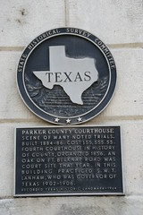
Parker County Courthouse. Scene of many noted trials. Built 1884-86. Cost $55,555.55. Fourth courthouse in history of county, organized 1856. An oak on Fort Belknap Road was court site that year. In this building practiced S.W.T. Lanham, who was Governor of Texas 1902-1906. Recorded Texas Historic Landmark, 1965. #3939
College St. & US 180, Courthouse Square, Weatherford, TX, United States
Subjects

Texas Historical Marker #03940
Parker County Poor Farm and Cemetery. Created in 1883, a farm near this site housed the county's indigent citizens. Farm residents and some county convicts worked to grow crops and raise livestock. Although entire families were once housed at the farm, by the 1930s the residents were mostly elderly. Their barracks-style house was moved to Weatherford in the 1940s after the farm was closed. A small cemetery was created here, and contains one legible marker. Additional grave sites have been marked with bricks. The earliest documented burial is from 1904, and the last was in 1937. Texas Sesquicentennial 1836-1986. #3940
Tin Top Rd., S of Weatherford, Weatherford, TX, United States

Texas Historical Marker #03941
Parker County, C.S.A.. Part of a colonial grant to S.M. Williams and Stephen F. Austin, father of Texas, but with no permanent settlers before 1850, this county was created in 1855 and named for Isaac Parker, its legislative sponsor. By 1860 it had 4,213 people and in 1861 its voters favored secession 535 to 61. Oliver Loving, a settler, was an official stock raiser, furnishing beef to the Confederacy in the Civil War. He and 18 other men organized a full-time patrol against the frequent, bloody Indian raids. Citizens of adjacent counties took refuge here. In 1864 three local men were charged with treason. One admitted inviting federal General J.G. Blunt to come from the Cherokee nation and give Parker County protection from the Indians. General John R. Baylor, a local rancher, was an officer in the Arizona-New Mexico campaign to make the Confederacy an ocean-to-ocean nation, and after victories there became Governor of Arizona. He was in the Confederate Congress from 1863 to 1865. Parker County sent the Confederate army nine companies. Its Company E, 19th Texas Cavalry, served in Parsons' Brigade--which fought over 20 engagements in three years with considerable distinction. (1964) #3941
College St. at Courthouse Square, Weatherford, TX, United States
Texas Historical Marker #03942
Parker Memorial Cemetery. The first burial here is thought to be that of Christina Driskill (1797-1862), whose son-in-law Isaac Green Parker (1816-1875) owned the land. In 1881 Parker's widow, Mary (Polly) Parker Turner (1820-1897) deeded the 4.31-acre plot for a public burial ground. A tabernacle was erected in 1928 and used at first for funeral services and later for meetings of the cemetery association. Formerly known as "Clements Cemetery", it was renamed "Parker" in 1937. Many members of the Pleasant Glade Community are buried here. #3942
FM 121 and Hall - Johnson Road, Grapevine, TX, United States
Texas Historical Marker #03944
Parks Camp. Founded in 1918 and named for rancher J.W. Parks, on whose land it was located, Parks Camp was a company town built for employees of the Texas Company (Texaco). The discovery of oil on Parks' land caused an economic boom in the area, and the Parks Camp at its height was home to about 15,000 people. By the 1920s the camp's facilities included a school, bank, post office, stores, community hall, doctors, and rows of individual and barracks-type housing. The town began to decline in the early 1940s and was completely abandoned by the end of World War II. #3944
Off US 83 on FM 576, Breckenridge, TX, United States
Texas Historical Marker #03946
Parmer County. Created August 21, 1876, from Bexar County. Named for Martin Parmer ("The Ringtailed Panther"), signer of Texas Declaration of Independence. Organized May 7, 1907. The XIT Ranch, extending across nine counties, initially owned most of Parmer. The Capitol Syndicate, which built Texas' Capitol, received in payment 3,050,000 acres of land and established the XIT in 1885. By 1890, population of the county was only 70. But, with syndicate land sales, buyers came on the new railroad in 1904. Brisk settlement began, with many small farms. Farwell is the county seat. (1965) #3946
401 3rd St, Farwell, TX, United States
Texas Historical Marker #03947
Parmer County Courthouse. Application: The Texas Historical Building Medallion inclosed. #3947
US 84, Courthouse grounds, Farwell, TX, United States

Texas Historical Marker #03948
Parnell. Roberts County was created on August 21, 1876, by the Texas Legislature, but remained unorganized, as in that year it had only one settler. Its 1880 population was 32. After the Santa Fe Railroad was built across this area in 1887, settlement increased. A January 1889 election to organize the county was invalidated by fraudulent voting. However, the disqualified officers opened a courthouse in a vacant store in Miami (20 miles southeast), the county seat according to the contested election, and placed the records in a heavy safe. The legally elected authorities later obtained the records by hiring a gunman to impersonate a landowner and to capture the safe when it was opened. Hauled to the legal county seat near this site, the safe was set on blocks and a 2-story frame courthouse was built around it. First known as Bennett and then as Oran, the town was renamed Parnell when the U.S. Post Office opened in March 1890. Parnell had a few businesses, about 12 residences, a school, and a saloon. Guests rode 25 to 30 miles to attend dances in the courthouse. Those attending court in Parnell had to camp out, as the hotel was small. Miami became county seat in 1898, and Parnell was abandoned. (1973; 1986) #3948
FM 283, NW of Miami about 20 mi., Miami, TX, United States

Texas Historical Marker #03951
Paisano Pass. Legend recounts that two Spaniards meeting here greeted each other "Mi Paisano" (My Countryman). First known to history when Juan Dominguez de Mendoza camped here on January 3, 1684. Well known after 1850 as a point on the Chihuahua Trail, an emigrant road to California. #3951
?, Marfa, TX, United States
Texas Historical Marker #03952
Paso de la Santa Cruz. Spot where in 1753 Juan Galvan, Spanish explorer, put up a huge cross, to show his choice of site for Mission San Saba. Indians gathered at the cross, remaining to participate in the first known Christian worship service in this area. The Mission, 2 miles east, and the River ford were both named for the cross. #3952
US 190/83 intersection, Menard, TX, United States
Texas Historical Marker #03953
Pat Garrett. Pioneer law officer Patrick F. Garrett, renowned for killing outlaw Billy the Kid in 1881, lived in a house at this site during his residence in Uvalde. He had come from Alabama to Texas in 1869; here he worked as a farmer, cowboy, and buffalo hunter. He served as sheriff in several cities and also dealt in ranching operations. He owned property here from 1891 to 1900. In 1908 he was killed in New Mexico after an argument over land, but many people assumed that the quarrel was merely a ruse to force Garrett to fight or be murdered from ambush. 1970 #3953
US 90, Uvalde, TX, United States
Texas Historical Marker #03954
Patton Baptist Church. The Walnut Grove Baptist Church of Christ was organized in 1872 a few miles south of this site. Richard Simpson gave land for a public school in 1878, and early worship services were thought to have been held in the school building. At a meeting in 1889 the name of the congregation was changed to Patton Baptist Church. Simpson gave land at this site for a church building in 1897. For many years the church has been the site of revivals, worship services, and family reunions. The congregation meets on a regular basis and continues to serve its community. #3954
?, Patton, TX, United States
Texas Historical Marker #03955
Rock Barn. Built 1891 by F. M. Patton, a rancher; native stone with cottonwood framing. Part of lumber came from abandoned Fort Elliott. Barn was one of first in county; used to store prairie hay, alfalfa. W. G. Stiles family, owners, purchased ranch in 1901. (Recorded Texas Historic Landmark, 1967) #3955
SH 152, E of Wheeler, Wheeler, TX, United States
Texas Historical Marker #03956
Paul Ingenhuett Home. Young Paul Ingenhuett (b. 1868), born on this block, succeeded his father Peter Joseph in the mercantile business. Soon Paul expanded into farming, sheep and cattle ranching, and helped found Comfort State Bank. In 1891 he married Ida Emma Sophie Flach and they had four children. After noted architect Alfred Giles designed several Comfort buildings, the Ingenhuetts employed him in 1897 to draw plans for this home. The limestone was quarried on family property. Recorded Texas Historic Landmark - 1979 #3956
421 Eighth Street, Comfort, TX, United States
Subjects
Texas Historical Marker #03957
Paul Quinn College. Texas' Oldest Liberal Arts College for Negroes. Originally Connectional High School and Institute for Negro Youth; opened in Austin, April 4, 1872,by the African Methodist Episcopal Church, under Bishop J.M. Brown (1817-1893), who served 1872-1876 as president. Founders were Bishop R. H. Cain, the Revs. J.H. Armstrong, W.R. Carson, J.V. Goins, Abraham Grant, William Leake, and Henry Wilhite. Later known as Waco College and located at 8th and Mary streets, the school taught newly freed slaves blacksmithing, carpentry, tanning, and the like. In 1881 it was moved to present site and renamed for Bishop William Paul Quinn (1788-1873), an early Missionary to the Western States. The expanded curriculum was taught in the first building erected from a "ten cents a brick" campaign, expressing the dreams of a desperately poor people. Additional buildings arose as service and value of the college became apparent, with growth accelerated since 1962 under leadership of Bishop O.L. Sherman. Illustrious alumni and students honor the Paul Quinn Motto: "A past to cherish, a future to fulfill." #3957
?, Waco, TX, United States